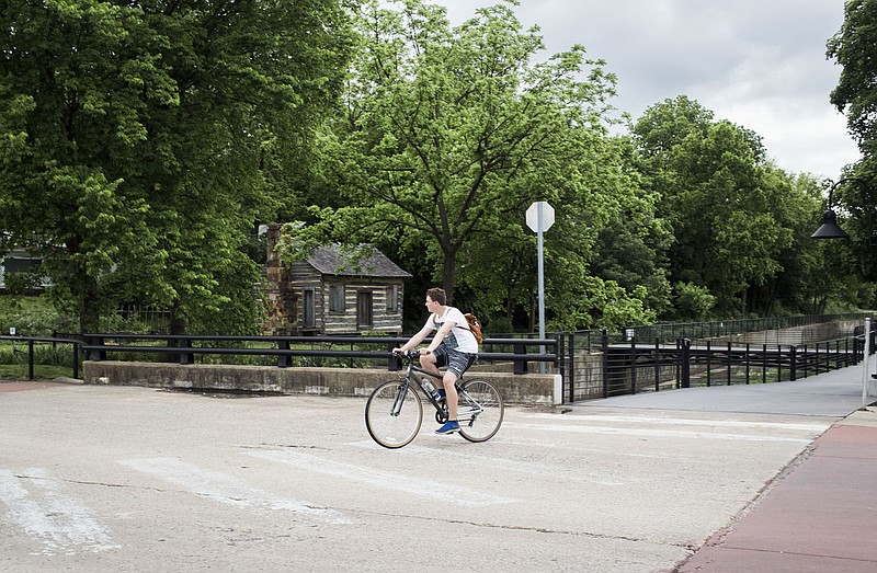
SPRINGDALE -- A study of the city's trails systems showed gaps the city could link to increase connections of residents to city attractions.
Representatives of engineering firm Garver on Monday presented to the City Council, working as a committee of the whole, suggestions of how to fill the gaps.
The city contracted with Garver for suggested improvements to the city's streets, intersections and active transportation infrastructure, explained Colby Fulfer, the mayor's chief of staff.
The council might choose some of these projects to complete with proceeds from up to $135 million in bond money for street improvements if Springdale voters approve a proposed bond issue May 9.
"We wanted to go into the bond project with some data," Fulfer said. "If we're going to spend taxpayer money, we want to ensure some return on their investments. The council can consider the priority of the projects based on the data."
The study's results on streets and intersections were presented by Garver to the council's committee of the whole March 20.
Juliet Richey, an urban planner with Garver, said engineers considered how the city could leverage its existing infrastructure investment in trails to serve the most residents, helping maximize what's in place for bicyclists and pedestrians.
"You've spent money and time putting these paths in place," she said.
Richey said sidewalks, trails or other infrastructure in neighborhoods could help connect students to schools where walking -- not bus service -- was available, schools like Elmdale and Smith elementary schools. Trails also could connect residents to community destinations such as city parks or Arvest Ballpark.
Richey said she sees real developmental potential for this type of infrastructure in the northwestern and southeastern parts of the city, where leaders expect heavy residential development.
Engineers also considered hundreds of comments submitted via a website during a public-input session from November to January, Richey said.
These comments pointed out gaps in the sidewalk systems, difficulty in reaching current trails and places residents want to go but have no way to get to, she said.
The comments suggested connections between Elmdale Elementary with J.B. Hunt Park, Silent Grove Road with J.B. Hunt Park and Morris Avenue in the former Bethel Heights to Mill Street in downtown, she said.
Others wanted infrastructure along North 40th Street from Elm Springs Road to access the J.B. and Johnelle Hunt Family Ozark Highlands Nature Center.
The study considered connections with 73 community destinations that would total nearly 37 miles of new trail, Richey reported.
Engineers also suggested an east-west spine of trail connecting the schools in the southeastern part of the city, George elementary and junior high, J.O. Kelley Middle School, Knapp and Harp elementary schools, Lakeside Junior High and the Don Tyson School of Innovation.
Council member Jeff Watson wondered about connecting the southeast part of the city with the Razorback Greenway, which runs through the center of Springdale, Fayetteville, Rogers and Bentonville.
"Other trails you have funded already connect to the Greenway," Richey replied. The southeastern part of town is connected north to south by Dean's Trail, which is connected to the Razorback Greenway downtown.
The proposed east-west spine would connect to Dean's Trail. "It's already moving many people," she said.
The city's building requirement call for all new or improved streets to include sidewalks and pathways, whether built by the city or developers.
For example, side paths along Gene George Boulevard, north from Arvest Ballpark, will connect to the city over a bridge at Interstate 49 to be built as part of the Har-Ber and Emma Avenue extension to the east, said Mayor Doug Sprouse. That east-west side path will be part of the Pride of Springdale Trail and provide a quick trip downtown.
Ron Petrie, a project leader for Garver, noted Meadow and Falcon avenues would make good candidates for Safe Streets and Roads for All, a federal infrastructure program providing money for safe, multiuse infrastructure.
"The streets are wider than needed for the traffic that travels them," he said.
Narrowing of the traffic lanes could provide space for bike paths painted on the pavement or on-street angle or parallel parking, Petrie said.
Gaps currently without sidewalks could be finished with sidewalks or paths.
And the city could construct "bump out" peninsulas, which could be filled with landscaping -- such as what has been installed along Emma, Petrie said.
"And narrower lanes can slow the speed of traffic," Sprouse added.
The report identified seven projects -- most of them downtown, Petrie said. All seven were presented in the study report, but Petrie discussed just Meadow Avenue.
One block south of Emma Avenue, the center of the downtown revitalization efforts, the Meadow project could be completed as a corridor over several blocks, not at individual intersections, he said.
"A lot of these could be done fairly inexpensively and would make a big difference," Petrie said.