Planners envision the $55 million Central Arkansas Regional Greenways project as a way to encourage and create cycling as a primary choice of transportation for people.
They refer to the Greenways project as a "transportation system" -- not just a network of locally based recreational cycling and jogging trails.
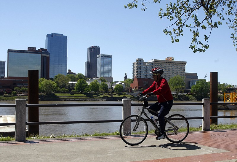
Jared Draper, Raleigh, N.C., office director for Toole Design, says the multiuse trails will connect "four counties and a number of communities across the region."
The proposed trails are divided into five corridors that connect regions in the Faulkner, Lonoke, Pulaski and Saline counties, according to a virtual public meeting held in early July.
This includes a Northwest corridor, a Central Beltway/West corridor, a Northeast corridor, a Southwest Trail and an East corridor.
According to the proposed plan, implementation of these trails will provide routes that connect North Little Rock and Little Rock to areas of Conway, Sherwood, Cabot, Austin, Ward, Lonoke, Central Little Rock to West Little Rock, Maumelle, Mayflower and Greenbrier/Wooster in various ways.
Draper says the five connected paths will be designed with the use of several typologies -- combining shared use paths, sidepaths and two-way separated bike lanes, directional separated bike lanes, delineated bike lanes and local facilities.
Visual reference of the current route plans -- with greater detail -- is available with an interactive map located at CentralArkGreenways.com.
Plans for the project have been ongoing since Metroplan voted in February 2020 to designate approximately half of its fiscal budget over the next 10 years to the implementation of the project.
The estimated $55 million in funding for the transportation system will come from the organization's Surface Transportation Program Block Grant from fiscal year 2021 to fiscal year 2030, according to Metroplan officials.
Metroplan Transportation Planner Daniel Holland says they hope to have trails "that rival any system in the nation."
Since the approval of the project, Metroplan and its partners -- Crafton Tull and Toole Design -- have relied on community feedback and comments in designing the proposed trail map.
The second public meeting included community survey input pulled from CentralArkGreenways.com -- as well as results from the first public meeting – where the data indicated that individuals would be more encouraged to use the system for transportation reasons if it is separated from main traffic areas.
The results also indicated that a lack of current infrastructure such as sidewalks, bike lanes and trails have previously discouraged community members from biking as their form of transportation.
Tab Townsell, executive director of Metroplan, believes establishing these alternate routes for transportation will provide accessibility that is currently not there.
Julie Luther Kelso, vice president of planning for Crafton Tull, took time at the second, most recent public meeting to shed light on what this project is and what this project is not.
"This is not a local bicycle and pedestrian plan. While people may initially want to have these pathways for recreation and social opportunities -- they are really being developed in mind for a transportation purpose," said Kelso.
Kelso says it has been a goal since the beginning to have the established trails "separated [from traffic] to the greatest extent possible."
Regulations for the routes, such as speed limits, use of E-bikes and further details are not yet finalized.
Additionally, many of the routes cross over various segments of land that are not owned by the public.
Kelso says the organization will address these areas and initiate negotiations of purchase, access easements or things of that nature at a later time.
Holland added, "We've identified where we want the routes -- with the acknowledgement that we've tried to locate on places we think would be the easiest to obtain or with public right-of-ways -- however, that will be more fleshed out in the design process."
The latest public meeting also touched on plans for a unified logo, trail-wide branding, signage and how they plan to create a safe environment in the regions where trails might come into close spaces with main traffic areas.
Draper said, "We're trying to make sure that users of the trail have as much separation all the way to the intersection, as much as possible."
Lighting, restrooms, seating, drinking fountains, trash cans, bicycle parking and repair, wayfinding and public art all are listed amenities the organizations are keeping in mind while designing the systems.
Holland says the next step in the project is to finishing up the typologies/amenities and looking at the context by which they might develop the system – as well as implementing the next phase in the ongoing decision of where these trails are best fit.
Townsell says "If you're a walker, runner, skater, or cyclist -- we want to hear your thoughts."
Both past and future project updates, interactive maps and surveys can be found at CentralArkGreenways.com.