When I read that Takahik River Valley Hikers had scheduled a bushwhack into the Upper Buffalo Wilderness to explore the Adkins Creek area, I immediately thought, "Sign me up."
The Upper Buffalo Wilderness encompasses the watershed for the headwaters of the Buffalo River in Newton County. I have hiked tributaries within the wilderness, such as Terrapin Branch, Boen Gulf, Bowers Hollow and others that feed the river, and I always come away impressed by the area's natural, unspoiled beauty. Adkins Creek was certain to be another great adventure.
The Adkins Creek area is close to where Main Prong Big Buffalo Creek and Reeves Fork merge to form the Buffalo River. The area has some of the highest summits in the Ozarks. On a topographic map for this drainage, the thin gaps separating elevation changes cry out to adventurous hikers, "Come explore."
For the start of what would be 4 ½ moderately difficult miles, Danny Hale, the hike leader, selected the Jerry Dahl Memorial trailhead. The native stone monument states that the surrounding pine forest was dedicated to the memory of Dahl, a forest supervisor in the Ozark-St. Francis National Forests from 1956 to 1962.
The memorial is off Arkansas 16/21, a little more than one mile east of the community of Fallsville. Turn left onto Forest Road 1463 and drive a well maintained dirt road for a couple more miles. There is an ample parking area at the memorial that encircles a giant oak tree that somehow escaped the logger's ax.
OFF WE GO
At 9 a.m. April 2, we were 18 like-minded outdoors enthusiasts trekking into the dense pine forest.
The hike started out on what I initially believed had once been a logging road. We had to tread around many deep, water-filled ruts created by others who had elected to drive rather than hike. When the road ended at an old homesite, I questioned whether the road we had hiked in on could have been this early settler's driveway.
It is always interesting tramping about the grounds of abandoned dwellings, seeking clues to what life had been like for these pioneers. Often, the only remnants of former inhabitants are nonnative plants they carried with them from a former homestead. Daffodils and jonquils were many settlers' favorites.
From the chimney remains and rock-walled well, it appeared this had once been an impressive homestead. Perched atop the mountain, the residents would have enjoyed an encompassing view into the deep gorge cut by the Buffalo River, some 500 feet below.
The true bushwhack began after we left the homesite, as we dropped down the mountainside.
Bushwhacking is all about following the path less traveled. But with the navigation apps available — like Gaia GPS and Topo Maps+ — hikers should not be intimidated about striking out in the forest where there are no trails, markers or signs. (Although these apps function via satellite and do not require cell service, it is still a good idea to carry a topographic map of the area for a "Plan B.")
Hiking books like Danny Hale's "Takahik Hiking the Ozarks" include the coordinates needed to plug into the app. All that remains is for a hiker to garner a "best route" to reach the destination.
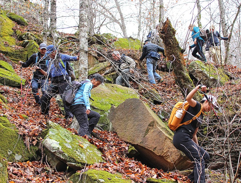
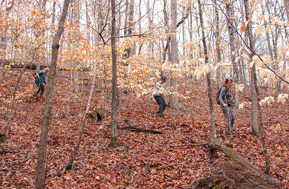
This is exactly what our group did after leaving the homesite. Without even a social trail to follow a route picked by earlier visitors, we spread out across the hillside, everyone seeking their own route as we descended the steep grade.
In the days before the hike, heavy rains had drenched the area. Rain continued even during the drive to the trailhead, stopping only minutes before the start of the hike. Even small drainages, which are normally dry, now flowed over their banks. It wasn't long into our bushwhack that we witnessed the first gravity-driven stream coursing down the mountain.
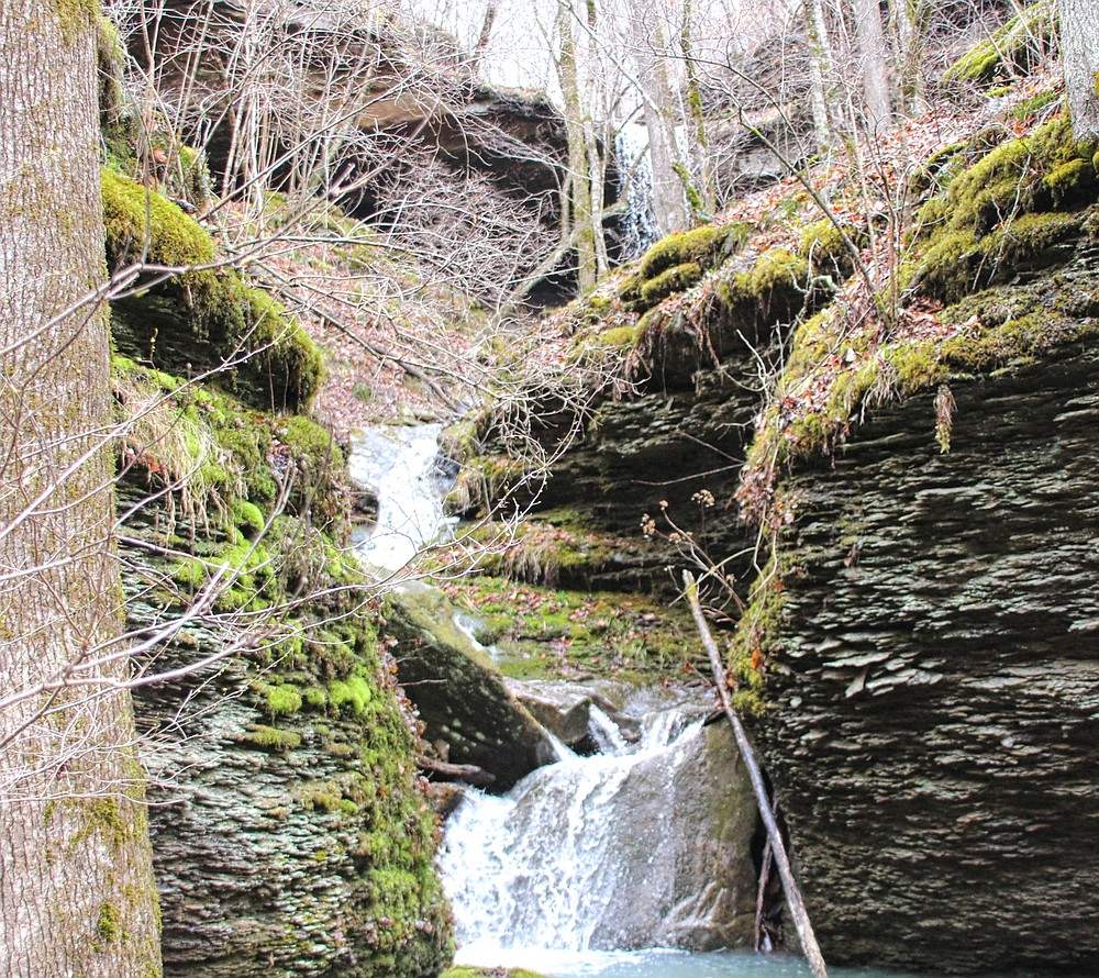
It is mesmerizing to observe a stream follow a path of least resistance as it cascades down rocky stair steps. Curtains of water spread evenly across rock ledges until finding a crevice or other fault line for water to spill over and crash to the next level.
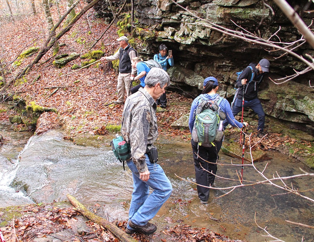
As we hiked along the waterway, our path was blocked when the drainage flowed against a rock bluff. This would be the first of many creek crossings. Luckily, we discovered a shallow section to cross where water did not spill over the tops of our boots.
LEANING LOG
Leaning Log Falls was our first waterfall on the hike. The log for which it was named had long since washed downstream, but the name remains.
The water volume was impressive as it poured over the ledge and splashed onto a rock laden floor some 27 feet below.
Utilizing something of a controlled slide down the steep bank on the right, we reached the bottom of the falls to enjoy a different perspective.
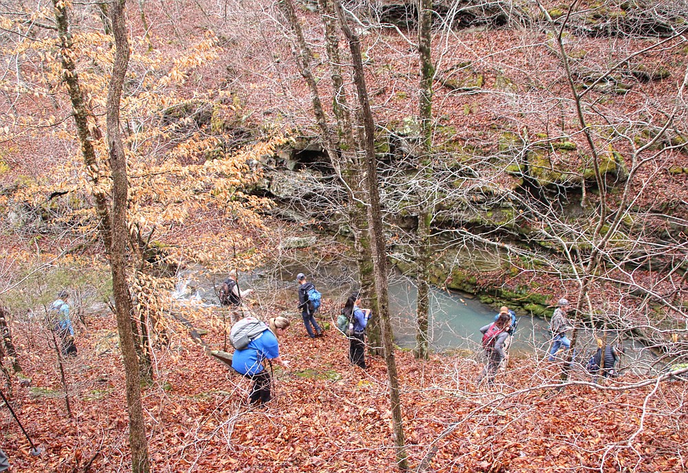
The hillside became steeper as we continued down the mountainside. With the waters of Adkins Creek just coming into view, what had been a hike-able ascent gave way to a sheer bluff blocking our route.
The group scoured the area for an alternate route. Someone discovered a crevice wide enough for a hiker to squeeze through and shimmy down to the creek bank -- proving once again that where there is a will, there is a way.
Reaching Adkins Creek, several hikers swapped out boots with water shoes for the many creek crossings to come. Others had come prepared for the wet crossings and already wore water socks under their boots. Most of us just accepted the inevitable —wet boots — and trekked on through the chilly water.
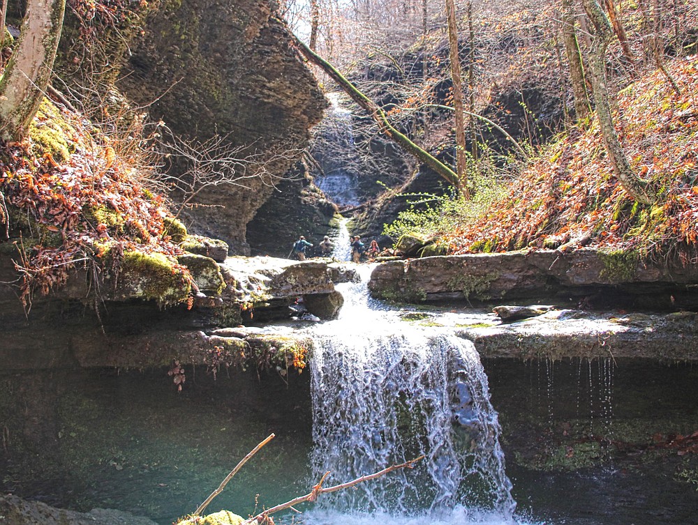
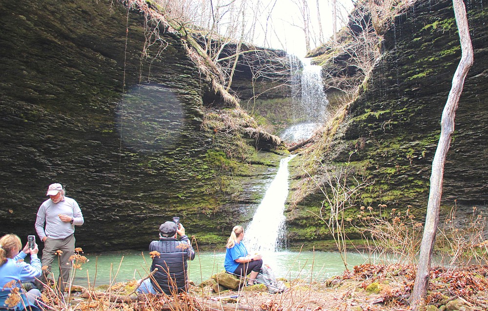
Most of the waterfalls we sought this day were upstream. However we began to follow the bank a short distance downstream for a fall we wanted to visit first. Soon we veered into an opening on river-right, to be immediately greeted by an unobstructed view of all three tiers of Adkins Canyon Falls.
Oh, yeah!
After the recent heavy rains, the triple set of falls was revealed in all their glory. Several hikers followed a steep scramble up the right for a close-up view at the base of the middle falls, the tallest freefall drop of the three.
Although our hike had just begun, with everyone busily capturing the triple falls in pictures and the area being such a picturesque setting, we decided to make this our lunch break. Or rather, lunch No. 1.
ONWARD
With the happy mealtime done, we backtracked to our first crossing to resume the trek upstream.
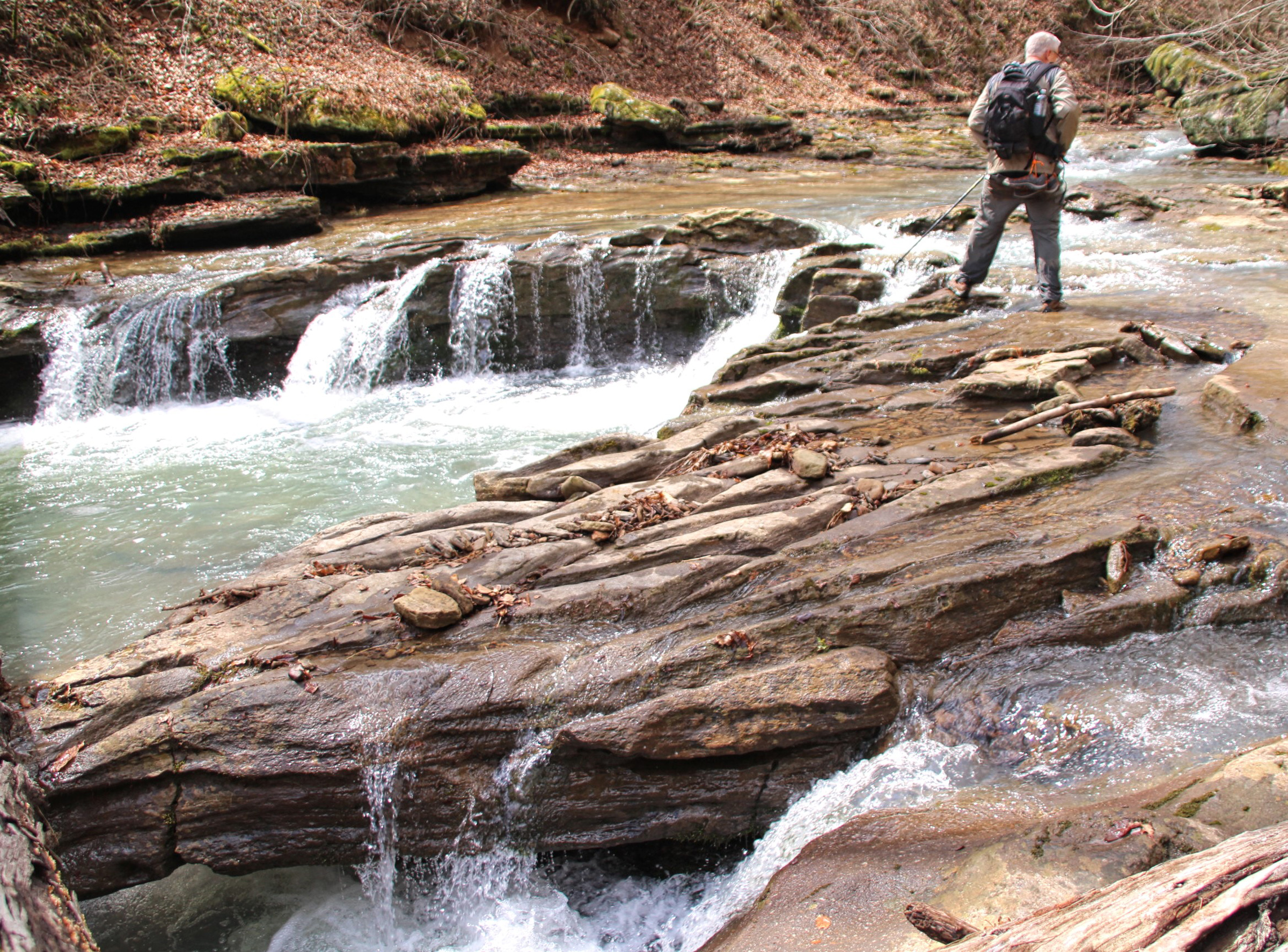
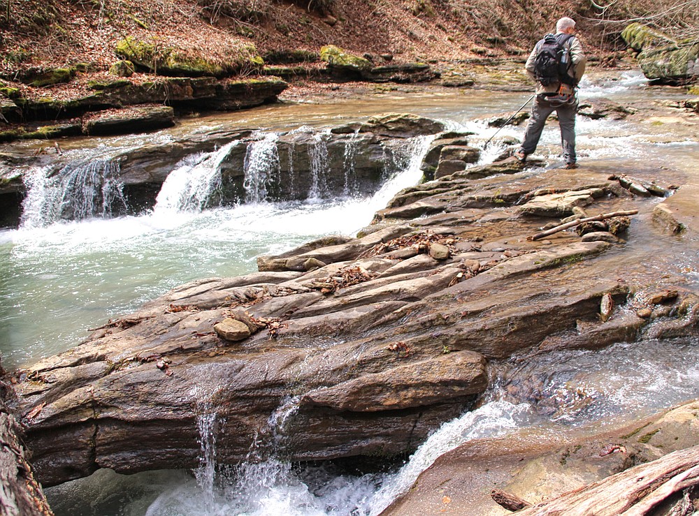
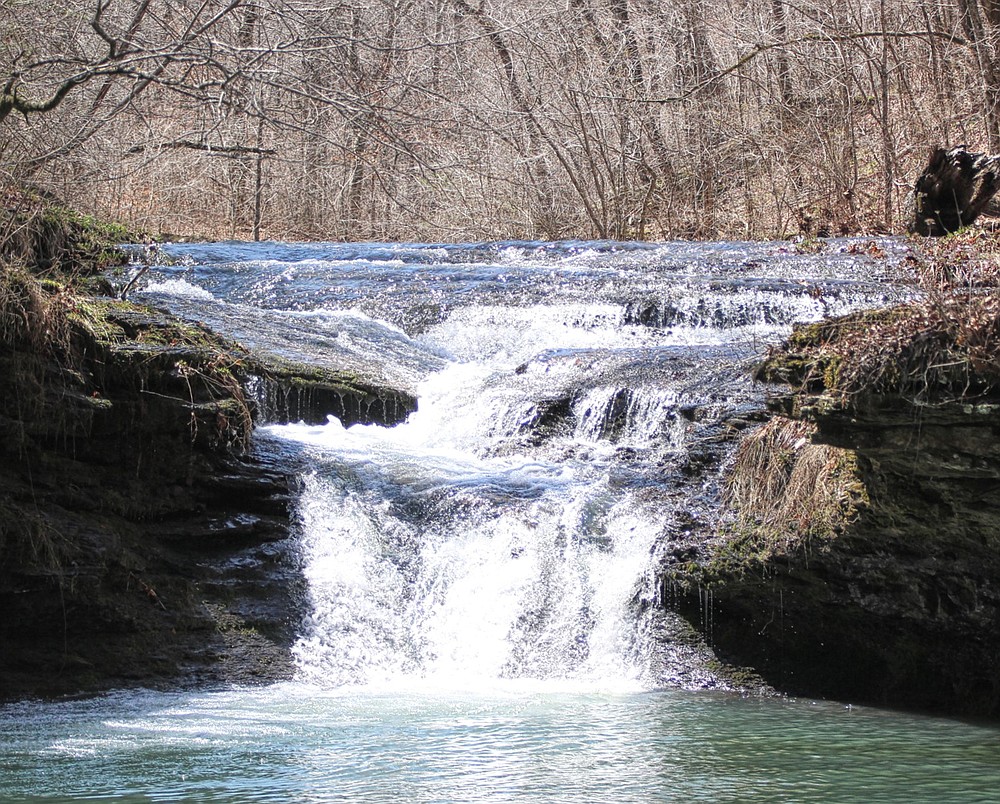
En route, we found a particularly unusual waterfall that had formed on a solid, thick rock ledge in a wide section of Adkins Creek. Over the years, water has carved a dozen or more cuts into the ledge to form mini falls. Appropriately, the feature is named Many Finger Falls.
Continuing upstream, we reached a room-size boulder perched on the lip of a stair-stepped cascading waterfall named Adkins Rock Falls. Luckily for us, this was one of the rare occasions when water levels were high enough for the stream to smash into the big rock, split the channel and encircle the boulder.
Another "oh, yeah" moment.
[Gallery not loading? Click here for photos » arkansasonline.com/425adkins/]
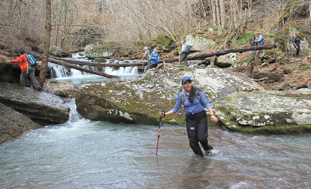
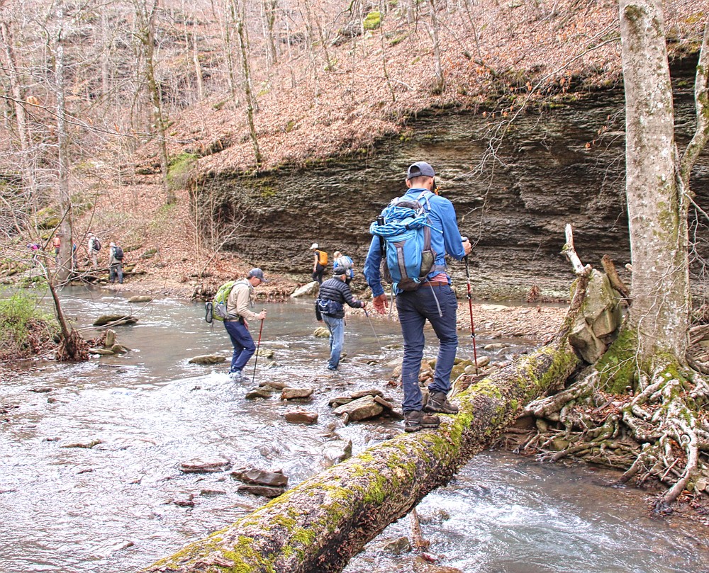
Despite the recent rain, the width of Adkins Creek dispersed the water enough so there were no dangerously deep crossings. Seldom did the water rise above our knees.
Our group of hikers ebbed and flowed as did the water within the stream, some drifting to river-right and others wandering left. Several hikers rock-hopped across, while others chose a daring stroll over a fallen log. As with the flowing water, each hiker picked what they believed was the path of least resistance.
In the opening stages of the outing, I hiked alongside friends from earlier hikes. As the day went on, I drifted around to visit and become acquainted with new companions. It is interesting to meet and hike with like-minded adventurers. A common interest in the outdoors and nature is a great foundation for beginning a friendship. (For more about this hiking club, see takahik.com.)
The creek's rushing waters have eaten away at the hillside, exposing thin, parallel layers of the compressed quartz and minerals that created the mountain. On one of these south-facing shale bluffs, fluorescent green watercress thrived on these tiny bench shelves.
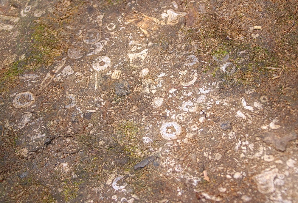
Strolling along the polished gravel banks of the creek, we often discovered a window into the area's past. Small sedimentary rock fragments embedded with bits and pieces of spiny sea urchin shells, petrified flora and other clues to life on earth long ago when this was the floor of a deep sea.
Continuing upstream, we discovered more beautiful falls and cascades, each possessing its own unique character.
We paused to investigate what appeared to be a series of stacked large flat rocks leading down the bank to the water's edge. Stairs on a large scale. It would require several strong men to have moved the rocks. But why?
HOMEWARD BOUND
Hiking upstream on our return to the vehicles reclaimed a portion of the elevation. However, a long, steep trek remained when we finally left the waters of Adkins Creek behind.
Viewing the topo, we saw a drainage farther upstream we could follow that would lead us back to the trailhead. This route up the drainage would be a steep and obstacle-strewn hike.
We opted for Plan B, as the crow flies: a direct return line angling across the hillside, resulting in a gentler ascent.
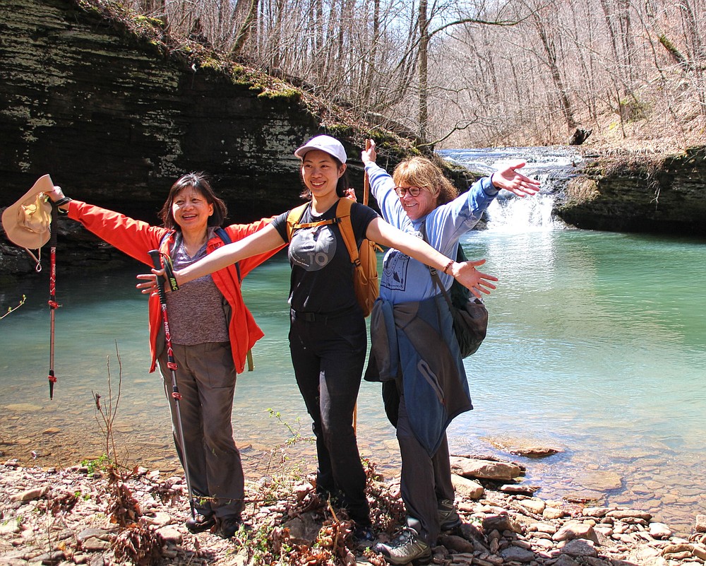
Hanging at the parking area, everyone was all smiles. Several of us enjoyed a celebratory cold adult beverage as the group gathered around vehicles, sharing memories of the adventure.
Exchanging farewells with old and new friends, we climbed into our vehicles to return to the so-called real world.
Bob Robinson of Fort Smith is the author of "Bicycling Guide to the Mississippi River Trail," "Bicycling Guide to Route 66" and "Bicycling Guide to the Lake Michigan Trail."
 Many Finger Falls put on a show April 2 during an outing of the Takahik River Valley Hikers to Adkins Creek in Newton County. (Special to the Democrat-Gazette/Bob Robinson)
Gallery: Hike to Adkins Canyon Falls