The regular duck season resumes Friday after a 10-day break. Hunters likely will pick up where they left off at the end of the first segment, awaiting a migration of ducks and the typical late fall rains that flood rain-dependent hunting areas.
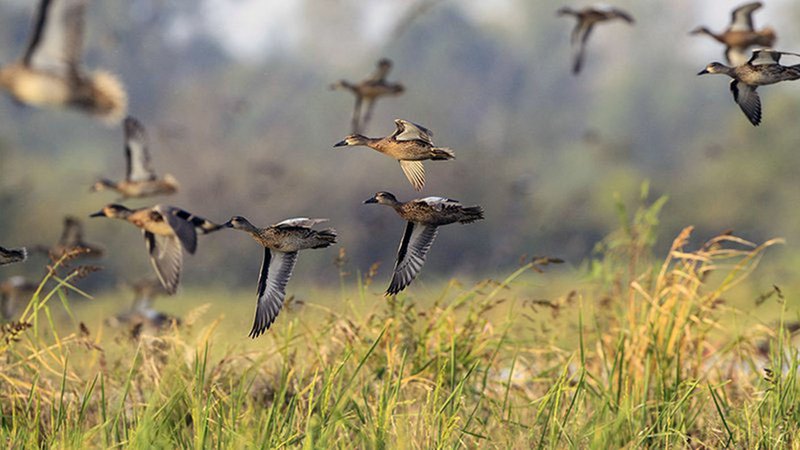
Reports from eastern and southeast Arkansas during Saturday's youth, veteran and active military special hunt noted few ducks flying much of the day, and ducks were hard to work. One of the more favored terms for the ducks Arkansans are mostly seeing in this early part of the 60-day season is "stale." The same ducks are flying around and are used to being hunted.
"Yeah, 'stale' has become the buzzword for a lot of hunters," said Luke Naylor, waterfowl program coordinator for the Arkansas Game and Fish Commission.
Areas that are not overly rain dependent have begun filling up nicely, while some areas that had a little bit of huntable water have seen part of that dry up in the past week, such as at Dagmar WMA, where the Conway George tracts are 100% flooded. The middle and western portions of Steve N. Wilson Raft Creek Bottoms WMA near Georgetown are now at or near 100% coverage. Henry Gray Hurricane Lake WMA, which depends on Glaise Creek for flooding, is at full pool, with the creek over its flood mark of 192 feet msl.
Dave Donaldson Black River WMA is fully covered in water, according to biologists. George H. Dunklin Bayou Meto WMA still waits on a big rainfall to push water even to a pumpable level for Buckingham Flats and Temple Island units.
* Water levels listed in this report were taken Monday and do not reflect any rainfall Tuesday and Wednesday.
NORTHEAST ARKANSAS
BIG LAKE WMA
North Woods GTR Mast production is good. The Bo Dock gauge currently reads 234. Target level is 235.5 with 100% flooded.
South Woods GTR Mast production is fair. The 7-mile gauge is currently at 232.9 feet. Target level is 234.5 feet with 100% flooded.
Simmons Field A good amount of millet and sedge is present. Seed production is very good in the North Unit, Middle and South fields. Nouth field contains 5 acres of millet. 100% flooded.
DAVE DONALDSON BLACK RIVER WMA
Upper Island GTR Moderate mast crop. Water level is 270.5. Target level is 269.5. 100% flooded.
Lower Island GTR Moderate mast crop. Water level is 269.15. Target level is 268.5. 100% flooded.
Upper Reyno GTR Moderate mast crop. Water level is 267.85. Target level is 266.9. 100% flooded.
Lower Reyno GTR Moderate mast crop. Water level is 267.85. Target level is 266.3. 100% flooded.
Winchester GTR Moderate mast crop. Water level is 264.65. Target level is 263.7. 100% flooded.
EARL BUSS BAYOU DEVIEW WMA
South Oliver GTR Mast production has been good. The area is 10% flooded with a current gauge reading of 0.0 foot. Water is rising in the GTR.
Thompson Tract GTR Mast production has been good. The area is 25% flooded with a current gauge reading of 0.7 feet.
Lake Hogue WRA Primarily deep open water habitat. Normal pool level.
SHIREY BAY RAINEY BRAKE WMA
Adam Brake GTR Good mast crop. Water level is 239.8. 90% flooded.
Rainey Brake GTR Good mast crop. 950% flooded.
Eagle Pond GTR Good mast crop. 100% flooded.
Phase III Moist-Soil Unit Good wetland-type vegetation. 40% flooded.
Charles Crisp Moist-Soil Unit Good wetland-type vegetation. 60% flooded.
Ward Field Moist-Soil Unit Good wetland-type vegetation. 100% flooded.
River Field Moist-Soil Unit Good wetland-type vegetation. 75% flooded.
ST. FRANCIS SUNKEN LANDS WMA
Hunt Area Mast production is good. Water levels in the huntable areas are dependent on the St. Francis River. The water level at Oak Donnick is 212.59.
Snowden WRA Mixed grasses are present. 5% flooded.
Payneway WRA Pools A,B, C, and D have mixed smartweed and barnyard grasses, Moderate mast in Pools A,B, and C. Pool A is at 0%. Pool B is at 0%. Pool C is at 15% and Pool D is at 5%.
EAST CENTRAL ARKANSAS
HENRY GRAY HURRICANE LAKE WMA
North GTR Good mast crop. Glaise Creek gauge at 192.65. Full pool.
South GTR Fair mast crop. Glaise Creek gauge at 192.65. Full pool.
REX HANCOCK BLACK SWAMP WMA
Gregory GTR Good mast crop. 30 percent flooded.
Main WMA Good mast crop. 40% flooded.
Wyeville Unit Good stand of millet and native vegetation. 100% coverage.
SHEFFIELD NELSON DAGMAR WMA
Mud Slough GTR Good mast crop. 15% flooded.
Apple Lake WRA good mast crop. 50% flooded.
Conway George Waterfowl Unit A Good millet and native vegetation. 100% flooded.
Conway George Waterfowl Unit B Natural slough area with beneficial wetland plants. 100% flooded.
Conway George Waterfowl Unit C Good stand of millet and native vegetation. 100% flooded.
STEVE N. WILSON RAFT CREEK BOTTOMS WMA
NOTE The White River at the Georgetown gauge was 17.1 feet on Monday and was forecast to be at 17.0 feet by Wednesday. If the forecast holds, this will reinstate all on-site permit draws for Saturdays and Sundays starting Saturday.
Unit A Excellent stand of native vegetation. 100% flooded.
Unit B Excellent stand of millet and native vegetation. 95% flooded.
Unit C Good stand of native vegetation. 100% flooded.
Unit D (Youth Area) Good stand of native vegetation. 100% flooded.
Unit E Excellent stand of millet and native vegetation. 100% flooded.
Unit F Good stand of millet and native vegetation. 100% flooded.
Unit G Fair stand of millet and native vegetation. 100% flooded.
Unit H (Mobility-impaired blind) Excellent stand of native vegetation. 100% flooded.
Unit I Poor stand of native vegetation. 85% flooded.
Unit J (Cypert Tract) Excellent stand of native vegetation. 65% flooded.
Unit K (Cypert Tract) Excellent stand of native vegetation. 60% flooded.
Unit L (Cypert Tract) Fair stand of native vegetation. 15% flooded.
Unit M (Magellan Tract) Fair stand of native vegetation. 90% flooded.
CENTRAL ARKANSAS
CRAIG D. CAMPBELL LAKE CONWAY RESERVOIR
Habitat and water levels are normal on both Pierce and Dix creeks.
BELL SLOUGH WMA
Bell Slough GTR Poor to moderate mast crop. 50% flooded.
Palarm Creek WRA Natural vegetation and planted millet. 50% flooded.
CYPRESS BAYOU WMA
Hunt Area Good mast crop. 100% flooded.
Red Cut Slough Tract Unit 1 Good stand of millet and native vegetation. Water level 15%.
Unit 2 Excellent stand of millet and native vegetation. Water level 100%.
Unit 3 Good stand of millet and native vegetation. Water level 100%.
Unit 4 Good stand of native vegetation. Water level 100%.
Unit 5 Good stand of native vegetation. Water level 30%.
Unit 6 Good stand of native vegetation. Water level 20%.
HARRIS BRAKE WMA
Harris Brake Upper Unit Average mast in the GTR. 80% flooded.
Harris Brake Lower Unit Average mast in the GTR. 95% flooded.
HOLLAND BOTTOMS WMA
Hunt Area Excellent conditions. 10% flooded.
Lake Pickthorne WRA Excellent conditions. East cell 25% flooded. West Cell is 75% flooded.
SOUTHWEST ARKANSAS
DR. LESTER SITZES III BOIS D' ARC WMA
Bois d'Arc Lake WRA Closed to hunting. Normal.
Red Slough WRA Closed to hunting. Water level 45%.
GTR Good mast production. Water level 55%.
Little Grassy Habitat is good. Water level 45%.
MILLWOOD LAKE Habitat is good. Water level 259.83.
OZAN WMA
Unit 1 Habitat good. 0% flooded.
Unit 2 Habitat good. 0% flooded.
Unit 3 Habitat good. 0% flooded.
Unit 4 Habitat good. 0% flooded.
Unit 5 Habitat good. 0% flooded.
SULPHUR RIVER WMA
Mercer Bayou Habitat conditions are fair. 40 percent flooded.
Henry Moore WRA Closed to hunting. 29% flooded.
SOUTHEAST ARKANSAS
BERYL ANTHONY LOWER OUACHITA WMA The WMA has good hard mast production. The only water on the WMA currently is in the sloughs and in the oxbow lakes.
FREDDIE BLACK CHOCTAW ISLAND WMA DEER RESEARCH AREA Habitat conditions are good. There is variable flooding associated with the Mississippi River. Use extreme caution when boating on the river.
TRUSTEN HOLDER Habitat conditions good. Flooding is river dependent.
SEVEN DEVILS SWAMP WMA Habitat conditions good. Below gauge. No water.
CUT-OFF CREEK WMA
Hunt Area Habitat conditions are good. No water.
Pigeon Creek WRA Habitat conditions are good. No water.
BAYOU METO WMA
Upper Vallier GTR Good habitat. Water level 177.17 feet, full pool at 180 feet.
Lower Vallier GTR Good habitat. Water level 177.03 feet, full pool at 179 feet.
Government Cypress GTR Good habitat. Water level 175.50 feet, full pool at 179 feet.
Buckingham Flats GTR Good habitat. 176.27 msl. First phase of pumping completed.
Temple Island GTR Good habitat. Water level 180.10
Canon Brake Good habitat.173.60 msl. Full pool at 177 msl.
Halowell WRA Excellent habitat. Staggered flooding of units.
Wrape Plantation WRA Excellent habitat. Staggered flooding of units.
NORTHWEST ARKANSAS
DARDANELLE WMA
McKennon Bottoms 8 acres of native millet. 24 acres of fallow ground. 100% flooded.
Potter's Pothole Hartman Waterfowl Unit Good stand of native vegetation. 90% flooded.
OZARK POOL
Dyer Lake Cells Fair stand of nutsedge and toothcup smartweed, and sprangle top. Units 1 and 2 are 100% flooded. Unit 3 south cell is 75% flooded. North cell 0%.
NIMROD LLOYD MILLWOOD WMA
Nimrod GTR Poor mast crop and desirable native vegetation. 5% flooded.
ED GORDON POINT REMOVE WMA
Little Hole (Unit 1) Natural vegetation. 70% flooded.
Willow Island Natural vegetation. 90% flooded.
Red Gate Native vegetation and Japanese millet. 75% flooded.
Pig Trough (Units 4 and 5) Native vegetation. 85% flooded.
Cedar Ridge (Unit 6) Natural vegetation. 75% flooded.
Unit 7A Japanese millet. 80% flooded.
Unit 7B Natural vegetation. 10% flooded.
Unit 8A Natural vegetation. 75% flooded.
Unit 8B Native vegetation. 85% flooded.
Unit 8C Native vegetation. 85% flooded.
Unit 9 Japanese millet. 100% flooded.
Controversy Corner (Unit 10) Natural vegetation and Japanese millet. 90% flooded.
Remmel Marsh Native vegetation Japanese millet. 80% flooded.
Mud Pond (Unit 12) Natural vegetation. 90% flooded.
Turkey Pond (Unit 13A) Natural vegetation and Japanese millet. 85% flooded.
Turkey Pond (Unit 13B) Natural vegetation. 30% flooded.
Turkey Pond (Unit 13C) Japanese millet. 70% flooded.
Teeny Pond (Unit 14) Natural vegetation and Japanese millet. 0% flooded.
Salt Lick (Unit 15) Japanese millet. Water level 60%.
Bobby's Pond (Unit 16) Japanese millet. 60% flooded.
Race Track (Unit 17) Japanese millet. 60% flooded.
FROG BAYOU WMA
Unit 1 Sprangle top, wild millet, smartweed, nutsedge and Japanese millet. 100% flooded.
Unit 2 Good stand of barnyard grass and nutsedge. 100% flooded.
Unit 3 Smartweed, toothcup, nutsedge, barnyard grass, sprangle top and duck potato. 80% flooded.
Unit 4 Barnyard grass, sprangle top, annual smartweed, nutsedge and crabgrass. 100% flooded.
Unit 5 Sprangle top, wild millet, smartweed, knotgrass, nutsedge and duck potato. 60% flooded.
Unit 6 Barnyard grass, smartweed, crabgrass and sprangle top. 50% flooded and pumping.
Unit 7 Excellent stand of barnyard grass, sprangle top and smartweed. 100% flooded.
GALLA CREEK WMA
Galla Creek GTR Moderate stand of native vegetation and millet, including a mixture of barnyard grass and sprangle top. 55% flooded.
PETIT JEAN RIVER WMA
Santa Fe GTR Poor mast crop. 0% flooded.
Sore-Head Moist Soil Unit Moderate to excellent stands of desirable native vegetation throughout. 100% flooded.
Slaty Crossing Moist-Soil Unit Due to ongoing waterfowl habitat enhancement projects, this unit did not grow a desirable native vegetation crop this year. Only about half of the unit produced a crop of millet, but the areas that did produce look amazing. 0% flooded.
Olin Cain Moist-Soil Unit 25% native vegetation and 100% flooded.
Black Lands Moist-Soil Unit Excellent stand of desirable native vegetation throughout. Poor mast crop in the wooded areas. 100% flooded.
Black Lands Duck Area Poor mast in the wooded sections. Moderate to great stands of desirable native vegetation mixed throughout. 100% flooded.
Pullen Pond Due to ongoing waterfowl habitat enhancement projects, parts of the northeastern sections of this area are bare ground. Other parts of this area have spotted sections of great desirable native vegetation. The desirable native vegetation has started to become more and more prevalent with each year of ongoing management work. Water level 20%.
Pond Creek GTR Poor mast crop with good stands of desirable native vegetation in the open lands. 0% flooded.
Slaty GTR Poor mast crop. 5% flooded.
Black Lands Duck Area Millet, native vegetation. 100% flooded.