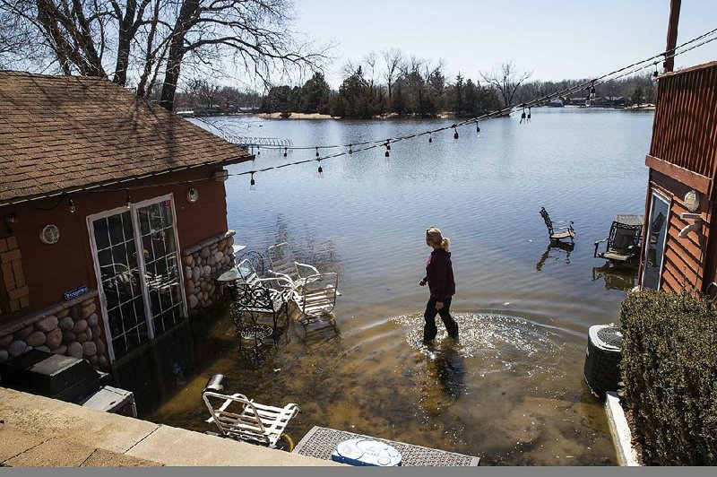
The stage is set for unprecedented flooding this spring for most of the nation, U.S. weather officials said Thursday.
More than 200 million Americans are at risk for some kind of flooding, with 13 million of them at risk of major inundation, the National Oceanic and Atmospheric Administration said in its spring weather outlook. About 41 million people are at risk of moderate flooding.
Major flooding now occurring in Nebraska, Iowa, South Dakota, Missouri and other Midwestern states is a preview of an all-too-wet and dangerous spring, said Mary Erickson, deputy director of the National Weather Service. "In fact, we expect the flooding to get worse and more widespread," she said.
This year's flooding "could be worse than anything we've seen in recent years, even worse than the historic floods of 1993 and 2011," she said.
Those floods caused billions of dollars in damage, and officials said this year's damage in Nebraska, Iowa and South Dakota has already passed the billion-dollar mark.
Forecasters said the biggest risks include all three Mississippi River basins, the Red River of the North, the Great Lakes, plus the basins of the eastern Missouri River, lower Ohio River, lower Cumberland River and the Tennessee River.
The Missouri River has already set records with historic flood marks measured in 30 places in Nebraska, Iowa and South Dakota, Kansas City forecaster Kevin Lao said.
The river "remains vulnerable to moderate flooding for the remainder of the spring and early summer," Lao said.
"People should be prepared for major flooding along the Missouri River ... going into the future."
Most of Nebraska, except right along the Missouri River, is unlikely to see major flooding again this year, but the rest of the flooded area is still prone to more, Low said.
Several factors will likely combine to create a pulse of flooding that will eventually head south along the Mississippi: above average rainfall this winter -- including 10-15 inches earlier this year in a drenching along the Ohio and Tennessee Valleys; the third-wettest year in U.S. history; and rapidly melting snow in the Upper Midwest.
Extra rain will take more farm runoff down the Mississippi, which will likely lead to more oxygen-starved areas in the Gulf of Mexico and likely make the summer dead zone larger than normal, said Edward Clark, director of NOAA's National Water Center in Tuscaloosa, Ala.
It's too early for scientists to make the complex calculations to see if human-caused climate change played a role in the flooding. However, scientists said the conditions are consistent with what they expect from global warming.
In addition to the year-to-year natural variability of weather, there is a long-term, climate-change-driven trend that is making extreme rainfalls even more intense, said Texas A&M University climate scientist Andrew Dessler.
"You can think of climate change as steroids for these rain events," he said.
University of Illinois climate scientist Donald Wuebbles, co-author of a report released Thursday on climate change and the Great Lakes, said: "We have been seeing a significant increase in precipitation coming as larger events, especially in the Midwest and Northeast, over the last five to six decades." It will get worse, so flooding will get to be a bigger concern, he said.
In part of the South, it already is.
Major flooding is already occurring this week on the Mississippi River near several Southern cities including Osceola, Ark.; Natchez, Miss.; and Baton Rouge, according to river gauges and data from NOAA.
On Thursday afternoon, the river was at 37.3 feet in Osceola and falling.
Wayne Reynolds, director of Arkansas' Mississippi County Office of Emergency Management, said the river is high but it's being contained within the levees.
"The river is several miles wide at several places in this county right now," he said. "It's not normal, but it's not unusual. It's flooding we're prepared for."
Reynolds said the levees are 20 feet high in Mississippi County, and the water was only a few feet up the levees Thursday.
"The flooding is not as bad as it was in 2011," he said. "It got within a few feet of the top of the levees then."
Reynolds said he expects the river to be at flood stage, or 28 feet, until at least the end of the month.
Since Feb. 8, about 100 U.S. Army Corps of Engineers personnel have been monitoring levees and other flood protection in Helena-West Helena; Memphis; and Clarksdale, Miss.
The swollen river has been flooding some unprotected western Mississippi communities since last month.
Information for this article was contributed by Seth Borenstein, Jeff Martin, Adrian Sainz and Jeff Amy of The Associated Press; and by Bill Bowden of the Arkansas Democrat-Gazette.
A Section on 03/22/2019