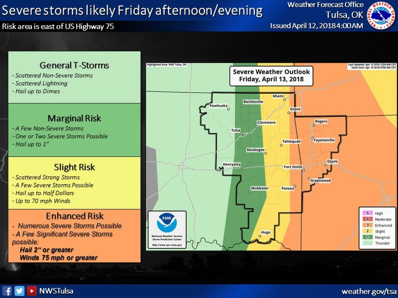
Northwest Arkansas has an enhanced risk of severe storms Friday evening according to the National Weather Service.
High winds today and Friday also lead to an elevated fire risk.
A few of these storms could become supercells with the threat for baseball size hail, damaging winds, and possibly, a few tornadoes, according to a National Weather Service report. The greatest potential continues to be across far eastern Oklahoma and also Northwest Arkansas,
Wondering about the severe wx potential for Fri for eastern #OKwx and western #ARwx? Here is the latest outlook: https://t.co/bfE3GruJtW
— NWS Tulsa (@NWStulsa) April 11, 2018
The latest forecast calls for the rain to enter western Arkansas around 4 p.m. and push into central Arkansas between 7 p.m. and 10 p.m. Friday.
Lance Pyle of the National Weather Service’s North Little Rock office advised that Arkansas residents need to “prepare for severe weather now,” including having a safe place to go if a tornado warning is issued.
As the rainfall departs, cooler air will be in place in Arkansas. Temperatures are set to fall near freezing early Sunday and below freezing Monday morning.
