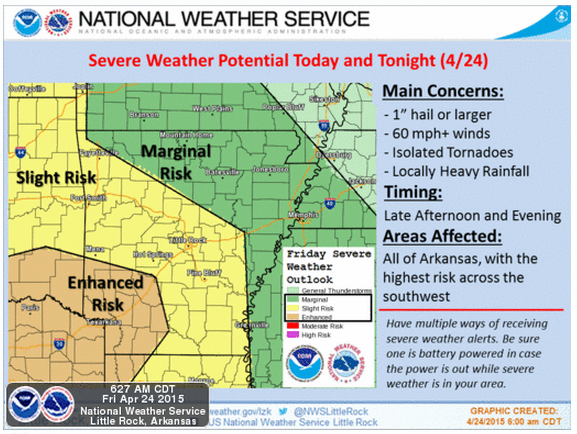
Strong storms capable of producing large hail, damaging winds and isolated tornadoes are possible in Arkansas on Friday afternoon and night, particularly "from Little Rock southwestward," the National Weather Service said.
The agency said in a statement that strong-to-severe storms should begin late in the afternoon and continue overnight into early Saturday morning.
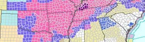
[FORECAST GRAPHICS: Storm timing, tornado/wind/hail probabilities, risk categories]
The Storm Prediction Center has a large swath of southwest Arkansas under an enhanced risk for severe weather, the third-highest of a five-point rating system that calls for the possibility of "numerous" severe storms.
"Storms may become severe, with large hail, damaging winds, and isolated tornadoes the main concerns," the weather service said. "Because the most unstable conditions will be found across the southwest counties, this is where severe storms are most likely."
An even larger part of the state north and east of the one under the enhanced risk is under a slight risk for severe weather, one notch lower on the rating system. Little Rock is included in the area under the slight risk.
In addition to the chances for hail, winds and tornadoes, the storms will drop heavy rain and potentially create localized flooding. Central and southern Arkansas are expected to largely see an inch of rain, with some localized spots getting even more than that.
Showers and thunderstorms may linger into Saturday in eastern Arkansas as the system exits the state, the weather service said, but dry conditions are expected the rest of Saturday and during the day Sunday. Additional storms are possible Sunday night through Tuesday, the statement said.