While the recent cold might have been shocking to anyone out in it, the record low temperatures seen over the past few mornings are neither uncommon nor a harbinger of things to come, according to the National Weather Service.
At Fayetteville's Drake Field, the official low temperature readings of minus 2 degrees Monday and minus 10 degrees Tuesday both were record lows for their respective dates. The previous record lows were 3 degrees on Jan. 15, 1972, and zero degrees on Jan. 16, 1997, according to the weather service.
Wednesday morning's low of minus 4 degrees tied the record for the date, also set in 1997.
Drake Field's all-time record low was minus 20 degrees on Feb. 16, 2021, according to the weather service. Joe Sellers, a meteorologist with the National Weather Service in Tulsa, said the low temperatures recorded over the past few days were not the result of any unusual weather patterns or events.
"We just had a really strong arctic outbreak," Sellers said. "It's not uncommon."
Today's forecast for Northwest Arkansas is expected to be mostly sunny, with a high near 42, according to the weather service. Tonight could see scattered flurries between 9 p.m. and 3 a.m. That will be followed by increasing clouds, with a low around 12, the weather service said. Wind chill values between 1 and 6 are anticipated. Winds could gust as high as 25 mph.
The next few days -- Friday through Sunday -- are expected to be mostly sunny, but cold.
Friday's forecast calls for below freezing temperatures with a high near 21 degrees and a low around 5. Saturday is also expected to be below freezing all day, but the temperature could get just above freezing for some of the day Sunday, according to the forecast.
After that, temperatures should be in the 40s and 50s with a chance of rain off and on throughout next week, Sellers said.
Keeping warm
While temperatures rose during daylight hours, frigid overnight temperatures fill up shelters for the homeless. 7 Hills Homeless Center had to move operations to Potter's House on Martin Luther King Jr. Boulevard in Fayetteville, according to a post on 7 Hills' Facebook page. Calls to the center's main number were not returned Wednesday.
Genesis Church in Fayetteville provides shelter from the cold and is full, but finds safe spaces for the overflow with the help of Samaritan Church and Elmdale Baptist Church in Springdale, said Janice Hanna, Genesis executive director. Genesis Church on Martin Luther King Jr. Boulevard shelters 45 to 50 people a night now, she said. The church also provides a meal each night and snacks and has retired nurses who volunteer with medical assistance.
Every year some of the homeless are very reluctant to leave their camps, where their few possessions are, Hanna said. They are afraid their campsites will get looted while they are gone, she said. Volunteers from the Micah Hope Ministry at the church provide transportation for those who can no longer endure the cold and call in, she said.
The city of Fayetteville is "very intricately a part of this," Hanna said. The city sets aside money in its budget to help shelters, providing a "huge benefit," she said.
Another benefit is experience. "We get better at this every year," Hanna said.
The state Division of Emergency Management maintains an interactive map of warming shelters and similar services statewide. See the map at http://tinyurl.com/3te9fmjx for locations and contact information.
Returning to normal
Locally, road crews and government offices were getting closer to normal. Jay Frasier, Benton County's administrator of public services, said most paved roads were "in real good shape" and the county's Road Department has shifted its attention to dirt and gravel roads.
"If the temperatures and the sunshine are what they say it's going to be, we'll have a good amount melt off and the roads will be in good shape by this afternoon," Frasier said Wednesday morning, adding he hadn't had reports of any slick spots.
"The sunlight is really helping a lot," said Terry Gulley, assistant public works director for the city of Fayetteville.
Direct sunlight both thaws ice and helps activate the deicing compounds spread by the city, he said. Traffic still needs to be wary of slick spots, particularly in shady areas, he warned.
Kendall Beam, Sebastian County's Office of Emergency Management director, said the combination of warmer temperatures and direct sunlight was clearing up the roads there.
"Direct sunlight is a blessing," he said. "With the temperatures coming up today and even more tomorrow, we should be back to 100% by tomorrow."
Ice patches remained in shady spots Wednesday, Beam said.
In Fort Smith, "I'd say over 98% of our streets are passable, and every street we had closed will be open by the end of the day," Street Department Director Matt Meeker said. "All the arterial and collector streets are clear, and side roads are mostly clear. Streets still have some snow on them so motorists need to drive with care, but the streets are passable."
One of four semitrailer loads of deicing compound ordered by and delivered to the Washington County Road Department arrived frozen solid around 1 a.m. Tuesday, but rain was as much a cause of that as the cold, according to Tad Sours, county communications director.
"When you've seen table salt that got water in it and it chunked up, that's what happened here," Sours said. "It rained on this load in transit, so it got wet, then it froze."
The other three loads that arrived gave the county enough deicing compound to apply while the fourth load is being thawed, he said.
"It was pulled into the heated barn, and we've put propane heaters on it," he said. "Thankfully we've had enough to apply until this load is ready."
Benton County offices observed normal business hours Wednesday after opening late Tuesday. The Quorum Court's Committee of the Whole meeting was moved from Tuesday night to tonight, according to County Judge Barry Moehring.
Peter Masonis, spokesman for the city of Rogers, said streets were in good condition and city offices opened at 10 a.m. Wednesday after being closed Tuesday. Masonis said normal government operations have resumed.
Sgt. Matt Ray with the Springdale Police Department said the city's streets were passable. He said the Police Department had received "a few calls" of weather-related accidents, but all were minor.
"It's mostly been people sliding into other cars," Ray said. "The typical bad-weather calls."
Doug Thompson can be reached by email at [email protected] or on X @NWADoug. Tom Sissom can be reached by email at [email protected] or on X at @NWATom.
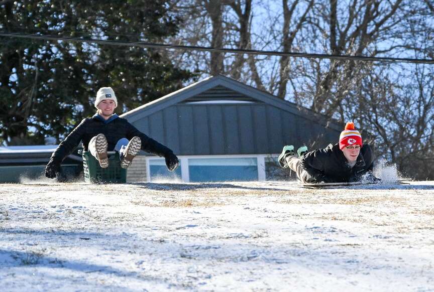 Topher Nelson and Trent Schroeder sled down a hill on Wednesday at Wilson Park in Fayetteville. Nelson and Schroeder, students at the University of Arkansas, did not have their own sleds, so they improvised by using a piece of cardboard and a laundry basket. Snow and ice buildup has yet to melt off after last Sunday's snowfall. Visit nwaonline.com/photo for today's photo gallery. (NWA Democrat-Gazette/Caleb Grieger)
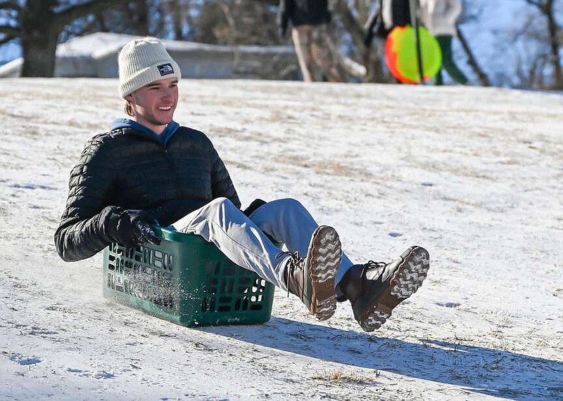
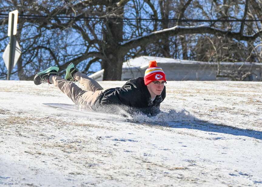 Topher Nelson sleds down a hill on Wednesday at Wilson Park in Fayetteville. Schroeder, a student at the University of Arkansas, did not have his own sled, so he improvised by using a laundry basket. Snow and ice buildup has yet to melt after last Sunday's snowfall. Visit nwaonline.com/photo for today's photo gallery. (NWA Democrat-Gazette/Caleb Grieger)