The record low temperatures seen over the past couple mornings are neither uncommon nor a harbinger of things to come, according to the National Weather Service.
The official temperature readings at Drake Field in Fayetteville showed a new record low for Jan. 16 of minus 10 degrees, according to the weather service. The previous record low for the date was zero in 1997. This morning's low of minus 4 degrees tied the previous record for the date, which was also set in 1997.
According to the weather service, the all-time record low recorded at Drake Field was minus 20 degrees on Feb. 16, 2021. Joe Sellers, a meteorologist with the National Weather Service in Tulsa, said the low temperatures recorded over the past few days were not the result of any unusual weather patterns or events.
"We just had a really strong arctic outbreak," Sellers said. "It's not uncommon."
Sellers said another blast of arctic air will reach the area Friday, but the high temperatures between today and Friday should be in the 30s and 40s. The next round of cold weather is not expected to bring any winter precipitation with it, Sellers said, and by next week temperatures should be in the 40s and 50s with a chance of rain off and on throughout the week.
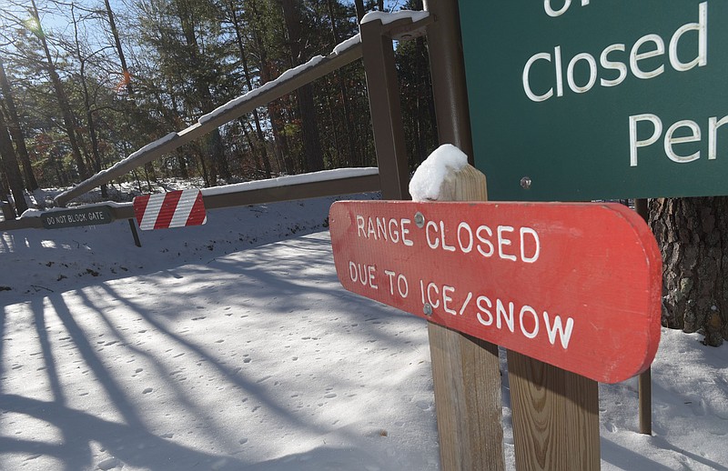
Getting back to normal
Locally, road crews and government offices were getting closer to normal. Jay Frasier, Benton County's administrator of public services, said most paved roads were "in real good shape" and the county's Road Department has shifted its attention to dirt and gravel roads.
"If the temperatures and the sunshine are what they say it's going to be, we'll have a good amount melt off and the roads will be in good shape by this afternoon," Frasier said.
Frasier said that if nothing unexpected happens, the Road Department crews will be done for the day at 3 p.m. and will return to working normal shifts for the next few days at least.
"I haven't had any reports of any slick spots," Frasier said this morning.
One of four semitrailer loads of deicing compound ordered by and delivered to the Washington County Road Department arrived frozen solid around 1 a.m. Tuesday morning, but rain was as much a cause of that as cold, according to Tad Sours, county communication director.
"When you've seen table salt that got water in it and it chunked up, that's what happened here," Sours said. "It rained on this load in transit, so it got wet, then it froze." The other three loads that arrived gave the county enough deicing compound to apply while the fourth load is being thawed, he said. "It was pulled into the heated barn, and we've put propane heaters on it," he said. "Thankfully we've had enough to apply until this load is ready."
Benton County offices were observing normal business hours today after opening late on Tuesday. The Quorum Court's Committee of the Whole meeting was moved from Tuesday night to Thursday night, according to County Judge Barry Moehring.
Peter Masonis, spokesman for the city of Rogers, said streets were in good condition today and city offices opened at 10 a.m. this morning after being closed Tuesday. Masonis said normal government operations have resumed.
Sgt. Matt Ray with the Springdale Police Department said this morning the city's streets were passable. Ray said the Police Department had received "a few calls" of weather-related accidents, but all of them were minor.
"It's mostly been people sliding into other cars," Ray said. "The typical bad-weather calls."
Schools across the region are closed today because of the wintry weather.
The University of Arkansas, Fayetteville, closed its campus today, the university announced on its website. In addition, the University of Arkansas at Fort Smith closed its campus and canceled all classes for the day. Northwest Arkansas Community College likewise declared all of its locations would be closed and remote learning would be in effect today.
What's in the forecast?
The weather service forecast for today calls for sunny skies with a high near 35 degrees and wind chill values between 10 and 20. South winds from 10 to 15 mph are expected, with gusts as high as 25 mph. Tonight should see increasing clouds, with a low around 24. South winds from 5 to 10 mph are predicted, with gusts as high as 20 mph.
Thursday is expected to be mostly sunny, with a high near 42. Thursday night is expected to bring scattered flurries between 9 p.m. and 3 a.m. That will be followed increasing clouds, with a low around 12, the weather service said. Wind chill values between 1 and 6 are anticipated, and north winds from 5 to 10 mph increasing to 10 to 15 mph after midnight are predicted. Winds could gust as high as 25 mph.
From Friday through Sunday, sunny skies are expected, turning partly cloudy Saturday night and going into Sunday. Friday's forecast calls for below freezing temperatures with a high near 21 degrees and a low around 5. Saturday is also expected to be below freezing all day, but the temperature could get just above freezing for some of the day Sunday, according to the forecast.