Picture a place with long, high-altitude views of the Ozarks, where campers can set up a trailer or tent anywhere they please or enjoy a picnic lunch in forest splendor.
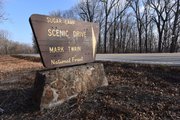
It’s all here, and more, along Sugar Camp Scenic Drive, an 8-mile gravel route through the Mark Twain National Forest in Barry County, Mo.
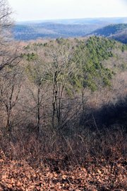
Scenic doesn’t do justice to the beauty that unfolds during a drive on this meandering, well-maintained road seven miles northeast of Seligman, Mo., or nine miles southeast of Cassville, Mo.
The drive twists, climbs and dives through hardwood forest every foot of the way. Winter may be the best time for a windshield tour. Oaks and hickories without leaves let travelers see far into the woods. Views from high ridges are clearer in the crisp, winter air.
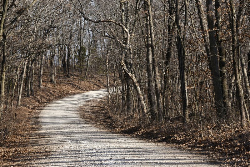
There are pull-offs at some of the vistas, but the road is wide enough to stop anywhere. And there’s little traffic.
Most travelers see the grandeur by car, but the route is multipurpose. Hikers may consider it a wide trail best seen on foot. Horse owners may want to saddle up their steeds and clip-clop along. Bicycle riders, too, enjoy a fine ride that’s most suited to mountain bikes.
A trip to Sugar Camp Scenic Drive on Dec. 22 took in the scenery through a car windshield first, then over a set of handlebars on a mountain bike.
To get there, most Northwest Arkansas visitors follow U.S. 62 north from Rogers to Arkansas 37 at Gateway. Turn north and the highway quickly becomes Missouri 37 at Seligman. About 1.5 miles north of the state line, turn east on Missouri 112 and go about seven miles to the start of Sugar Camp Scenic Drive. It’s marked with a large sign on the left.
The route runs east through the forest, past a couple of gorgeous views, to a little picnic area with two tables about four miles into the drive. Hungry travelers would be hard pressed to find a more lovely picnic spot.
It’s also a dandy place to park the car and hop on a mountain bike. Riders can pedal to their heart’s content along the main road or explore the network of two-track logging trails that spur off the main drag. These little byway treasures also make for great hiking.
Riders and hikers who eat hills for breakfast will find all the climbs they want. Or it’s easy to stay on more level ground. Both landscapes can be found not far from the picnic area.
Like to camp? Set up the camper or pitch a tent wherever the mood strikes. Camping is allowed anywhere in the Mark Twain National Forest. All kinds of nooks and crannies in the woods are fine campsites.
Sugar Camp Scenic Drive can be the centerpiece of a longer drive through scenic countryside. The route follows Forest Road 2275 the whole way east. It becomes pavement just before Forest Road 2275 meets Missouri 86.
Follow Missouri 86 a few miles north to Route F. Go west on Route F about six miles to Roaring River State Park. Where Route F meets Missouri 112, go south back to Sugar Camp Scenic Drive to complete a loop of about 25 miles.
Cheap thrills in a car are found along Route F. The hills are so steep they seem like a two-lane blacktop roller coaster. Hit the summit of a hill at 45 mph and it feels like the car might jump into the sky.
The loop takes travelers through Roaring River State Park where trails, trout fishing and Roaring River Spring are the attractions. The spring bubbles to earth at a rate of 20 million gallons per day of clear, cold water.
It all starts at Sugar Camp Scenic Drive on four wheels, two pedals or two feet.