SEATTLE — On a clear mid-August night about 3 a.m., an Alaska Airlines Boeing 737 heading to Seattle-Tacoma International Airport took a radical turn.
Jets typically begin their approach to Sea-Tac as many as 20 miles north of the runway and fly south over Seattle's residential neighborhoods, roughly following Interstate 5.
But on this test flight, Alaska Airlines was demonstrating a new satellite-based airplane-navigation system that it hopes will transform air-traffic patterns at Sea-Tac, and eventually, airports everywhere.
So the jet made its turn over Elliott Bay instead, and lined up with Sea-Tac's runway lights just six miles north of the airport.
The new technology steers air traffic on autopilot along a smoothly descending, satellite-guided path, avoiding the stair-step approach and constant interplay with air traffic controllers now required to bring in planes.
It promises to save airlines big money on fuel while cutting overflights, noise and carbon emissions for people on the ground. Based on experience in which it's been deployed, the system should be safer and reduce delays for travelers.
Alaska Airlines, supported by Boeing's Jeppesen navigation unit, hopes to use Sea-Tac as a template for the Federal Aviation Administration's planned revamp of the entire country's air-transportation network.
The airline projects reduced overflight noise for 750,000 Seattle-area residents, along with annual savings for planes using the airport of 2.1 million gallons of fuel and 25,000 tons of carbon-dioxide emissions.
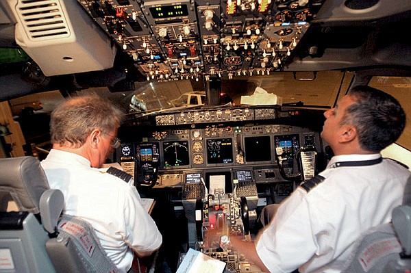
"There is nobody who loses here," said Mike Adams, the pilot in command of the August test flight.
Getting to the promised future involves a highly complex transition, however, and federal regulators and airlines have been slow to move forward. A report by the inspec-tor general of the Department of Transportation in July was sharply critical of FAA progress so far.
At the world's busiest airport, Hartsfield-Jackson in Atlanta, the FAA introduced 10 advanced satellite-based landing paths two years ago. But because air-traffic policies governing planes landing on parallel runways have not been updated after a lengthy review lasting more than four years, so far not a single airline has been cleared to fly any of the routes.
At other airports, the FAA has developed landing procedures that are mere overlays of routes already flown routinely, with "little or no added benefits" such as shorter routes to provide an incentive for airlines to use them.
More broadly, according to the inspector general report, the "FAA has not developed a plan to effectively manage and budget for the elements necessary to deliver [the new navigation system's] benefits," including training for air traffic controllers and deployment of software.
Alaska Airlines began using the new navigation system in 1996 to enable its planes to fly safely into Juneau, Alaska, approaching along a narrow sea channel surrounded by rugged mountains. Other airlines have since applied it in other areas, including Australia and Tibet.
The technology, which links satellite-based GPS with the plane's autopilot system, has proved its accuracy in such difficult terrain. A plane
Business, Pages 21, 24 on 09/21/2009