I was as excited as a young child on Christmas morning, waking 30 minutes before the 6 a.m. alarm. I lay in bed, willing the clock to go faster so I could begin what was going to be "a memorable day."
The day had finally arrived for me to join the Ozark Society Highlands Chapter for a bushwhacking adventure in the Upper Buffalo Wilderness. Hiking in the wilderness would be reason enough to be excited, but this was Pine Hollow. An area I had never explored.
Terry Fredrick, the outing leader, told me the hollow is protected from development and other man-made alterations under the federal Wilderness Act. It is pretty much the same as it was more than 100 years ago. Supporting second-growth oak-hickory forest, the area represents some of the best and last remaining examples of Arkansas' original natural landscape.
Even though it would not make the posted start time for the March 18 hike arrive any sooner, I went ahead and rolled out of bed. I had stuffed my day pack with lunch, snacks, water and other supplies the evening before. All that remained was a quick breakfast, grabbing my hiking stick and hitting the road.
By the 9:30 a.m. start time, there were more than a dozen like-minded individuals at the designated rendezvous, the Mossville cemetery on Arkansas 21 in Jasper. Everyone gathered around Fredrick as he shared safety tips, advice on equipment and asked if everyone had signed the release form. Next, he reminded the group of the challenging conditions we would face on the hike. He stressed there were no established hiking trails. This was true bushwhacking.
When no one packed up their gear and climbed back in their vehicle for a hasty exit, our Pine Hollow Adventure officially began.
At one time the hike began directly across from the cemetery. When someone discovered they were crossing private property, being the socially conscious group Ozark Society members are, they adjusted to start the hike north of the cemetery. So, about half a mile up the road, we dropped off the highway's shoulder and quickly disappeared into dense Ozark backwoods.
Immediately we were traversing the tightly packed contour lines I had seen on the topo map, which means we were tramping down a steep hillside. Hikers were scattered across the mountain to lessen the impact our presence would leave on the environment.
It was great to be outdoors exploring the Ozark Mountains. Temperatures were in the low 30s with little change in the forecast. But the sun shone brightly in clear blue skies, and the scenery was outstanding. This is the best time of the year to explore The Natural State's backcountry. Trees have dropped their leaves to expose rock formations and views of other natural features normally blocked during the leaf-on season. It also allowed the sun's much-appreciated rays to warm our chilled bodies.
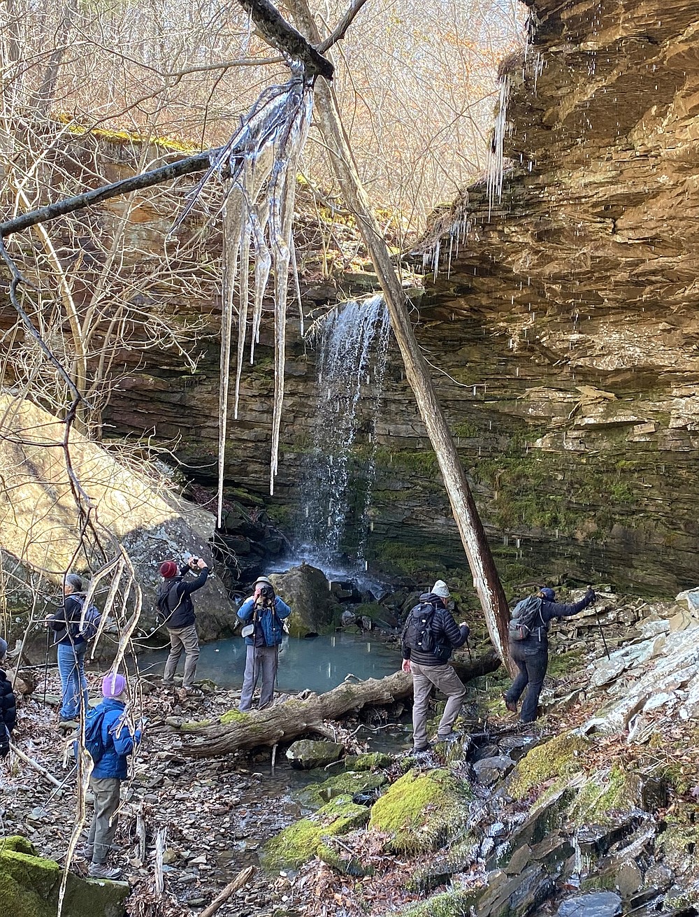
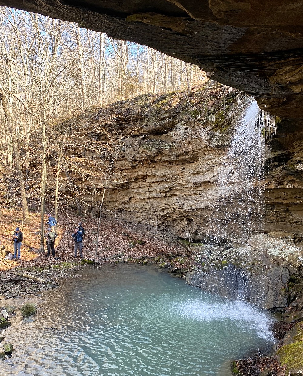
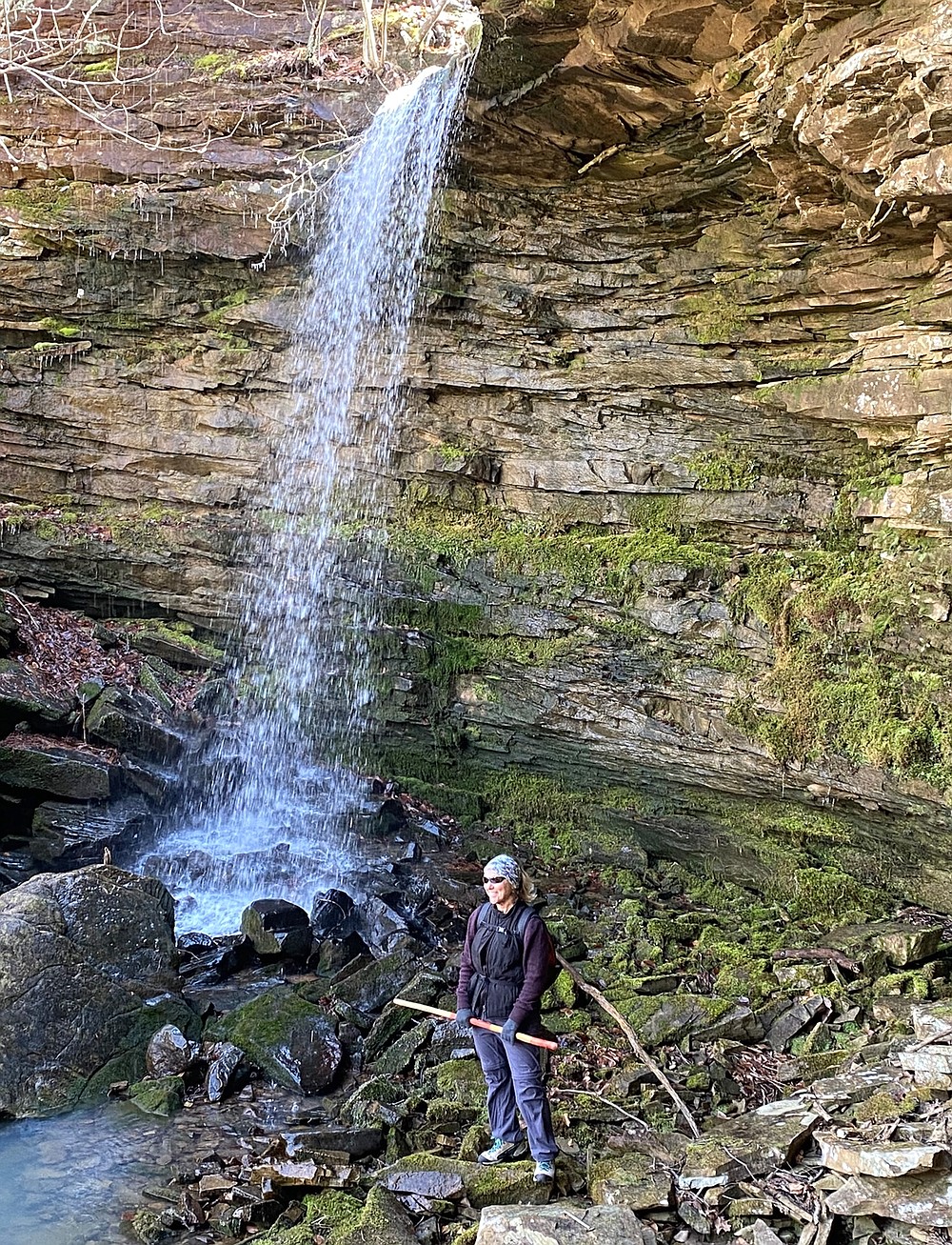
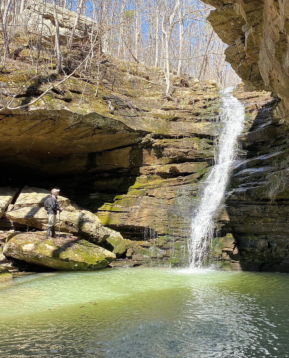
Down the hillside we hiked until we arrived at the lip of a 60-foot sheer bluff. We followed its edge until we found a hike-able route to the bottom. Our efforts were rewarded with our first "Kodak moment." A steady stream of water poured off the rim of the bluff.
When someone asked Fredrick the name of the falls, he proudly responded, "It doesn't have a name. This is wilderness."
UNTOUCHED, UNNAMED, UNMARKED
Makes sense to me. Leave these natural areas untouched and unnamed. Also, leave them unmarked. It was great that we hadn't seen any bright survey tape wrapped around trees to mark someone's route.
If a hiker is searching for a waterfall, find the blue lines of a topographic map and start following it downhill. That's where you will find them. Once you reach the bottom of a hollow, continue along the bluff line to discover more tributaries flowing off the canyon walls. Which is what we did after leaving the first falls sighting. And yes, there were more waterfalls.
If you don't have an experienced leader like Fredrick as a guide, learn how to use a global positioning system device and set out on your own adventure. Prepare. Study that map. Be sure to record the coordinates where you park your vehicle so you can find your way out, then pick an area on your topo map with plenty of close contour lines, and let your adventure begin. It is also a good idea to carry a compass and headlamps with you. Just in case you must resort to Plan B.
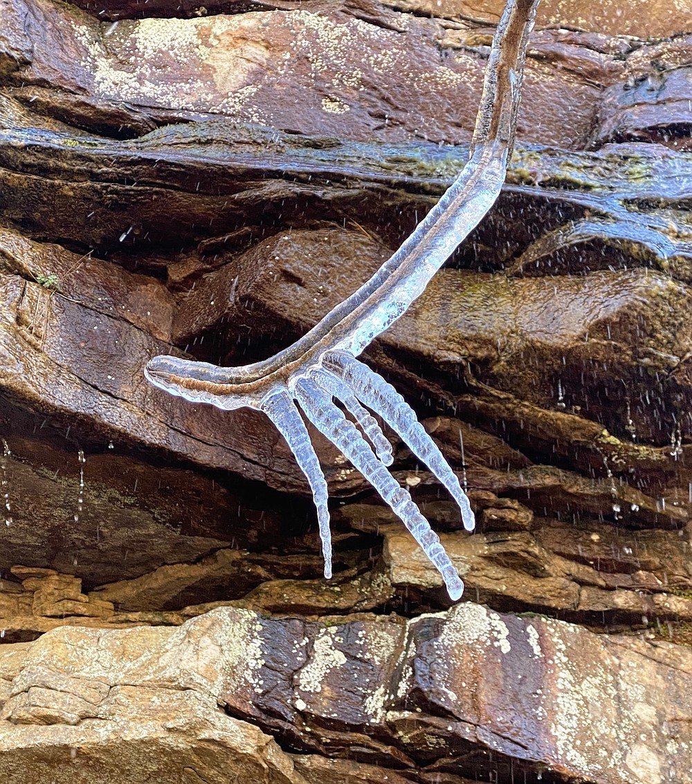
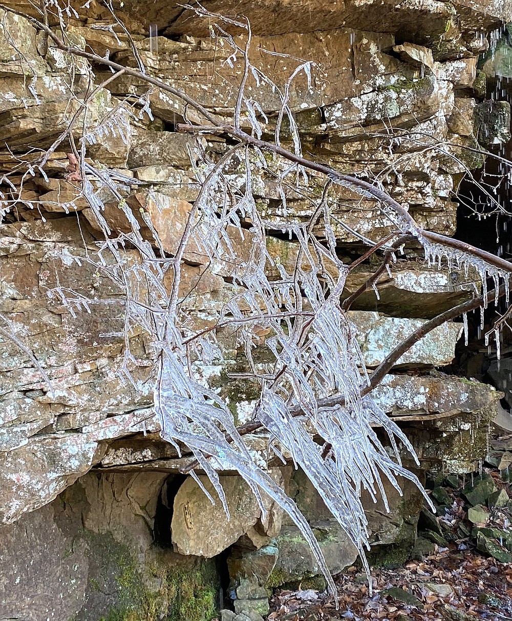
Recent rains had the waterfalls flowing nicely. Additionally, the bluff walls seeped moisture from the saturated ground, creating a variety of beautiful ice formations. Thin layers of ice coated the rock surface, and hundreds of icicles clung from rock ledges.
Also, at the bluff's base, crumbled piles of fallen ice crystals glistened in the sun. My favorites were the beautiful ice sculptures created by wisps of wind-blown water spraying nearby naked tree branches.
AND THERE IS MORE
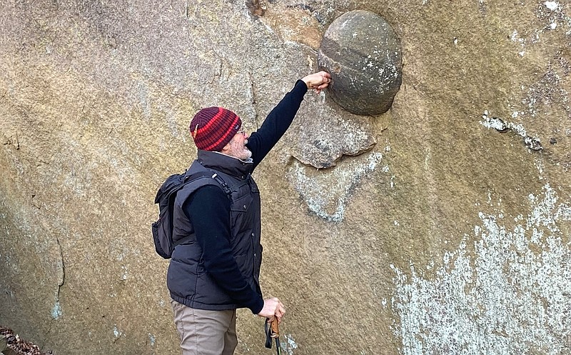
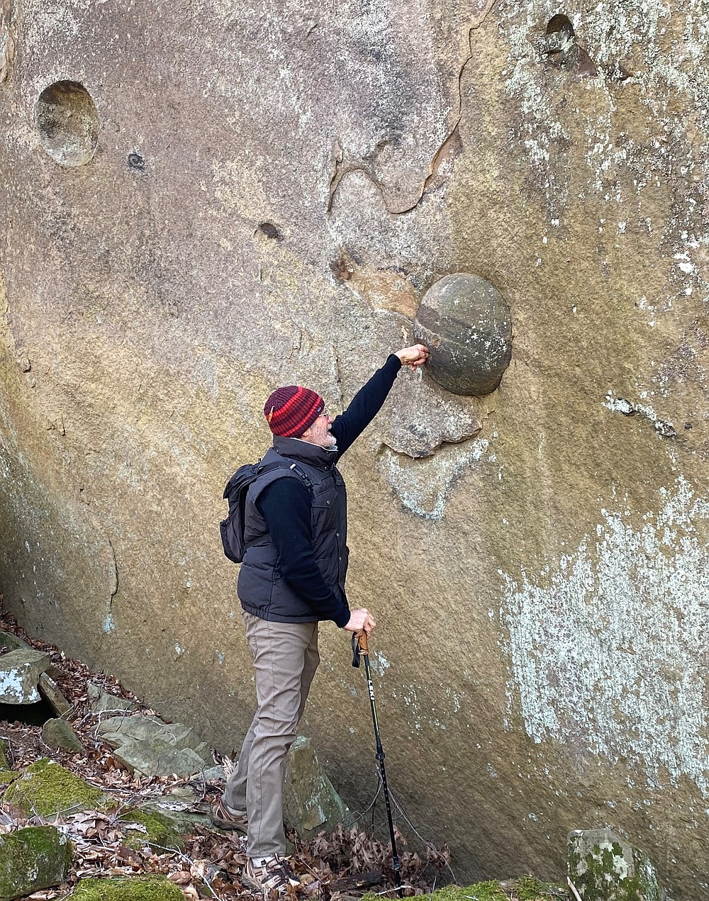
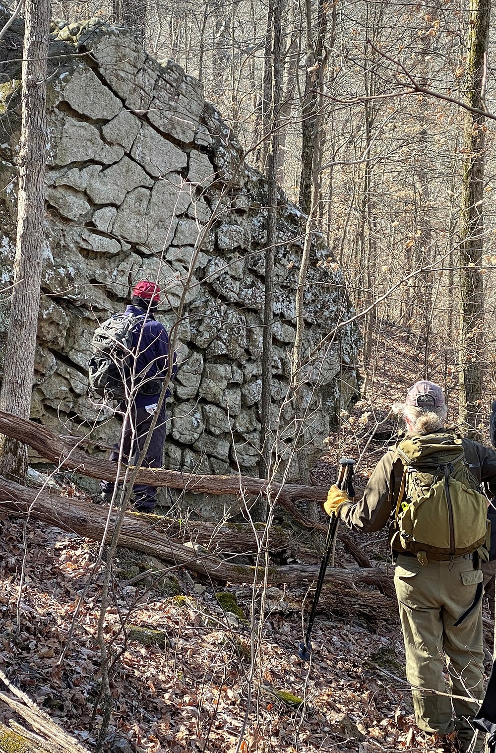
Pine Hollow not only offers beautiful waterfalls and picturesque bluff lines, but it also hosts unique geological structures known as concretions. Though often mistaken for fossil eggs or turtle shells, they are a geologic composition of the earth. They form inside sediments before hardening into rock. As minerals within the deposit develop successive layers around a nucleus, it forms the rounded shell now protruding from the rock.
We saw a round bowling ball-like stone, about the size of a beach ball, known as calcareous concretion. It was embedded in a huge boulder that appeared to have splintered from the bluff farther up the hillside. Even though only a single embedded stone remained, there were more imprints where others had been. They formed a straight line across the boulder that reminded me of planets orbiting the galaxy. With a line through the concretion, it resembled Saturn, contributing to the illusion.
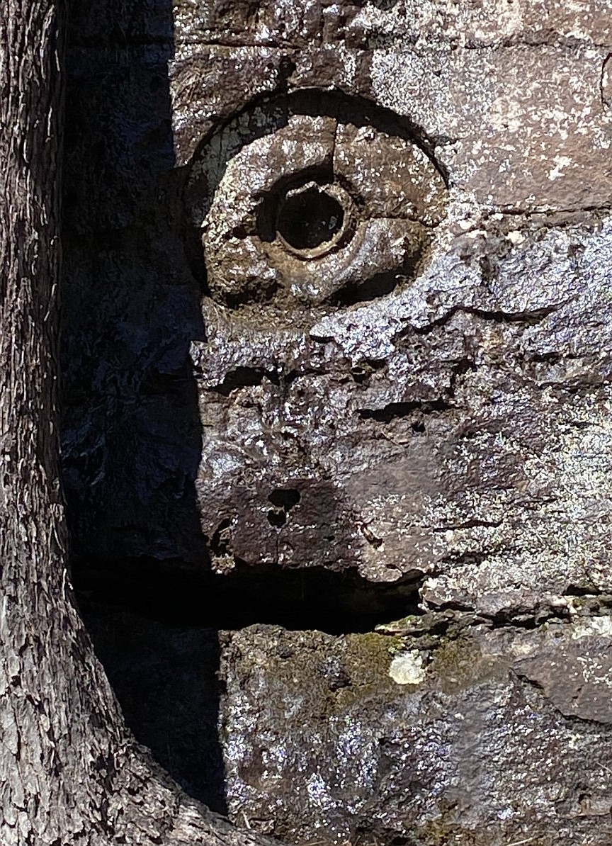
Shortly after this, we came across another impression that resembled a concretion. There was an indention in the center of the globe that made it look like a large eyeball. Combined with an opening below that resembled a mouth, it was easy to envision an imprinted face in the boulder.
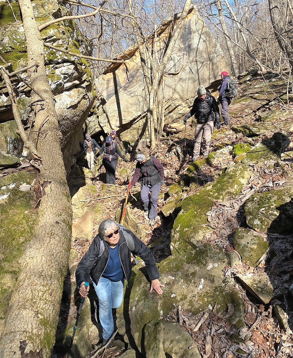
There was more scrambling over large rocks and dropping on all fours to crawl under fallen trees as we worked our way down the hollow. And creek crossings. Lots of crossings. For those who maintained their balance hopping from rock to rock, their feet remained dry.
IN ITS OWN WAY
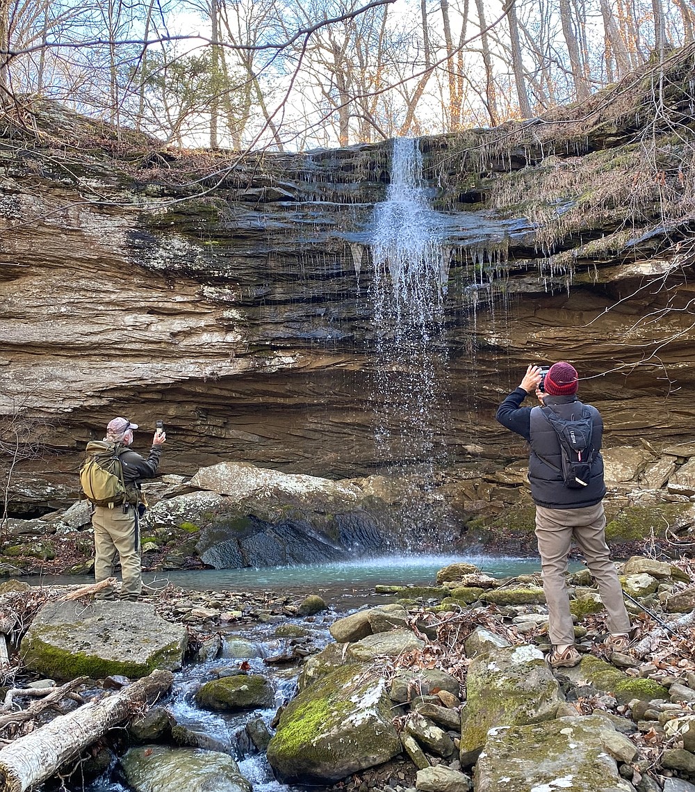
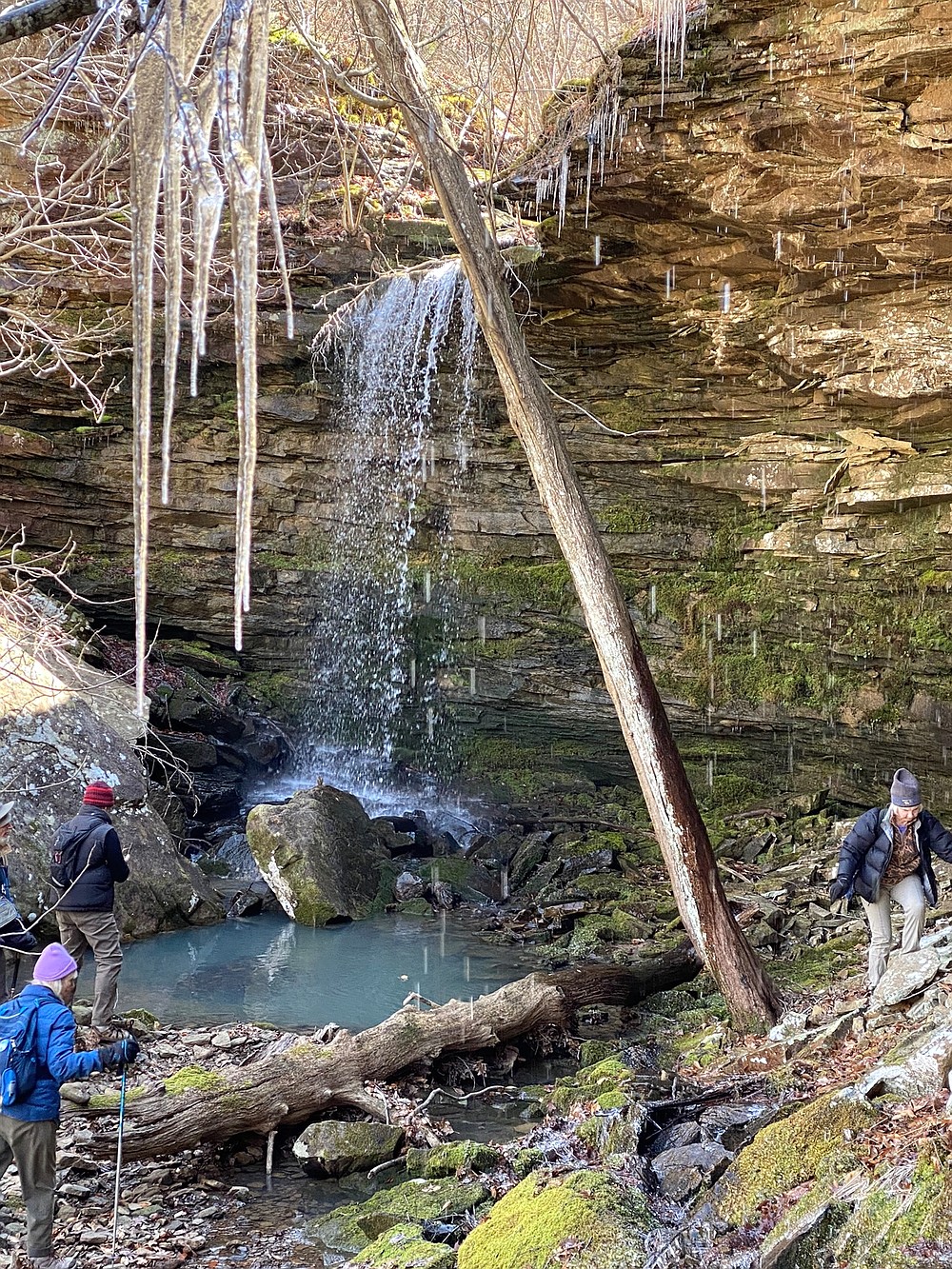
We reached another waterfall, flowing in all its splendor, with lush green ferns as a backdrop and bordered by dangling icicles clinging from the rim of the canyon. No two waterfalls are the same, each beautiful in its own unique way.
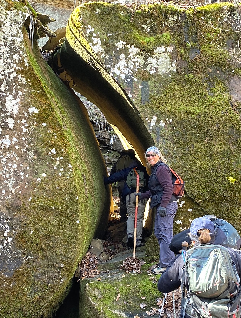
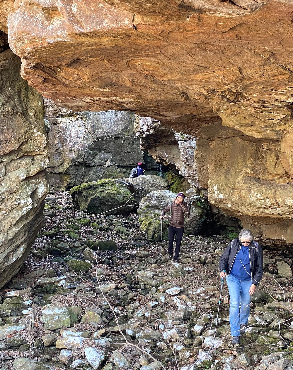
The next feature in this Land of Oz (or Ahs) was a giant boulder split down the middle, leaving a gap just wide enough for hikers to pass through. What made this special was that the crack was a crescent moon shape. I have never seen such a fissure.
The passageway through the rock opening led us to a deep bluff shelter. It was carved 80 feet into the solid, red rock bluff, with a 30-foot ceiling. The mouth of the opening was decorated with dozens of fallen icicles.
Then it was down another steep hillside to reach yet another drainage, followed by more rock hopping back and forth across the stream.
We were pleasantly surprised to discover a variety of early-season flowers spreading their colorful blossoms. Lavender cutleaf toothwort and pink Dutchman's breeches glowed in the bright sunlight.
HOUSE-SIZE BOULDERS
As we reached an intersection of two deep hollows, Roger Keesee, another experienced Ozark Society explorer, turned to say, "Now the true bushwhack begins."
What had the previous two hours of hard-core hiking been? But the man knew what he was talking about. Thus far, most of the hike had been downhill. Payback time had arrived.
Peering at the steep drainage ahead, I saw piles of massive, house-size boulders. A small waterfall poured over a rock ledge near the top, then disappeared within the stacked rocks below. It reappeared multiple times farther down the stacked boulders, stair-stepping its way to the drainage we had just hiked. Each hiker's goal was to plot a pathway through the string of boulders to reach the top.
At the summit of the drainage, we were rewarded with yet another splashing stream as it cascaded down a 30-foot, moss-coated crag.
The strenuous trek up the steep drainage strung the group out. We gathered at the cascade to regroup before tackling the final leg of the outing.
After everyone was accounted for, we followed the sheer wall of rock until we reached an opening we could use to scramble up the bluff top. From there, it was a leisurely walk in the woods to finish our hike. Once at our vehicles, everyone hauled out snacks and beverages for the customary socializing after an Ozark Society adventure.
This adventure was indeed "a memorable day."
KEEP IT NATURAL
The creation of the Upper Buffalo Wilderness provided the highest level of protection available for pristine areas such as Pine Hollow. It is now the responsibility of those who visit these areas to preserve them for future generations to experience.
Please, leave no trace.
Bob Robinson is the author of "Bicycling Guide to the Mississippi River Trail," "Bicycling Guide to Route 66" and "Bicycling Guide to the Lake Michigan Trail."
[Gallery not showing? Click here to see photos: arkansasonline.com/327pine/]
Gallery: Pine Hollow adventure