SILOAM SPRINGS -- Heavier rains outstrip all other causes of worsening floods in the Illinois River's basin, according to a study presented Tuesday by the U.S. Army Corps of Engineers.
Development in Northwest Arkansas and clearing of forests throughout the river's basin are relatively minor contributing factors to floods, said Edmund Howe, a hydraulic engineer working for the corps' Little Rock district. Howe presented the study's finding at a public hearing at 5:30 p.m. Tuesday at the First Baptist Church in Siloam Springs. At least 83 people attended, according to a count taken by the corps, which organized the meeting in cooperation with the Cherokee Nation and Oklahoma's Grand River Dam Authority.
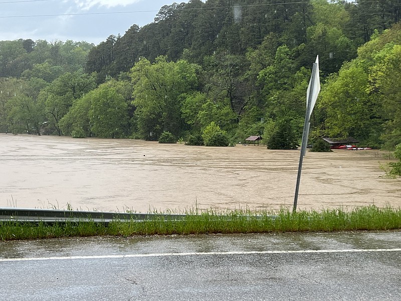
The Illinois River begins in northwest Arkansas and flows from there into eastern Oklahoma before draining into the Arkansas River. The river overflowed its 25-year flood level twice since 2011 and its 100-year flood level once in the same time period.
The study shows an average increase of 10 inches average yearly rainfall at several sites within the watershed and almost 20 inches at one site shown Tuesday. Howe said he could not cite what the average rainfall figure at each site was off the top of his head. For comparison, the average yearly rainfall at Drake Field in Fayetteville was 41.8 inches in 2022, according to the National Weather Service.
Not only is average rainfall increasing but the rain is more intense when it does come, Howe said.
"If you have an average amount of rainfall but most of it falls in the same two months, you're going to have more flooding," Howe said.
Audience member Jason Mitchell of near Siloam Springs said he has 50 acres he has to clear of trash after each flood. He appreciates the study and finds it credible, he said, but would like to see more scrutiny of how much upstream wastewater plants contribute to the river's condition.
Property owners along the river can set up riparian zones by planting trees, brush and other ground cover along the river to help slow down the rise of water during floods and to help control erosion, Howe told the crowd. Bigger measures such as detention basins -- artificial ponds to hold stormwater runoff -- would be too expensive to build and to maintain to be worthwhile, he said. He estimated property owners would have to build at least 30 basins to make a worthwhile difference.
U.S. Army Corps of Engineers study on Illinois River flooding
https://www.swl.usace.army.mil/Missions/Planning/Illinois-River-Flood-Study/