ST. PETERSBURG, Fla. -- Hurricane Ian, one of the most powerful storms ever recorded in the U.S., swamped southwest Florida on Wednesday, turning streets into rivers, knocking out power to more than 2 million people and threatening catastrophic damage further inland.
A coastal sheriff's office reported that it was getting many calls from people trapped in flooded homes. Desperate people posted to Facebook and other social sites, pleading for rescue for themselves or loved ones. Some video showed debris-covered water sloshing toward homes' eaves.
As the eyewall moved ashore on Captiva and Sanibel Islands, live traffic web cameras showed storm surge overwhelming streets, rising higher than mailboxes and stop signs before the cameras cut out. Naples was experiencing 6 feet of storm surge and rising, blowing away the previous record of just over 4 feet.
The hurricane center declared the storm made landfall around 3 p.m. near Cayo Costa, an island just north of Captiva and off the coast of Fort Myers with few full-time residents and reachable only by boat.
A second landfall on the mainland, near Pirate Harbor and north of Punta Gorda, happened around 4:35 p.m.
Bill Karins, a meteorologist with NBC's climate unit, tweeted that the worst storm surge would likely occur after landfall, when the highest winds come ashore.
The storm was expected to move over central Florida Wednesday night and this morning and emerge over the western Atlantic by later today as a tropical storm with maximum sustained winds around 65 mph.
"As you see it move inland you'll see the eye start to diminish but don't let that fool you, it will still pack a formidable punch as it moves across the state of Florida up the I-4 corridor over the next couple of days," said Jamie Rhome, acting director of the hurricane center.
Mark Pritchett stepped outside his home in Venice around the time the hurricane churned ashore from the Gulf of Mexico, about 35 miles to the south. He called it "terrifying."
"I literally couldn't stand against the wind," Pritchett wrote in a text message. "Rain shooting like needles. My street is a river. Limbs and trees down. And the worst is yet to come."
The then-Category 4 storm slammed the coast with 150 mph winds and pushed a wall of storm surge accumulated during its slow march over the Gulf. More than 2 million Florida homes and businesses were without electricity, according to PowerOutage.us. Nearly every home and business in three counties was without power.
The storm previously tore into Cuba, killing two people and bringing down the country's electrical grid.
About 2.5 million people were ordered to evacuate southwest Florida before Ian hit, but by law no one could be forced to flee.
News anchors at Fort Myers television station WINK had to abandon their usual desk and continue storm coverage from another location in their newsroom because water was pushing into their building near the Caloosahatchee River.
As of a 9 p.m. Eastern time NHC position update, Ian was about 40 miles northeast of Punta Gorda and about 85 miles south-southwest of Orlando. The storm was moving north-northeast near 8 mph.
Though expected to weaken to a tropical storm as it marches inland at about 9 mph, Ian's hurricane force winds were likely to be felt well into central Florida. In the hours since landfall, top sustained winds had gradually dropped to 90 mph, making it a Category 1 hurricane crossing the peninsula. Still, storm surges as high as 6 feet were expected on the opposite side of the state, in northeast Florida.
The storm's hurricane-force winds extend up to 50 miles from the center; tropical-storm-force winds extend up to 175 miles.
Sheriff Bull Prummell of Charlotte County, just north of Fort Myers, announced a curfew between 9 p.m. and 6 a.m. "for life-saving purposes," saying violators may face second-degree misdemeanor charges.
"I am enacting this curfew as a means of protecting the people and property of Charlotte County," Prummell said.
Jackson Boone left his home near the Gulf coast and hunkered down at his law office in Venice with employees and their pets. Boone at one point opened a door to howling wind and rain flying sideways.
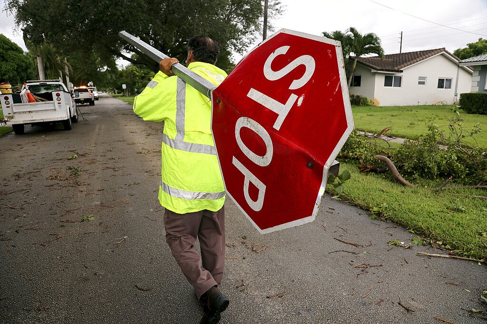
"We're seeing tree damage, horizontal rain, very high wind," Boone said by phone. "We have a 50-plus-year-old oak tree that has toppled over."
In Naples, the first floor of a fire station was inundated with about 3 feet of water and firefighters worked to salvage gear from a firetruck stuck outside the garage in even deeper water, a video posted by the Naples Fire Department showed. Naples is in Collier County, where the sheriff's office reported on Facebook that it was getting "a significant number of calls of people trapped by water in their homes" and that it would prioritize reaching people "reporting life threatening medical emergencies in deep water."
Ian's strength at landfall tied it for the fifth-strongest hurricane when measured by wind speed to strike the U.S. Among the other storms was Hurricane Charley, which hit nearly the same spot on Florida's coast in August 2004, killing 10 people and inflicting $14 billion in damage.
Ian made landfall more than 100 miles south of Tampa and St. Petersburg, sparing the densely populated Tampa Bay area from its first direct hit by a major hurricane since 1921.
Flash floods were possible all across Florida. Hazards include the polluted leftovers of Florida's phosphate fertilizer mining industry, more than 1 billion tons of slightly radioactive waste contained in enormous ponds that could overflow in heavy rains.
The federal government sent 300 ambulances with medical teams and was ready to truck in 3.7 million meals and 3.5 million liters of water once the storm passes.
"We'll be there to help you clean up and rebuild, to help Florida get moving again," President Joe Biden said Wednesday. "And we'll be there every step of the way. That's my absolute commitment to the people of the state of Florida."
The governors of Virginia, Georgia, South Carolina and North Carolina all preemptively declared states of emergency. Forecasters predicted Ian will turn toward those states as a tropical storm, likely dumping more flooding rains into the weekend, after crossing Florida.
The hurricane center predicted up to 12 inches in South Florida and up to 30 inches for central and northeast Florida this week.
SLOWER STORM, HIGHER WATER
Hurricane Ian approached the state with 155 mph winds, two mph shy of Category 5 status, before weakening to 150 mph by landfall.
Nine storms have reached Category 5 status while at sea but only four have made landfall at that strength in the U.S. -- three of them in Florida. The most recent was Michael, which hammered the panhandle in 2018. Andrew devastated South Miami-Dade in 1992 and an unnamed storm now known as the Labor Day hurricane swept the Florida Keys in 1935. Camille roared into the Mississippi coastline in 1969. All four of those Category 5 hurricanes were tropical storms three days before landfall.
"I think we're going to end up seeing that it may end up being a Category 5," DeSantis said. "But at a minimum, it's going to be a very strong Category 4 that's going to rank as one of the top five hurricanes to ever hit the Florida peninsula."
For Southwest Florida, 2004's Hurricane Charley is the yardstick for the worst storm they've lived through. The Category 4 storm came through like a small buzz saw, crossing the state and exiting near New Smyrna Beach.
Charley killed 30 Floridians and caused more than $5 billion of damage. Power was out for weeks in some spots, and public schools were closed for two weeks in some central Florida counties.
Now another strong storm is tearing through the same region, but meteorologists and emergency managers are warning residents that it's not the same storm, despite the similar track. Ian is slower, bigger and wetter than Charley, and the population of the region has grown dramatically, putting more people in the bull's-eye.
"This is not Hurricane Charl[ey], but something you have never experienced," tweeted Craig Fugate, who led the state's emergency management response to Charley in 2004.
Before making landfall Wednesday, Hurricane Ian's eye was double the size of Charley's tight 7-mile wide eye, and its wind field was also far larger, with tropical-storm-force winds extending up to 175 miles. Charley's wind field was far smaller, with tropical storm winds extending out around 70 miles from the center.
Charley also rushed through the state as an unusually fast storm, with speeds of 20 to 25 mph. Hurricane Ian is forecast to be much slower, with speeds from 10 mph to 5 mph. That slowdown will allow it to dump incredible amounts of rain across most of the state and push "catastrophic" levels of storm surge ashore.
Charley brought 5 to 8 inches of rain to the state, while Ian could bring up to 24 across most of central Florida.
A final factor that could make Hurricane Ian far more devastating than Charley is the number of people and buildings at risk.
Population in the counties closest to landfall has grown by more than half a million since 2004, tweeted Matt Lanza, a meteorologist for Space City Weather in Houston.
Officials are indicating that most of the damage from Ian could be from flooding, which could pose a serious problem for people in parts of the state who might not have flood insurance.
Citizens Property Insurance, the state-run insurer of last resort that covers more residences than about any other company, said Wednesday it estimates it may see 225,000 claims from Hurricane Ian. The company doesn't offer flood insurance, which is mostly offered through the federal National Flood Insurance Program.
Preliminary estimates, also made before landfall, indicate $3.8 billion in losses for Citizens, spokesperson Michael Peltier said.
Information for this article was contributed by Curt Anderson, Christina Mesquita, Cody Jackson, Adriana Gomez Licon, Freida Frisaro, Anthony Izaguirre, Mike Schneider, Seth Borenstein, Aamer Madhani, Bobby Caina Calvan, Andrew Welsh-Huggins and Jay Reeves of The Associated Press and by Alex Harris, Michelle Marchante and Devoun Cetoute of The Miami Herald.
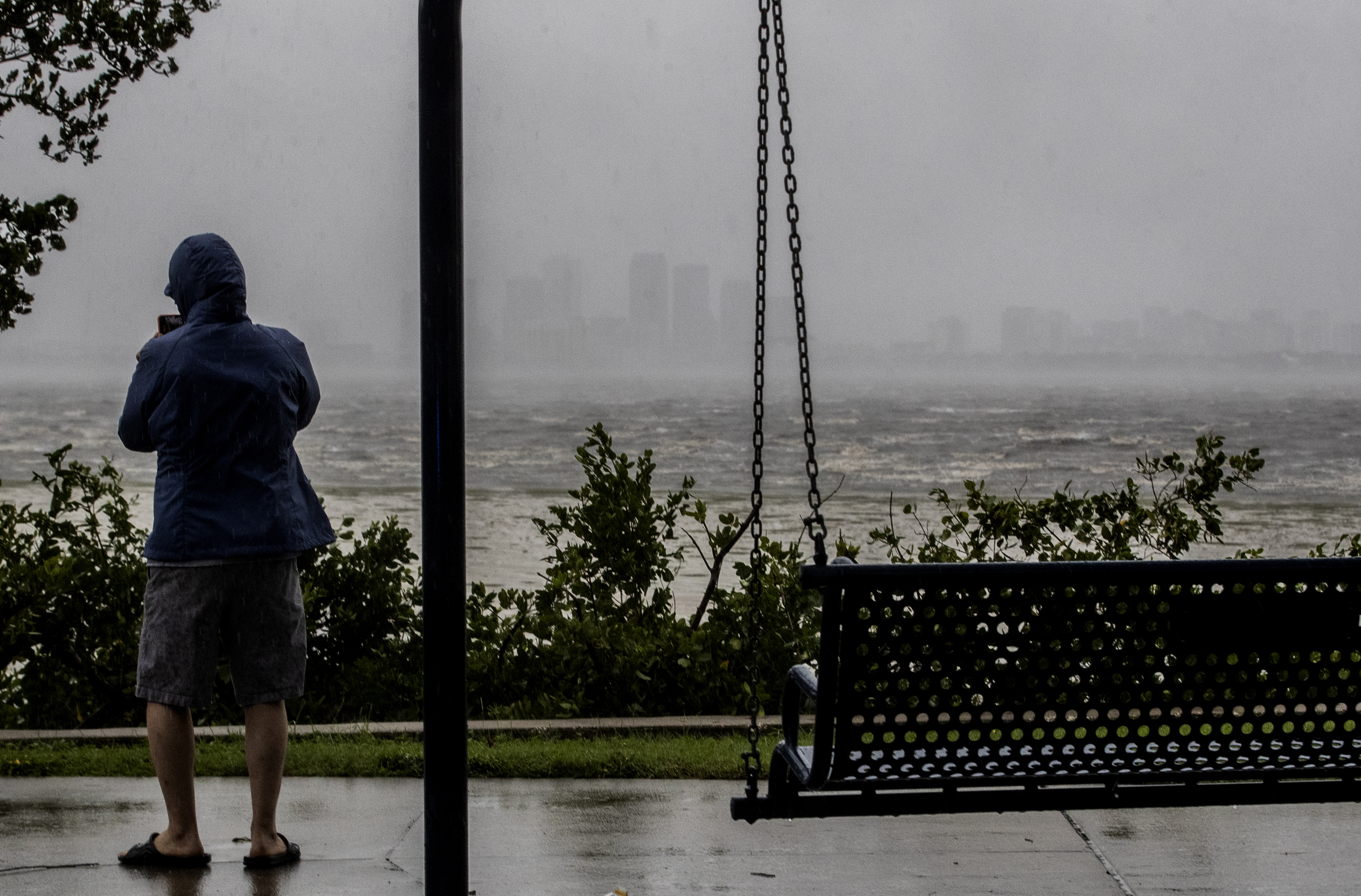 One sightseer witnesses the receding waters of Tampa Bay because of low tide and tremendous winds from Hurricane Ian with downtown in the distance in Tampa, Fla., Wednesday, Sept. 28, 2022. (Willie J. Allen Jr./Orlando Sentinel via AP)
 A man stands in the middle 7th Street in Ybor City on the rains soaked streets, a few hours before the high winds from Hurricane Ian hit Tampa, Fla., Wednesday, Sept. 28, 2022. (Willie J. Allen Jr./Orlando Sentinel via AP)
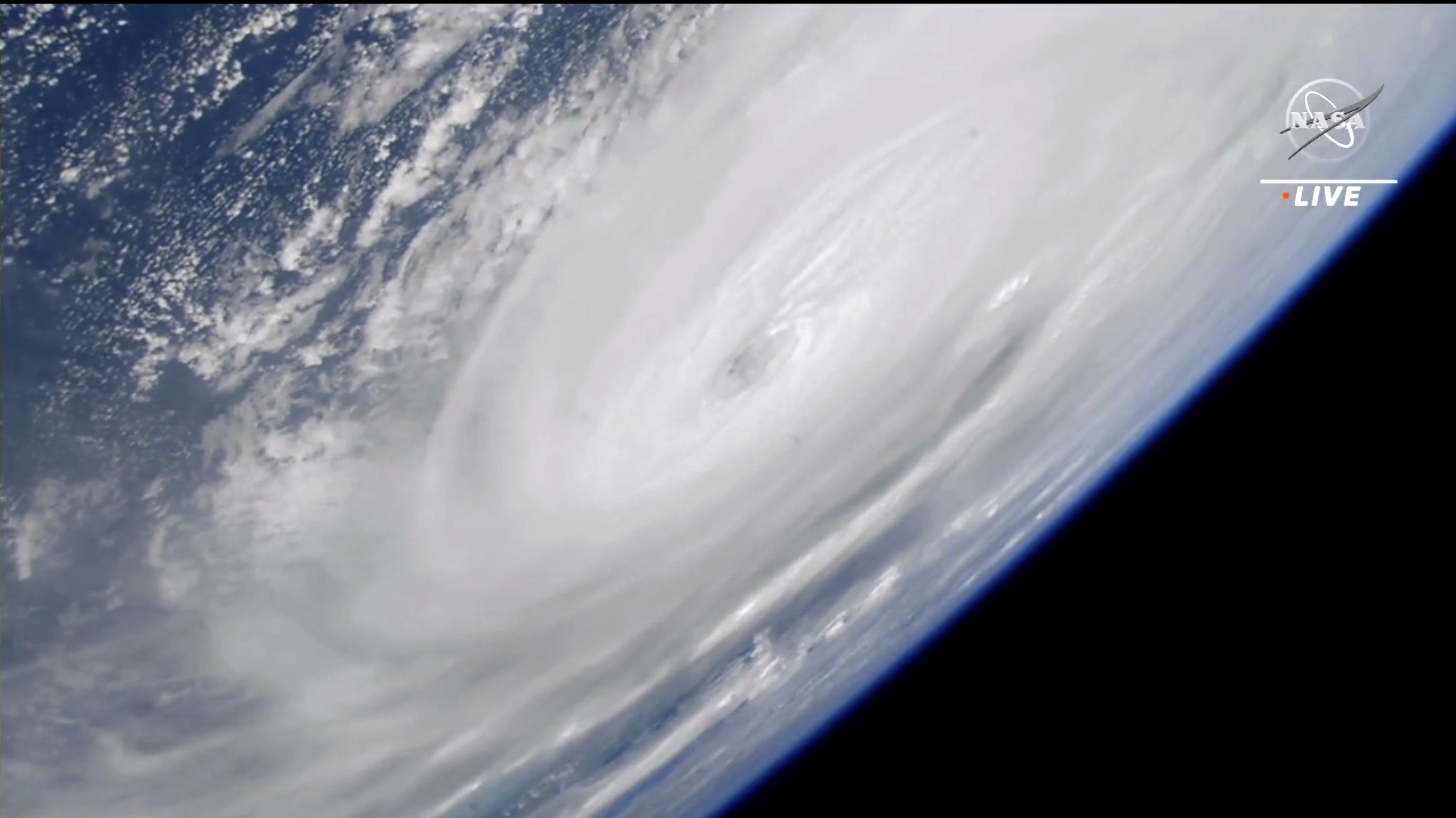 In this image made from a NASA livestream, Hurricane Ian is seen from the International Space Station on Wednesday, Sept. 28, 2022. Hurricane Ian made landfall in southwest Florida near Cayo Costa on Wednesday as a catastrophic Category 4 storm. (NASA via AP)
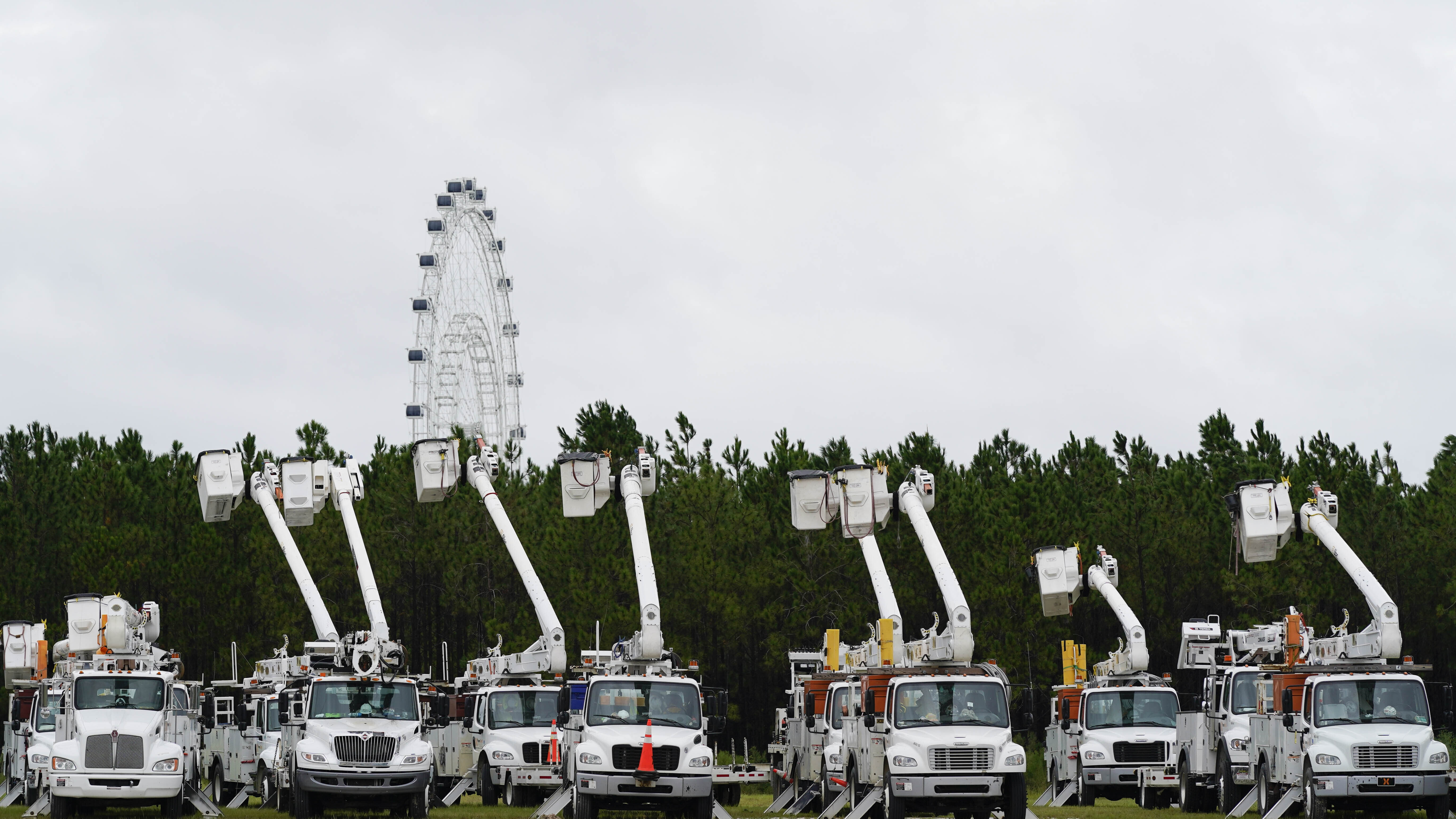 Utility trucks are staged near the Orange County Convention center, ahead of Hurricane Ian, Wednesday, Sept. 28, 2022, in Orlando, Fla. (AP Photo/John Raoux)
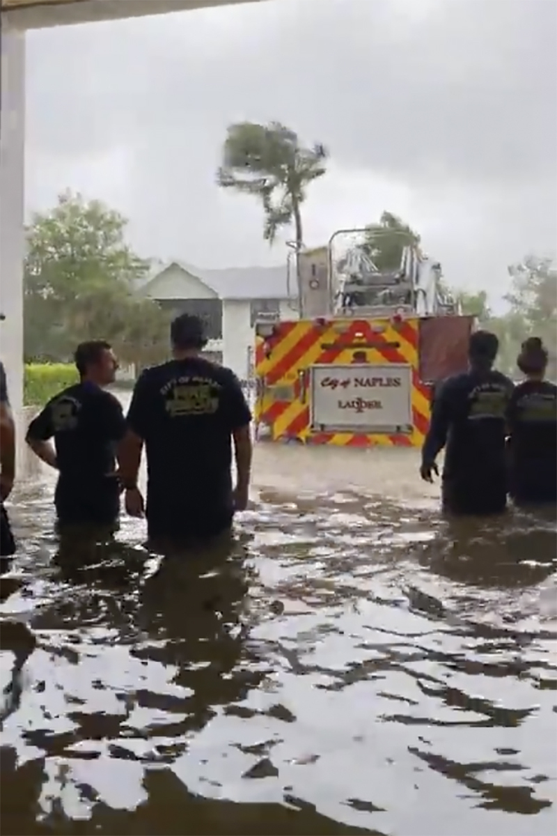 This image provided by the Naples Fire Rescue Department shows firefighters looking out at the firetruck that stands in water from the storm surge from Hurricane Ian on Wednesday, Sept. 28, 2022 in Naples, Fla. Hurricane Ian has made landfall in southwestern Florida as a massive Category 4 storm. (Naples Fire Department via AP)
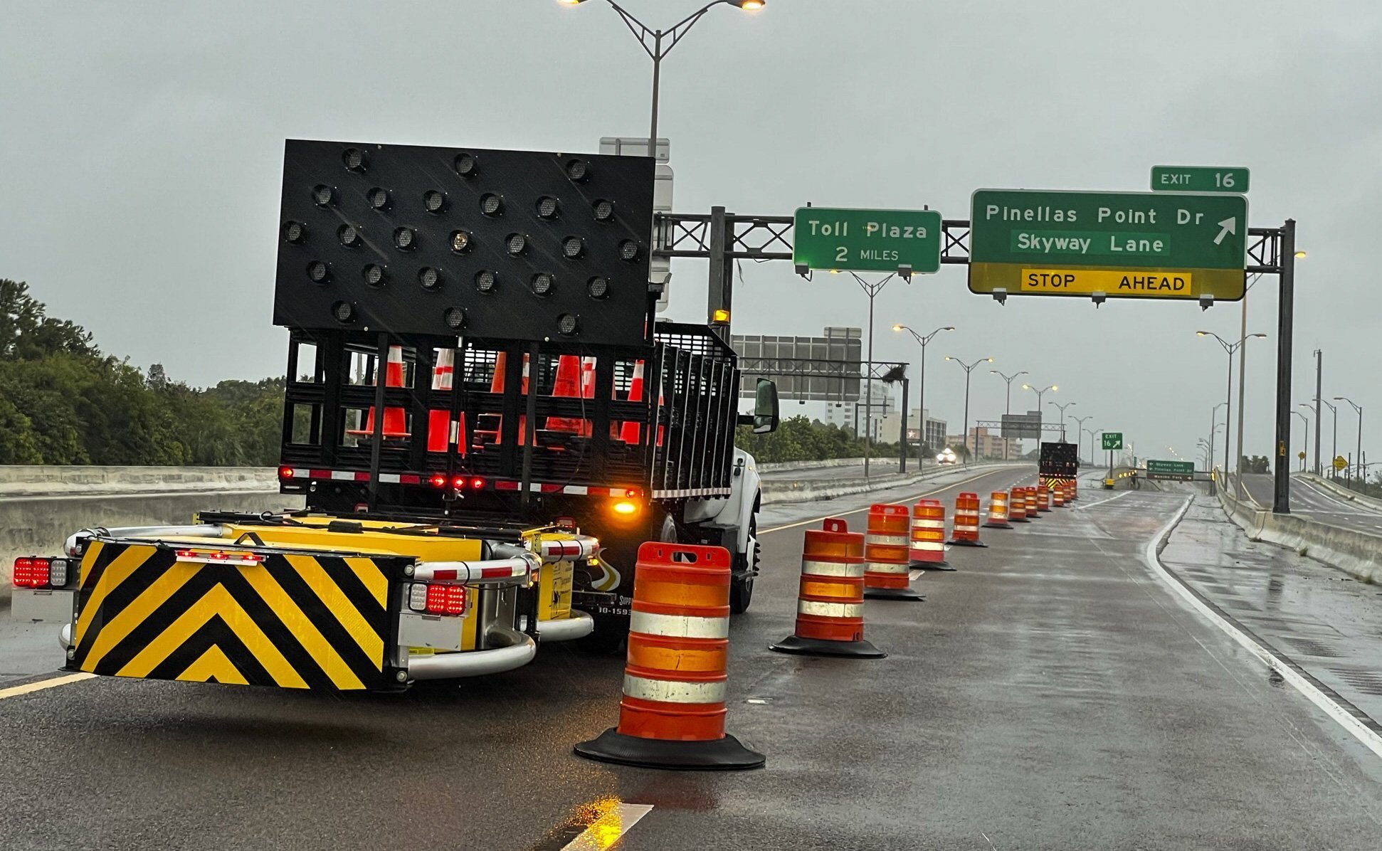 Access roads to the Sunshine Skyway bridge are blocked off as the span is closed due to high winds from Hurricane Ian on Wednesday, Sept. 28, 2022 in St. Petersburg, Fla. Hurricane Ian has made landfall in southwestern Florida as a massive Category 4 storm.(Dirk Shadd/Tampa Bay Times via AP)
 A traveler rests on a couch at the Orlando Airport prior to the facility being closed ahead of Hurricane Ian, Wednesday, Sept. 28, 2022, in Orlando, Fla. Travelers will be sent to a shelter as the airport will be closed. (AP Photo/John Raoux)
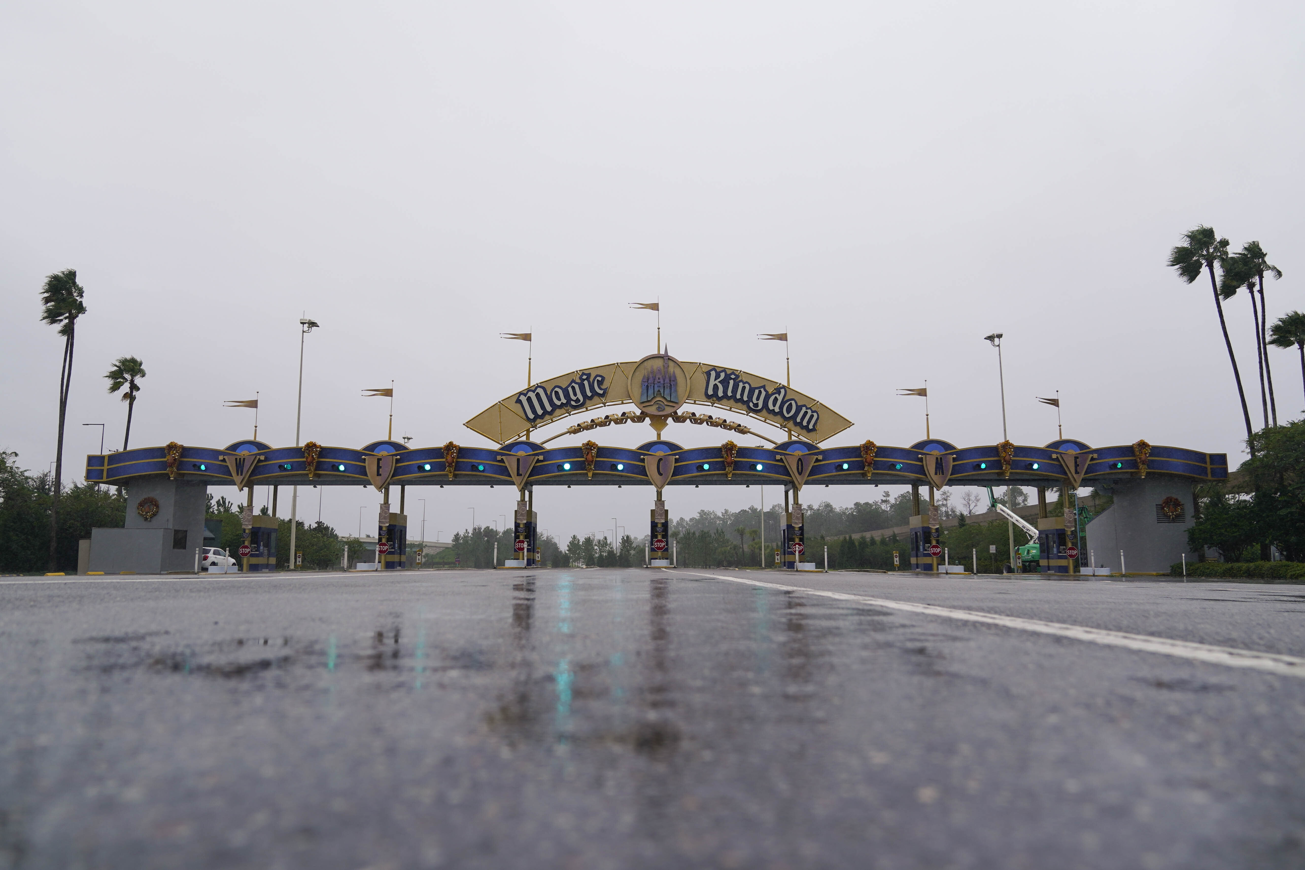 The entrance to the Walt Disney theme park is seen as the park is closed as Hurricane Ian bears down on Florida, Wednesday, Sept. 28, 2022, in Lake Buena Vista, Fla. (AP Photo/John Raoux)
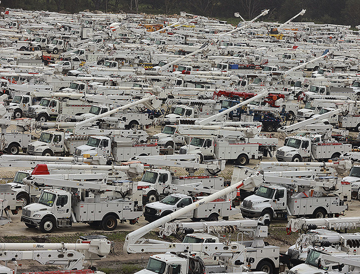 In The Villages of Sumter County, Fla., utility trucks are set up. Hurricane Ian rapidly intensified as it neared landfall along Florida’s southwest coast Wednesday morning, gaining top winds of 155 mph, just shy of the most dangerous Category 5 status. More photos at arkansasonline.com/929ian/ (AP/Orlando Sentinel/Stephen M. Dowell)
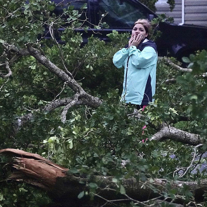
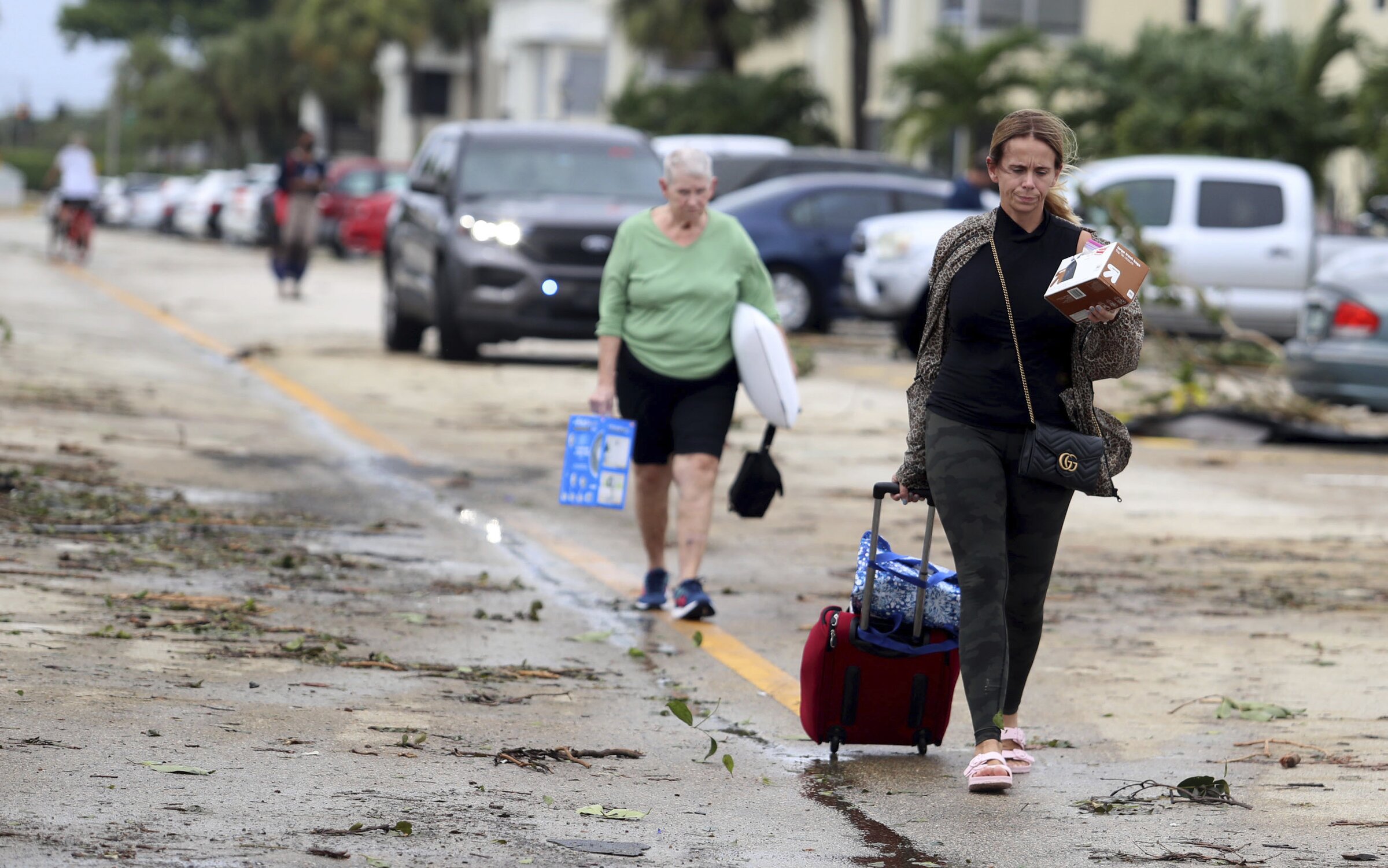 King Point residents leave with their belongings after an apparent overnight tornado spawned from Hurricane Ian at Kings Point 55+ community Wednesday in Delray Beach, Fla. (AP/South Florida Sun-Sentinel/Carline Jean)
 Ella Hamilton, 5, uses downed palm fronds to make a “stage” for herself and her two sisters who like to sing in the Rio Vista neighborhood, of Fort Lauderdale, Fla on Wednesday. (AP/South Florida Sun-Sentinel/Amy Beth Bennett)
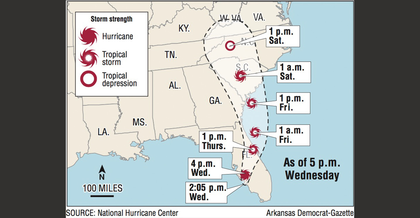 A map showing the projected path for Hurricane Ian.
Gallery: Hurricane Ian hits Florida