There's no bad time to visit the Buffalo National River, even when there's barely a trickle in the stream.
That was obvious during a Sunday drive to the river on a lovely October weekend some years ago. There were trails to hike, elk to see and a beautiful river to view that flowed just ankle deep in places.
A trip to the Buffalo is always on the agenda when folks from out of town come to visit. Our guests in the car were from up North and were itching for some new water to float come spring. They'd heard of the Buffalo and had traveled south to scope it out.
We hopped in the car that Sunday morning for our little scouting trip to see the beauty of the Buffalo. The drive to the Buffalo River country is pleasant indeed. Oohs and aahs came from our friends as the bluffs and rugged hill country came into view between Kingston and Boxley Valley.
I mentioned that, if we were lucky, we'd see some elk. We scanned the meadows between Boxley and Ponca as we traveled Arkansas 43. Our midmorning arrival was too late to see any elk. They'd already retreated from the fields into the forest.
First stop was the Ponca river access. We figured the few cars in the lot belonged to hikers on the Buffalo River Trail that runs along the river.
The transparent water ramped up the wow factor for our guests. They loved the turquoise hue of the pool on the upstream side of the Ponca low-water bridge.
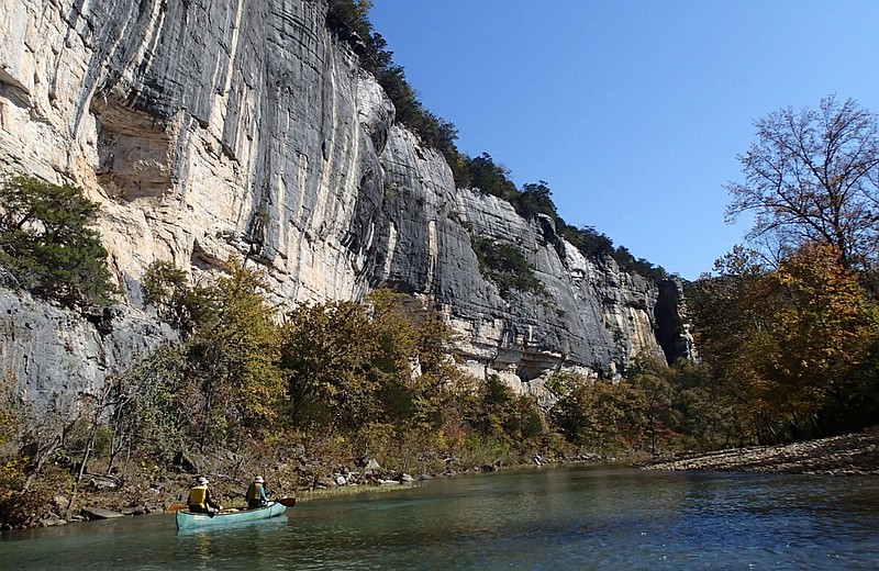
I was eager to show off some of the river's bluffs that rise high above the Buffalo, our country's first national river. This is easy to do with a short drive from Ponca to Steel Creek on a highway that's crooked as a snake.
Down, down we headed toward the campground and canoe launch at Steel Creek. Roark Bluff towers high above the river along all of the Steel Creek area. We had a picnic lunch on some boulders by the river at the launch site, then explored upstream a bit. The river was low so walking was easy along the gravel bar near the bluff.
Next it was on to Lost Valley for one of the most beautiful hikes in the Ozarks. The hiking trail up Lost Valley offers more for you hiking buck than most trails you'll see. It's an easy 2.2-mile hike, 1.1 miles in and 1.1 back out.
Clark Creek flows through Lost Valley to make the walk even more gorgeous. That Sunday was the first time I'd hiked at Lost Valley when the stream was dry. Nary a trickle flowed through the valley. That is, until we arrived at Natural Bridge.
Here, about one-half mile into the hike, Clark Creek spills out of a tunnel in rock. It's a lovely spot worth a thousand pictures. In fact, Ken Smith's book, "The Buffalo River Handbook," features a National Geographic photo of the spot that was taken in 1945.
Our friends had seen enough. Next stop was at a Buffalo River outfitter where they booked a cabin for the following spring. We'd get together then for three days on the river in April when there'd hopefully be the perfect water level.
Time to head home, but not before we had one more look for those elk. And there they were. Five bulls and a cow were grazing in front of a cane break in a meadow. Four of the bulls sported massive antlers and another had two spikes for headgear.
Seeing these elk made our day, and we hadn't even launched a canoe. But we sure enough did, later in the spring.
Flip Putthoff can be reached at [email protected] when he's not floating a river.