Old memories of an historic railroad remain, but new memories are made daily on foot or by bike along the Katy Trail in the heart of Missouri.
Bicycles, tricycles, walkers and runners have replaced the thundering trains of the Missouri-Kansas-Texas Railroad that once traveled steel rails across Missouri. After the MKT rail line through Missouri was abandoned in 1986, the tracks were removed to make way for the 237-mile-long Katy Trail between Clinton, Mo. to the west and Machens, Mo., near St. Louis on the east.
Katy Trail State Park opened in April 1990 and remains one of the top cycling destinations in the nation. The wide trail is level most of the way since it's built along the old railroad bed. A surface of finely crushed gravel makes for pleasant bicycling or foot travel. A section of the Katy in western Missouri is open for horseback riding.
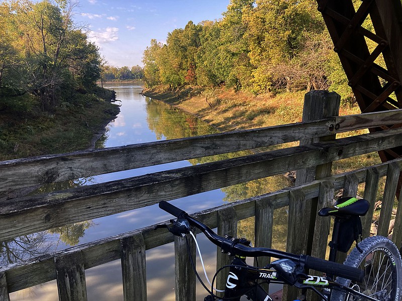
Trailheads are situated all along the Katy in small towns and larger cities. The western miles of trail, between the Missouri towns of Clinton and Rocheport, run through pastoral rural Missouri farm country. Some say the most scenic miles are the stretch between Rocheport and Jefferson City. Here the Katy Trail runs beside the Missouri River that's flanked by towering bluffs. From Jefferson City east to Machens is a mix of river and bluff scenery as well as meadows and farm fields.
The Katy is mostly level, all right, but that has its ups and downs, said Dan Ferritor of Fayetteville. On the upside, there are no lung buster hills to climb. A minus might be that there's no downhill coasting.
"You're pedaling every inch of the way," said Ferritor, 83, a cycling enthusiast and former University of Arkansas chancellor.
"A lot of the trail is so pretty. And there's so many ways you can do it," he added.
Riders can explore the Katy on short trips or make a cycling vacation by riding from end to end, all 237 miles. On multiday trips, camping or staying in motels or bed and breakfasts are options.
A group can set up a support system where a nonrider meets riders at the end of the day and drives the group to lodging in a nearby town.
"It's a place you can take the whole family. You see experienced bike riders and kids on tricycles. A lot of the trail is close to good places to eat. It's really set up for recreation," Ferritor said.
Mary Loots and her husband, Rick, live on Beaver Lake east of Rogers and biked the Katy Trail in late September.
"We were riding near Rocheport, and we had the Missouri River on one side and bluffs on the other side. One place we parked our bikes and hiked up to a winery," Mary said.
It's a place that can combine history with a great bike ride, she noted. On their trip, they visited Arrow Rock State Historic Site at Arrow Rock, Mo. They biked through a long tunnel at Rocheport, Mo. that MKT trains once rumbled through.
"That tunnel goes right through rock," she said.
A photo of the tunnel inspired the couple to ride the Katy Trail for the first time.
"I saw that picture and said 'I've got to ride through that,'" Mary recalled.
Tiny Missouri River towns such as McBaine, Wilton and Hartsburg have their own history. The trail is marked every mile with a sign post that corresponds to the historic railroad mileage system.
The Katy leaves the original railroad corridor in a few sections. Missouri River floods in 1993 and 1995 washed away parts of the rail bed. These were rebuilt slightly away from the railroad route.
Any bike is suitable for Katy Trail riding. "Gravel grinder" bikes designed for riding back-country gravel roads are ideal. Mountain bikes, recumbents, e-bikes and recreational bikes built for comfort are all seen on the trail.
If 237 miles isn't enough, there's the 47.5-mile Rock Island Spur that forks off the Katy Trail at Windsor, Mo. The spur trail meanders northeast to Pleasant Hill, Mo.
Ride for a couple of miles or the tackle the whole enchilada, and it's obvious why the Katy Trail is one of the nation's premier biking destinations.
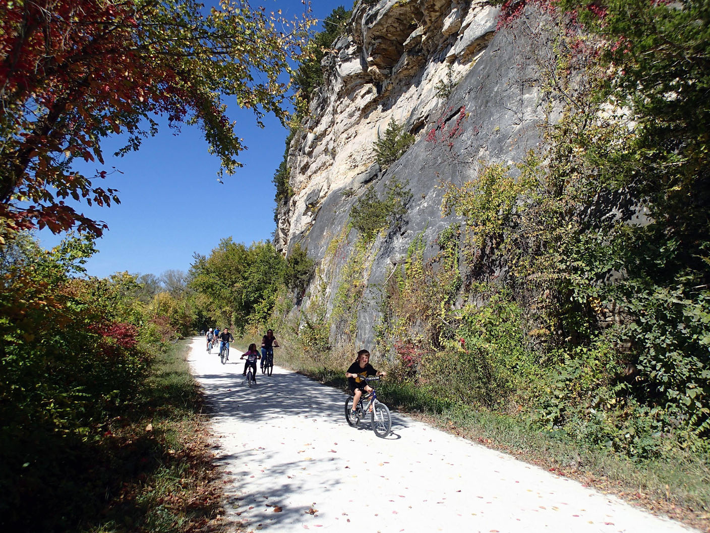 A family of riders rolls along the Katy Trail on Oct. 9 2022 near Rocheport in central Missouri. Bluffs abound on the section of trail between Rocheport and Hartsburg, Mo. (NWA Democrat-Gazette/Flip Putthoff)
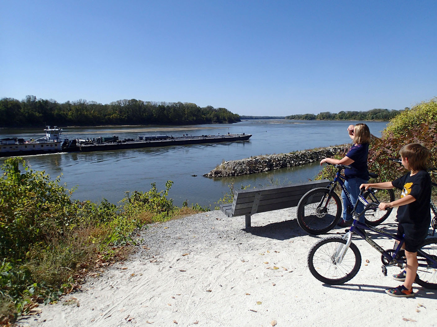 Young Katy Trail riders watch barges on Oct. 9 2022 being pushed upstream on the Missouri River. (NWA Democrat-Gazette/Flip Putthoff)
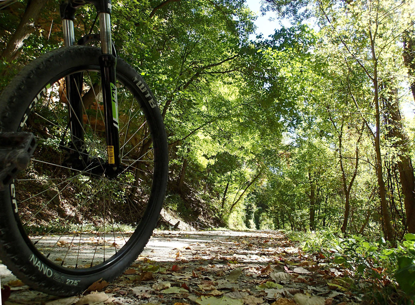 October's bright colors are seen Oct. 9 2022 along the Katy Trail. (NWA Democrat-Gazette/Flip Putthoff)
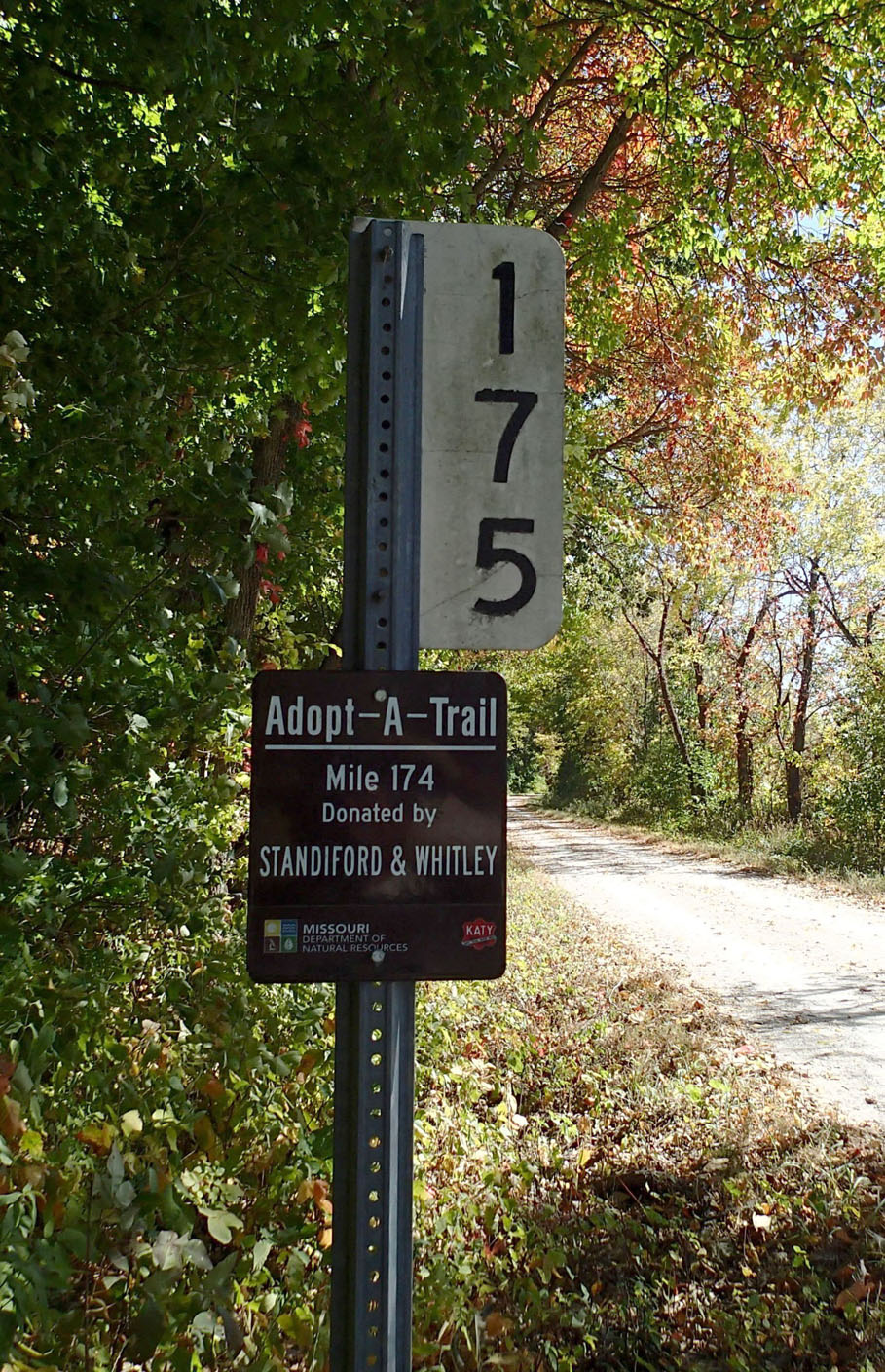 Mile markers help bikers gauge the distance of their rides. (NWA Democrat-Gazette/Flip Putthoff)
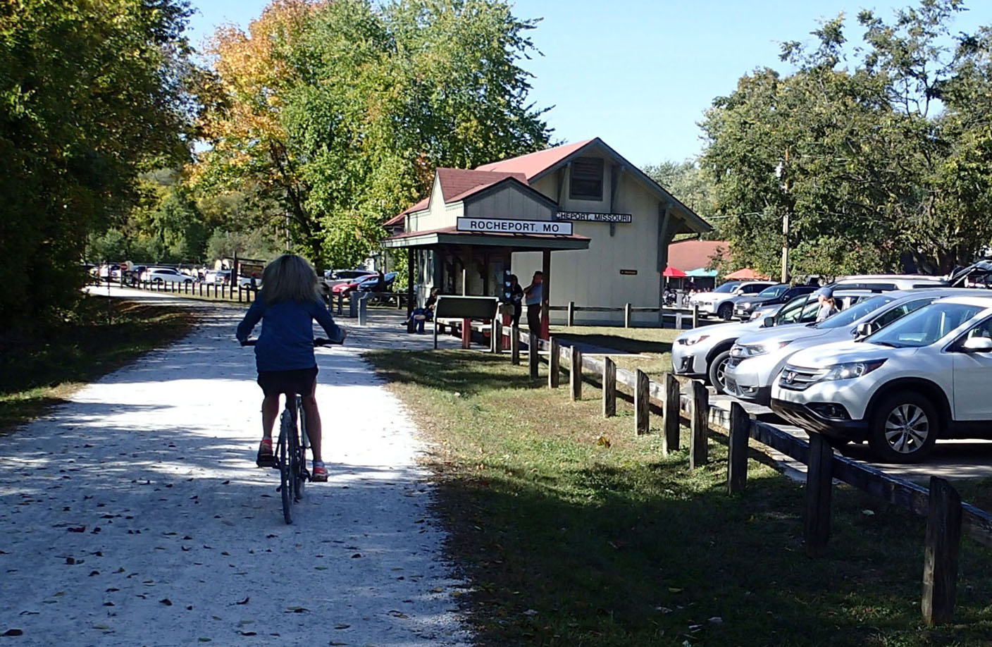 Trailheads are plentiful along the Katy Trail. Many have restrooms, water and are close to restaurants. (NWA Democrat-Gazette/Flip Putthoff)
More News
NoneVisit the Katy Trail
Katy Trail State Park is designed for walking and bicycling. The majority of the trail is accessible to people with disabilities. Electrically assisted pedal-powered bikes are allowed with a maximum speed of 20 mph.
Also allowed are electrically powered mobility devices for persons with disabilities such as Segways or electric golf carts. Gas powered vehicles, including all-terrain vehicles, are not allowed.
Information: katytrailstatepark.com, mostateparks.com
Source: Missouri State Parks