SPRINGDALE -- Leif Kindberg, executive director of the Illinois River Watershed Partnership, said he answers phone calls every week from Northwest Arkansas property owners saying they're seeing stormwater on their land they've not experienced before.
"Precipitation in Northwest Arkansas is increasing significantly," he said.
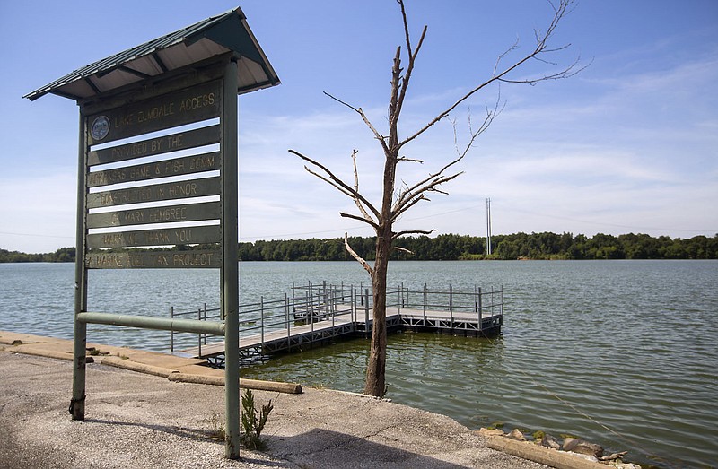
Kindberg shared numbers recorded at Lake Elmdale by the U.S. Army Corps of Engineers. They said the average annual rainfall in Springdale has risen by 10.5 inches from 2000 to 2021, he said.
Data from the National Weather Service shows 41.65 inches of rain fell in 2000 at Northwest Arkansas National Airport, according to the service's website. The airport recorded 51.2 inches of rain in 2021.
"Climate change is happening," agreed Ben Peters, director of Springdale's Engineering Department. Peters became head of the department Aug. 1, replacing Brad Baldwin, who retired Aug. 20. "We are seeing larger rain events and more rain falling over shorter periods of time than it used to."
Elizabeth Bowen, a project manager with the Northwest Arkansas Regional Planning Commission, said leaders of cities and counties in the area want to develop a regional stormwater management plan.
"The plan will call for both quantity and quality stormwater drainage management," Bowen said.
Kindberg quoted Regional Planning's projection of 1 million people living in Northwest Arkansas by 2045.
"Even with all the lots, driveways, roofs and infrastructure we see, half of what we will need in 23 years is not built yet.
"We need to get ahead of it, and create a plan so citizens can do their very best," he said.
The watershed partnership has under revision its own management plan for stormwater to identify sources of pollution carried by runoff into waterways in the Illinois River watershed. The plan also will consider using low-impact design features to mitigate the runoff like riparian repair of stream banks or rain catchment systems for homeowners, Bowen noted.
And the region's cities might have to update their drainage requirements, she said.
"The developers are meeting minimum requirements," Kindberg said. "But are minimum criteria good enough? What new levels do we have to meet the flow of stormwater?"
MANAGING PEAKS
Springdale allows no more runoff from a piece of property after its development than it had before development, Peters said. However, the total volume of water running off could increase with the same amount leaving the property in a longer span of time, he said.
"We're really managing peaks," he said. "Peaks that probably aren't happening in rivers and major creeks, but more likely in small ditches and tributaries."
The construction engineering industry has determined rainfall formulas for developers to determine amounts of stormwater that require extra mitigation to remove, Peters said. These include rainfall data over the last 80 years.
"But like the stock market, history does not dictate future events," he noted.
Several different formulas are approved to determine runoff levels, but each measures differently, Peters said. The difference in peak flows could be statistically insignificant or wrong by about 25%, he said.
Every developer proposing a project in Springdale is required to submit to the city the results of hydrology and hydrotics surveys of the property and the development, Peters said. The department currently works with about 80 or 85 development projects underway, he said.
Hydrology looks at the distribution of water both on and below the Earth's surface, as well as the impact of human activity on water availability and conditions. Hydrotics considers the sources of that water.
Peters explained water flows off land in two ways: concentrated and sheet. Concentrated flow runs off into channels, ditches, creeks -- the most common flow for subdivisions. Sheet flow is a shallow flow of water coming off of a wide area. If sheet flow exists, developers must have a sheet flow study, Peters said.
The most common practice regionally and the national norm for removing stormwater is detention ponds, Peters said. The ponds most likely are dry until rain fills them, and the water is gone in 24 to 48 hours, he said.
It's a holding pond that limits the volume of water leaving at any one time. The size of pipes in the pond's drainage or weirs, which change the shape or speed of the flowing water, make the difference, Peters said.
The city also offers a handbook of low-impact design features a developer may use to mitigate storm drainage. These can include rain barrels and stormwater catchment systems, which are not commonly used because they require higher maintenance for homeowners, Peters said.
PONDS OR PAVERS?
Springdale developer Tom Lundstrum does not like detention ponds. He said they take up space that could be better used.
The parking lot at Lundstrum's Little Emma mixed-use development in downtown Springdale is made of pervious pavers, which let the water flow through into the ground, Lundstrum said.
"We had only 3/4 acre at that site, and we needed the land instead of the pond," he said.
The design and engineering processes are continuing for Lundstrum's Big Emma project across East Emma Avenue, and plans for managing stormwater drainage have not been finalized, he said.
Land is still relatively cheap in Northwest Arkansas, so developers generally don't mind the pond taking up space, Peters said.
David Gilbert, an engineer with Plymouth Engineering in Lowell, noted storm water management must be unique for each site.
"Each site has different runoff patterns," he said.
Gilbert worked recently with Scout Enterprises, developers of the proposed Hawksview subdivision on East Brown Road in the city's northwestern quadrant. Developers wanted to create a unique, low-impact community using older, existing houses. These houses will be moved to the site and renovated inside and out.
The developer proposed gravel road shoulders and gravel driveways, as well as rain catchment systems to reduce runoff.
The Planning Commission did not approve the plan, citing neighbors' concerns about drainage. City Council on June 14 overturned the commission's decision and accepted the planned-use development.
FIXING IT
Gilbert noted he also has been working with the city of Elm Springs to mitigate problems in the Camelot subdivision. He noted the subdivision was built before that city had standards.
"In Elm Springs 10 years ago, their attitude was, 'Build it, and we'll fix it later,'" Peters said.
Even today, smaller cities do not have an engineering staff -- unless the city hires one on contract, he said. No one reviews drainage reports, he said.
Gilbert said a home builder filled in an existing drainage ditch and built a house across it.
"He didn't take into account where it could flood," Gilbert said. "It would not be built the same way today."
Legendary, a subdivision immediately north, was abandoned by the developer amid the 2008 recession. That subdivision had no retention ponds, Gilbert said.
The water flowed downhill into Camelot.
Springdale helped to control the flooding in Camelot, immediately west of Shaw Family Park, by building extra-large detention ponds in the park to control runoff, Gilbert said.
In another case, the city had permitted construction for a single-story house, but in the middle of construction, the owner decided to add a basement without planning, Gilbert said. But that basement sat lower than the property's flood level.
"If it's too low, it will flood," he said.
"Flooding problems are individual decisions," Gilbert said. "You've got to be careful about what you do on each piece of property."