When Hurricane Ida barreled into the Louisiana coast with near 150 mph winds Aug. 29, it left a trail of destruction. The storm also triggered the most Gulf of Mexico oil spills detected from space after a weather event since the federal government started using satellites to track spills and leaks a decade ago.
In the two weeks after Ida, the National Oceanic and Atmospheric Administration issued 55 spill reports, including a spill near a fragile nature reserve. It underscores the vulnerability of the region's offshore oil and gas to intensifying storms fueled by climate change.
"That's unprecedented, based on our 10-year record," said Ellen Ramirez, who oversees NOAA's around-the-clock satellite detection of marine pollution, including oil spills. "Ida has had the most significant impact to offshore drilling" since the program began, she said.
Using satellite imagery, NOAA typically reports 250 to 300 spills a year in U.S. waters, including the Atlantic, Pacific and the Gulf of Mexico, a pace of about 25 spills a month. In the two weeks before Ida, NOAA spotted five possible oil slicks in the Gulf. The program, the National Environmental Satellite, Data and Information Service, uses satellite technology to detect important but hard-to-see events, like methane leaks, signs of deforestation and others, that affect the climate and environment.
NOAA cautions that there are still limits to using satellite technology to detect oil spills, and changes in wave patterns or shadows cast by clouds can sometimes look like slicks. With this technology, the agency cannot measure the amount of oil spilled. It produces the reports so the U.S. Coast Guard and others can mount a rapid response, scrutinizing the satellite imagery to differentiate between areas of thick oil that can be removed by skimming and lighter oil sheens, which are generally too thin to recover.
In the days immediately following Hurricane Ida, The New York Times used satellite and aerial survey images, as well as ship-tracking data, to report on a substantial spill near Port Fourchon, a main hub for Louisiana's offshore oil and gas industry. A Houston-based oil and gas exploration company and the most recent leaseholder in the area, Talos Energy, initially led a cleanup effort at the site. Since then, the company has said that divers at the site discovered an abandoned pipeline, not owned by Talos, that could instead be the source of the leak.
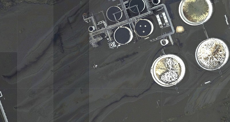
Hurricane Ida dealt a particular blow, experts say, because of its intensity and its path. The storm made landfall at Port Fourchon, the service hub for the vast majority of offshore oil platforms in the Gulf.
In the days after the hurricane, satellite imagery showed at least 10 spills flowing from platforms and other fixed structures in the Gulf. These offshore platforms, some as tall as skyscrapers, hold the equipment to drill, pump, store and transport oil and gas, and are designed to withstand severe storms, but many are decades old. Offshore operators have said some of those platforms sustained significant structural damage from Ida.
As of last week, the Bureau of Safety and Environmental Enforcement, which regulates the offshore oil and gas industry, said workers still hadn't returned to 32 platforms. About 16% of the Gulf's oil production and 24% of its gas production remains shut down.
On Aug. 30, even as the thick slicks spread their way across the water, the Biden administration moved to lease more than 80 million acres in the Gulf for new oil and gas production. The Bureau of Ocean Energy Management expects those leases to produce up to 1.12 billion barrels of oil and 4.4 trillion cubic feet of natural gas over the next 50 years.
Much of the older oil and gas infrastructure has been abandoned. A report published earlier this year by the U.S. Government Accountability Office found that since the 1960s, federal regulators have allowed oil and gas producers in the Gulf to leave 18,000 miles of pipeline on the sea floor. Those pipelines, about 97% of the decommissioned ones in the area, are often abandoned without cleaning or burial. Federal data shows that approximately 47% of pipeline segments and 75% of platforms are inactive or abandoned.
The spills caused by Hurricane Ida have brought more damage to a shoreline made fragile from decades of drilling. One of the slicks was near the East Timbalier Island National Wildlife Refuge, an ecologically rich part of a barrier island chain that forms the first line of defense against vulnerable inner bays, as well as the hub of Port Fourchon.
"We won't know the true ecological impact for a while," said Scott Eustis, community science director at the New Orleans-based nonprofit Healthy Gulf, who has long studied the effects of oil and gas drilling on Louisiana's wetlands. "These islands were here to protect Louisiana. But instead, we've drilled wells and we've abandoned pipelines," he said. "And they're leaking."