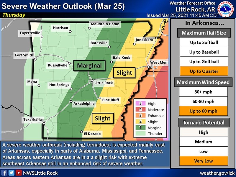
A storm system moving northeast Thursday into Arkansas is expected to intensify around noon, bringing a chance for strong winds, large hail and isolated tornadoes, forecasters said.
Risks include golf-ball-sized hail, winds up to 80 mph, and a “low” potential for tornadoes, according to a Thursday morning briefing by the National Weather Service.
[ARKANSAS WEATHER: Hourly forecast + weather radar » arkansasonline.com/radar]
Areas along the Mississippi River are at an enhanced risk for severe weather, forecasters said, with decreasing chances further west.
In the Little Rock area, tornado probability is 5%, with chances of damaging winds and large hail listed at a 15% probability, according to the briefing.
Forecasters predict severe weather associated with the system will be most likely to occur in areas east of Arkansas, including parts of Alabama, Mississippi and Tennessee, the briefing states.
This story has been updated. It was originally published at 11:40 a.m.