Paddling through this most remote and mysterious patch of Beaver Lake is like exploring a southeast Arkansas swamp -- minus the alligators and the six-hour drive.
When spring rain fills Beaver Lake to the brim, rising water creeps into a lowland of woods, weeds and bushes. The flood transforms this neck of the woods far up the lake's War Eagle arm into a magnificent bottomland swamp.
Wood ducks strafe the new wetland on colorful wings. Great blue herons wade the shallows on long skinny legs snatching an occasional fish or snake with their pointed beaks. Mink patrol the moist shorelines. Big catfish and carp swirl in the dark water.
It's a wildlife reception for paddlers who make the effort to visit this swampland of the Ozarks two miles downstream from War Eagle Mill. Best way to get there is by paddlecraft. Launch on the War Eagle River under the historic War Eagle bridge and paddle downstream. Park in the lot across the road from the mill.
Another option is to travel up the War Eagle arm of the lake by motor boat to the swamp. Or adventurous kayakers can paddle the route.
Nature didn't create this wetland realm. The Army Corps of Engineers did when Beaver Dam was built in the 1960s. Beaver Lake is about as high as it can get, called the top of the flood pool. The lake surface is 1,130 feet above sea level. This is the ideal level to explore the inlets and outlets of this reservoir swamp.
A level between elevation 1,126 and 1,130 feet is the window of swamp-paddling opportunity. The lake level was holding steady at 1,127.5 feet on Thursday, so a swamp expedition should be good for the next week or so.
Getting to the swamp is half the adventure. Paddlers glide past high riverside bluffs for the 2-mile trip. Cliff swallows are everywhere, darting hither and yon from their nests of dry mud that look like little moonshine jugs.
It's like two worlds, one of craggy cliffs typical of the Ozarks, then a change to a swamp that is far from typical.
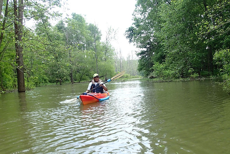
Gene Williams could hardly believe his eyes and ears kayaking on his first visit to the Beaver Lake swamp in late May.
"This is incredible. I never would have thought of paddling here," he said. "Who would think a spot like this could exist on Beaver Lake. Just the beauty and to hear no sound. Just the birds and the breeze."
Williams, of east Benton County, was amazed as much by the bluff walls upstream from the swamp. Layers of rock are shaped like waves. Others appear orderly as a brick wall, as if created by a stone mason's trowel.
"You wonder what pressure, what forces made this," he said.
Sloughs and inlets crisscross the swamp that's about the size of a soccer field. Some channels are barely wide enough for a kayak to sneak through. There's plenty of wider, more open water as well.
Here oak and hickory trees shade paddlers, not the bald cypress and tupelo trees of real swamps in Arkansas' southeast. Explorers will likely count more birds than mosquitoes during an expedition to this Ozarks swamp, one of the most unique areas at Beaver Lake.


More News
More Ozark swamps
Two other spots on Beaver Lake become temporary swamps at high lake levels. One beautiful area is in the back of the Van Winkle Hollow arm, with a launch site at the end of a gravel road.
Drive on Arkansas 12 through Hobbs State Park to Arkansas 303. Go north on 303 for about one-half mile. Take the first gravel road to the right at follow it one-half mile to the lake.
Another swamp area is located just east of the Arkansas 12 bridge launch ramp.
Source: Staff report