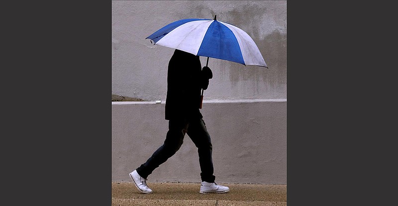
Arkansas starts 2021 in a soggy state.
A storm front that moved into the state Tuesday will make its way out today, after soaking some parts of southwest Arkansas with as much as 6 inches of rain, said Tabitha Clarke, a meteorologist with the National Weather Service in North Little Rock.
While the rainfall took place over several days, Clarke said it was southeast Arkansas that got the biggest deluge over a 24-hour period.
Rohwer in Desha County got 4.26 inches over the 24 hours that ended Thursday, she said. Lincoln County got 3.36 inches, and Monticello got 3.5. She said southeast Arkansas was in for another one-half to 1 inch of rain Thursday night.
A second system pushed the storm front out of the state Thursday, but southwest Arkansas was in for another 2 inches of rain overnight Thursday, Clarke said. That could cause flash flooding, she said.
A flash flood watch was expanded Thursday to include all of southern and Central Arkansas. That watch was in effect through Thursday night.
Minor river flooding is expected in the Ouachita, lower White, Cache, and lower Black river basins through early next week, according to the National Weather Service.
All of the rain has left Arkansas saturated, Clarke said.
Besides flash floods, a hazardous weather outlook Thursday afternoon said ice could be a problem in some higher terrain of the Ozark Mountains on Thursday night. Ice accumulations were expected to be less than a quarter of an inch.
The National Weather Service in Tulsa said in a briefing Thursday that "the most impactful winter weather" from the system would be confined to Madison and Carroll counties, but other parts of Northwest Arkansas could have some icing on roadways.
Clarke said the ice would probably melt early today.
Some parts of the Ozark Mountains could have snow over the weekend, according to the extended forecast.
"Another disturbance will brush northern Arkansas on Saturday, bringing with it a chance of snow in the Ozarks," according to the National Weather Service in North Little Rock. "Some minor accumulation is possible with amounts up to a couple tenths of an inch in the higher terrain. Little to no impacts are expected."
The forecast for today in Little Rock is mostly cloudy with a high of 45 degrees. The low tonight is expected to be 38 degrees, followed by a high of 45 on Saturday. No precipitation is in that forecast.
Fayetteville has a 50% chance of rain before noon today, but any new precipitation today would amount to less than a 10th of an inch, according to the weather service. Otherwise, the forecast is for cloudy skies and a high near 44 degrees. Tonight's low will be around 30 degrees, with a high of 38 on Saturday and a 20% chance of snow that day.
By Monday, high temperatures in Little Rock and Fayetteville will be in the upper 50s, according to the weather service.
The storm system that drenched Arkansas dumped a foot of snow in west Texas and spawned tornadoes across the Lone Star State.
"A very active and stormy weather pattern will be in place across large portions of the nation as we wrap up the last several hours of 2020 and then surge into 2021," the National Weather Service said Thursday afternoon.
"A strong storm system currently situated across the southern Plains and lower Mississippi Valley region will be driving numerous weather-related hazards over the next couple of days and into the weekend as the storm system lifts northeast through the eastern U.S.," it said.