ST. PETERSBURG, Fla. — Just as the remnants of Eta finally blew out to sea on Friday, another storm formed that threatens to follow its path of death and destruction into Central America this weekend.
Hurricane experts were closely watching the Caribbean, where Tropical Storm Iota formed Friday afternoon. Forecasters warned that Iota could power up quickly, to major hurricane strength, as it approaches Central America late Sunday or Monday, and wreak more havoc in a region where people are still grappling with the aftermath of Eta.
The National Hurricane Center in Miami said Iota could take dangerous wind, storm surge and as much as 30 inches of rainfall to northern Nicaragua and Honduras. The storm was about 335 miles south-southeast of Kingston, Jamaica and had maximum sustained winds of 40 mph. There were no coastal warnings or watches in effect as of Friday afternoon.
Iota is a record-setting 30th named storm of this year’s busy Atlantic hurricane season. Such activity has focused attention on climate change, which scientists say is causing wetter, stronger and more destructive storms.
In terms of Eta, forecasters said its remnants would pick up forward speed in the next day or so as it pulls away from the Southeast seaboard. Eta also triggered flash flooding, water rescues and at least one bridge collapse in South Carolina, said Sandy LaCorte, a meteorologist with the National Weather Service in Greenville, S.C.
Eta hit Nicaragua last week as a Category 4 hurricane, killing at least 120 people as torrential rains brought flash floods and landslides to parts of Central America and Mexico. Then it meandered across Cuba, the Florida Keys and around the Gulf of Mexico before slogging ashore again near Cedar Key, Fla., and dashing across Florida and the Carolinas.
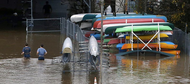
The Tampa Bay area was buffeted with gusty winds and rain, and there was one U.S. death linked to Eta: In Braden-ton Beach, Mark Mixon stepped into his flooded garage as he was placing sandbags around his home Wednesday evening and was electrocuted, said Jacob Saur, director of public safety for Manatee County.
Earlier, firefighters in Tampa had to rescue about a dozen people who got stuck in storm surge flooding on a boulevard adjacent to the bay. Some vehicles remained on the roadway Thursday. Isolated neighborhoods also experienced enough flooding to evacuate.
Information for this article was contributed by Lynne Sladky, Cody Jackson and Michelle Liu of The Associated Press.