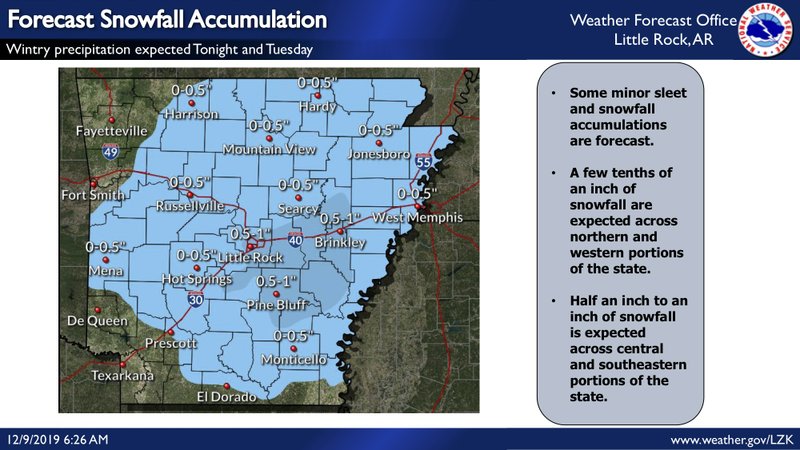
Monday’s warm temperatures are predicted to give way to snow across much of Arkansas on Tuesday, with temperatures plummeting and causing as much as an inch to stick in central parts of the state, forecasters said.
The National Weather Service said the precipitation will begin as rain late Monday with sleet and snow mixing in through parts of north Arkansas early Tuesday morning. Central and southern Arkansas will see a similar shift during late morning and early afternoon, according to forecasters.
“For central Arkansas, this would probably be our first crack at [snow] for the season,” meteorologist Jeff Hood said.
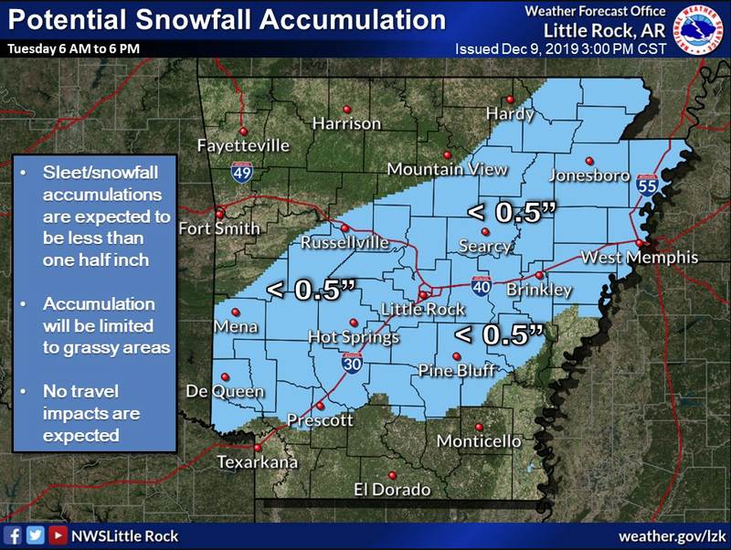
Nearly all but the northwest and southwest corners of the state can expect a chance of snow, according to the weather service. While much of Arkansas is predicted to receive up to half an inch, central portions of the state may receive as much as an inch.
Forecasters said drivers should expect the snow to have minimal impact on the state’s roads, however.
The potential for sleet and snow comes ahead of warm temperatures Monday, with much of the state set to reach the upper 60s to low 70s, the weather service said. Temperatures are predicted to drop across the state over the next day, though, with some parts of north Arkansas falling into the high 20s.
Forecasters expect temperatures to heat up again later this week, ushering the state into a period of “fairly nice weather” for early-to-mid-December, Hood said.