ROGERS -- Spring is in the air, and families are itching to get back to the many parks around the city. This year, they'll have more park land to choose from and some existing parks and trails will be improved.
Lance Jobe, assistant city engineer, said residents and visitors can expect many changes this year and next.
Frisco Park
Frisco Park celebrates the transportation history of Rogers from the Butterfield Stage Coach Line through the Frisco Railroad. The park also has an historical clock and is the beginning of the three-fourths of a mile Frisco Historical Trail.
Source: Staff report
Frisco Park
City officials hope a redesign will make Frisco Park an anchoring place for the downtown area.
Officials earlier this month announced selecting Ross Barney Architects of Chicago to redesign Frisco Park, which is in the center of downtown. The Walton Family Foundation recently granted the city $805,668 for design services for the park.
Ross Barney was one of three design firms interviewed for the project. It's known for urban design spurring community engagement, Jobe said. Its most well known work was designing the Chicago riverwalk and the 606, also known as the Bloomingdale Line, a system of elevated trails, landscaping and art installations.
"We want them to make Frisco Park a place where people can eat, play, listen to music and generally make it more usable," Jobe said.
Residents will have a chance to let designers know what they want to see at Frisco Park through community input sessions later this year, Jobe said. Plans are for the architecture firm to have designs ready by February.
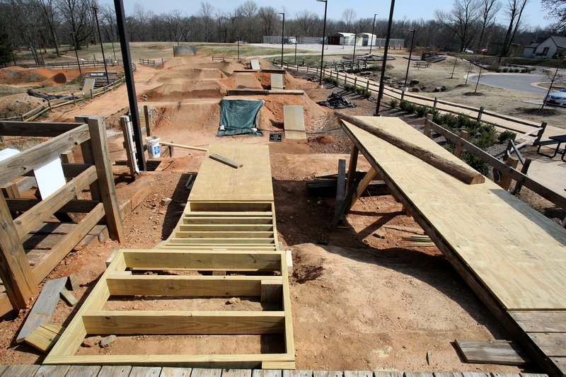
Railyard
The Railyard Bike Park, a slopestyle bicycle course in downtown Rogers, has had a history of issues during rainy spells and closes frequently.
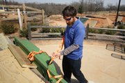
Plans call for the area to be better protected this year by a system of tarps, more sod and different pipes for better drainage, Jobe said. The changes will get the water out of the park quicker and reduce the amount of standing water, said Nathan Hudgens, manager for Lake Atalanta and the Railyard Bike Park.
"It seeps slowly as it is now," Hudgens said. "It will mean less maintenance for my staff and a quicker turnaround to get the park ready to open."
It takes one week to redo a section of the park, or about two weeks total for the entire park, he said.
The changes won't keep rain from ever closing it because it's dirt, Hudgens said. While many similar bike parks are in arid climates such as Arizona, there are a few in climates similar to Northwest Arkansas, and they're plagued with the same problem, he said.
"The Boulder one is in a climate that dries it out quicker," Hudgens said.
The nature of having freezing days, some time to thaw and a nice day or two before another freezing spell means the Railyard is in continuous flux and near constant repair.
Its upgrades will keep the city from having to replace the entire park with concrete, but parts of it will still be cemented over, Hudgens said. The return trail at the starting point will be among those, since it takes 35 irrigation heads to manage and requires high maintenance.
The new tarp system will require fewer man hours and get the park back open faster.
"Right now it takes almost a full day to tarp this park, and that's with four people working on it," Hudgens said. "The new system will allow two people to do it and do it quicker. We'll have wooden jumps instead of dirt."
Those with children can look forward to the train car route changing from intermediate to beginner to allow for a fun addition to an easy ride.
No cost estimate for work at the Railyard was available because the city hasn't finalized plans.
Lake Atalanta
The bridge at Lake Atalanta and other items damaged during last spring's flooding will be repaired this year once the Federal Emergency Management Agency gives the city official approval for its plans, Jobe said.
The city has received initial approval, but is still assembling cost estimates. FEMA is covering the $500,000 estimated for repair.
A storm that brought eight inches of rain to the region last spring caused an estimated $500,000 worth of flood damage to the park. That estimate includes $125,000 for repair to the bridge, $62,500 for repair to a pedestrian bridge, $37,500 for a park slope and $25,000 to repair the park entrance.
Another $87,500 would repair the lake's weir and channel and $162,000 would go toward repairing two scour walls.
Pinnacle Open Space
The new park will be Pinnacle Open Space, which will sit on 26 acres west of Interstate 49.
Jobe said little infrastructure is planned for the area, aside from a single track trail to get pedestrians out to the site with the ability to walk around in nature. A stream bank restoration project will focus on Osage Creek.
The City Council approved spending $963,000 from general fund reserve for the project. Half of that cost will be reimbursable through a grant agreement with the Walton Family Foundation.
The proposal presented to the city included trails, boardwalks and native plantings. It painted the open space as an area good for educational purposes. Tree houses such as the ones at Lake Atalanta and fishing habitats would be appropriate for the space, said John McCurdy, director of community development.
The project is in the design phase now. Construction is expected to start in 2019.
Trail enhancement
Trail users can expect a lot of enhancements to the Razorback Greenway and other trails in Rogers. Jobe said multiple locations of the trail will have sharp curves softened, problem areas straightened out and a connecting trail will be built to Pinnacle Hills Promenade. Construction will begin this summer and is expected to wrap up by the end of the year.
The Walton Family Foundation gave $1 million in December for trail improvement around the city.
Among the proposed improvements is a pedestrian counter by the New Hope bridge. The counter will give a digital readout of how many people have used the trail.
The city has used trail counters in other areas, such as Lake Atalanta, but this counter would have a permanent location. That would make it more usable and the digital readout would make it more accessible, Jobe said. They have yet to decide whether the count will be done by day, month or year.
Northern Loop
City Engineer Nathan Becknell said the Northern Loop, a trail system that goes around the city, will be finished by the end of the year. The large project was split into phases such as the opening of the New Hope trail bridge by the interstate, Turtle Creek trail and Cambridge trails.
The next connection of the Northern Loop the city hopes to complete is construction from the Regional Sports Park on Dixieland to Foerster Park on Olive Street.
"This one is tricky because it requires crossing the highway near the railroad tracks," Becknell said. It's proved complicated getting the proper permits. "On first glance, it might seem simple to just put a signal there or something, since the trail now exists on either side, but it's that a lot of people have to give their blessing. There are so many routes of what to do, and we have to be extremely careful that it provides a route safely."
First speculative plans made vehicles stopping on the train tracks a real possibility, but now the city has a safe and final version in mind. Becknell said the project should be completed sometime this spring or summer, but no later than the end of the year.
Work on the Northern Loop over the last five years, which includes about half of what's been built, cost an estimated $3.5 million, he said.
Final construction for the Northern Loop is connecting the Rogers Activity Center to downtown.
"It's tough because this area is already fully developed," Becknell said. "We've had trouble finding a good route and evaluating alternatives. There are lots of streets and sidewalks, of course, but we want an obvious path. We've evaluated every street, alley and ditch line and we're about to pick one."
Residents contributed ideas during a community pop-up project more than a year ago. The city made a temporary pedestrian route through the area down Third and Poplar streets for a day or two. Becknell said it had mixed results, with some people in favor and others against it.
"It's more likely that we will go with a route on the north side along the railroad tracks instead," he said.
NW News on 03/19/2018