4:48 P.M. UPDATE:
The National Weather Service has issued a tornado watch that covers part of six Arkansas counties.
The watch, announced shortly after 4:30 p.m., lasts until 1 a.m. and covers Yell County in central Arkansas, Pike County in southwest Arkansas and Logan, Montgomery, Polk and Scott counties in western Arkansas.
— Brandon Riddle
2:15 P.M. UPDATE:
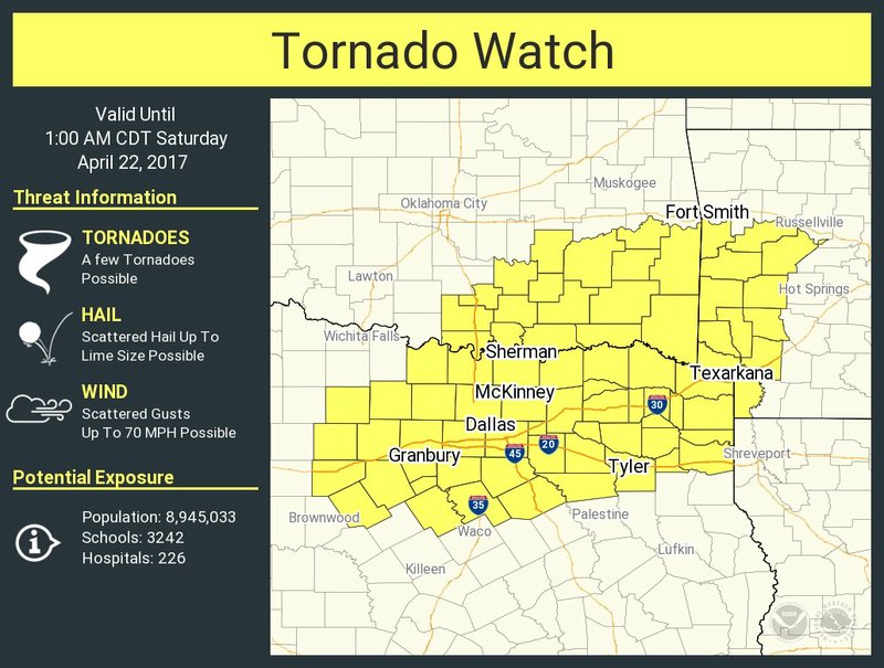
Damaging straight-line winds and isolated tornadoes are the primary threats as storms push across Arkansas on Friday night and into early Saturday, forecasters said.
Much of the state is under at least a slight risk for storms to turn severe, according to the National Weather Service’s North Little Rock office. Wind gusts up to 70 mph and large hail are possible.
Western portions of Arkansas, including Fort Smith and Texarkana, face an enhanced risk, meaning that numerous severe storms are possible.
Two rounds of storms are expected: one that will form along a line in western and northwest Arkansas and a second that will bring scattered thunderstorms to central and southern Arkansas.
Storms, severe at times, were already moving though western Arkansas as of around 2 p.m. as part of the first round.
The second round is expected to push through central Arkansas late Friday afternoon and will leave the state by Saturday morning.
Forecasters say the northern portion of the state will likely see the best chance for precipitation.
By the time the front pushes through, up to 3 inches of rain will be possible across northern Arkansas. Other areas will likely see rainfall amounts around 1 inch.
Clouds and rain will keep temperatures down in northern Arkansas on Friday, while southern portions of the state will see highs in the 80s.
— Brandon Riddle
EARLIER STORY:
NORMAN, Okla. — Severe thunderstorms with high winds, large hail and possibly tornadoes are forecast in parts of Oklahoma, Texas, Arkansas, Kansas and Missouri.
The National Weather Service issued flood warnings in central Oklahoma, southeastern Kansas and southwestern Missouri as heavy rain began falling Friday morning.
The weather service says up to five inches of rain is possible along with golf-ball sized hail and winds of up to 70 miles per hour. In central Oklahoma, thousands were without power when power poles were apparently blown down as a storm moved through the Oklahoma City metro.
The weather service's Storm Prediction Center says tornadoes are also possible in southeastern Oklahoma, northeast Texas and western Arkansas.
The storms are expected to continue into Friday night before moving out of the region early Saturday.
— The Associated Press