Update: 8:30 a.m.
A number of highways in the Little Rock metro area were riddled with delays Wednesday morning as a band of thunderstorms moved over central Arkansas during rush hour, live traffic maps show.
Heavy traffic was reported on the Interstate 30 bridge and a section of Interstate 40 eastbound near Crystal Hill Road was stopped around 8:30 a.m, according to the highway department.
Earlier
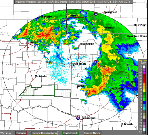
Strong storms were moving through parts of Arkansas Wednesday morning and the National Weather Service said that potentially severe thunderstorms could effect the state for the remainder of the week.
A powerful band packing straight-line winds with gusts up to 40 mph and hail was tracked in the Hot Springs area around 6:30 a.m., according to a special weather statement.
In general, the "unsettled pattern of storms" are not likely to organize into stronger systems, the weather service said in an outlook. But the potential for locally severe weather exists in the northwest part of the state into Thursday, according to the outlook.
Thunderstorms dropped more than 4 inches of rain in the Jonesboro area Tuesday night, flooding dozens of streets and prompting police to advise drivers to stay off the road, the Arkansas Democrat-Gazette reported Wednesday.
Jonesboro police were surveying the area around daybreak Wednesday to determine if any streets remained flooded, a spokesman said.