Rivers in Arkansas continued to recede Thursday while floodwaters from the Midwest surged down the Mississippi River, corralled within levee systems designed to protect towns.
Only one place in Arkansas was still at "major flood stage" late Thursday afternoon -- the Mississippi River at Osceola.
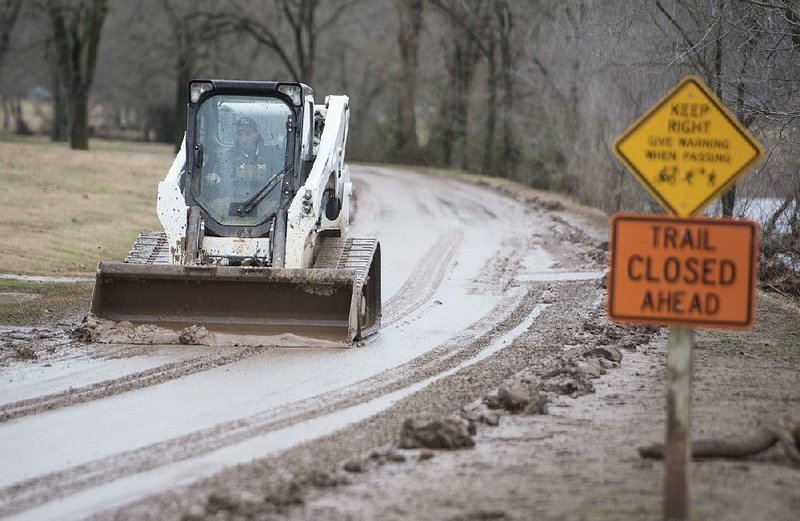
The White River at Des Arc was at major flood stage until 6 p.m. Thursday, when the river level dropped below 30 feet.
Des Arc Mayor Jim Garth said the "major flood stage" designation from the National Weather Service was a bit of a stretch for his town.
"We had some flooding, and we had to shut a couple of streets down in town," he said. "They had some water on them, but nothing major. It's nothing that we haven't seen before."
Garth said the situation seemed minor compared with the flood of 2011, when the White River was 8 feet higher than it was this week.
The White River crested at 31.49 feet at Des Arc on Monday. By late Thursday afternoon, it had dropped to 29.9 feet, one-tenth of a foot below major flood stage.
Regular flood stage at Des Arc is 24 feet. That is the level at which a river goes out of its banks.
The highest crest on record for the White River at Des Arc was in 2011, when the water reached 39.43 feet. Monday's crest ranked as the ninth-highest.
By next week, the Mississippi River is expected to be at major flood stage at Arkansas City in Desha County and at Greenville, Miss. The Greenville gauge on the Mississippi River is 6 miles east of Lake Village in Chicot County as the crow flies.
Dan Koch, a meteorologist with the National Weather Service in North Little Rock, said the definition of major flood stage is based on impact. It could mean some county roads or subdivisions are flooded or that residents are using sandbags to protect homes, he said.
Koch said precipitation over the next few days probably won't raise river levels in Arkansas any higher. He said one-half to 1 inch of rain is expected across the state tonight.
Snow is predicted Saturday for northern and western Arkansas. Koch said it will likely be a dusting or up to 1 inch of accumulation in most of that area, but it could reach 2 inches around Baxter and Fulton counties, which border Missouri.
Koch said the ground is too warm for the snow to stay around for long, and its melting will have little effect on river levels. One inch of snow in Arkansas equals about one-tenth of an inch of water, he said.
The Mississippi River crested Thursday at Osceola at 39.67 feet and should begin receding today, according to the National Weather Service.
Flood stage at Osceola is 28 feet. Anything over 35 feet is considered major flood stage at Osceola.
The record highest crest at Osceola was 50.9 feet in 1937. The water there reached 47.48 feet during the flood of 2011 and 45.8 feet during Arkansas' legendary flood of 1927.
After the 1927 flood, the U.S. Army Corps of Engineers built levees, spillways, and locks and dams to help control flooding along the Mississippi River and some of its tributaries. In some areas, the levees created a sort of bottleneck that resulted in river levels that were higher during the flood of 1937.
"If you confine it to a narrower channel, there's only one way the water can go, and that is up," Koch said.
Joseph Richmond, the emergency management coordinator for Mississippi County, said flood damage was limited in the Osceola area and confined primarily to agricultural lands.
Seventy miles southwest of Memphis in Helena-West Helena, the Mississippi River was at 47.2 feet Thursday, and the National Weather Service was predicting minor flooding there.
The Mississippi River is expected to crest at 49 feet early Sunday at Helena-West Helena. Flood stage there is 44, which the river reached Monday. The record at Helena-West Helena is 60.21 feet reached in 1937.
Jay Hollowell, the mayor of Helena-West Helena, said the Helena River Park and its boardwalk are flooded but that is to be expected. He said a levee and 100-yard-long sea wall protect downtown.
"We don't see any flooding in the downtown area," he said. "We don't get any of that."
Hollowell said the Corps has been monitoring the levee in Phillips County this week.
"When you've got something as big and strong and mighty as the Mississippi River, when it gets up to these levels, you pay attention," he said.
Hollowell said the river is wider and deeper at Helena-West Helena than it is in St. Louis, where there has been severe flooding.
"We're able to accommodate more water flow than they are up north," he said.
The Mississippi River was at 42.35 feet late Thursday at Arkansas City. Flood stage there is 37 feet. The National Weather Service is predicting the river there to reach major flood stage of 44 feet Sunday and to crest at 45.5 feet Tuesday.
The Mississippi River was at 53.97 feet a little farther downriver at the Greenville gauge late Thursday. The river there is predicted to reach major flood stage of 57 feet Tuesday and crest at 57.5 feet late Tuesday or early Wednesday. Flood stage at Greenville, Miss., is 48 feet.
Gov. Asa Hutchinson has declared 38 of Arkansas' 75 counties as disaster areas. At least two deaths in the state have been attributed to the flooding.
Metro on 01/08/2016