Flood warnings will continue through Monday for areas along the Arkansas and Fourche LaFave rivers, forecasters said Thursday.
Moderate flooding has already occurred along the Arkansas River in Dardanelle, Little Rock, Pine Bluff, Morrilton and at the Toad Suck Lock and Dam Tailwater, the National Weather Service said.
A small-craft advisory issued May 8 continues on the Arkansas River because of the heavy flow of water due to floodwaters from Oklahoma and rainfall, U.S. Army Corp of Engineers spokesman Miles Brown said.
The flow, which varies on different portions of the Arkansas River, is normally between 25,000 and 40,000 cubic feet per second but as of 6 a.m Thursday, the river flow near Dardanelle was over 340,000 cubic feet per second, according to the National Weather Service. The river flow is only slightly less than during a 1986 flood of the Arkansas River, and the only flood larger than that was a 1990 flood with flows of 450,000 cubic feet per second, according to Brown.
The small-craft advisory will continue until the flow of the river flow drops below 70,000 cubic feet per second, which could be weeks from now, Brown said. The river is also a danger to small crafts because of debris flowing at high speed down the Arkansas River, he said.
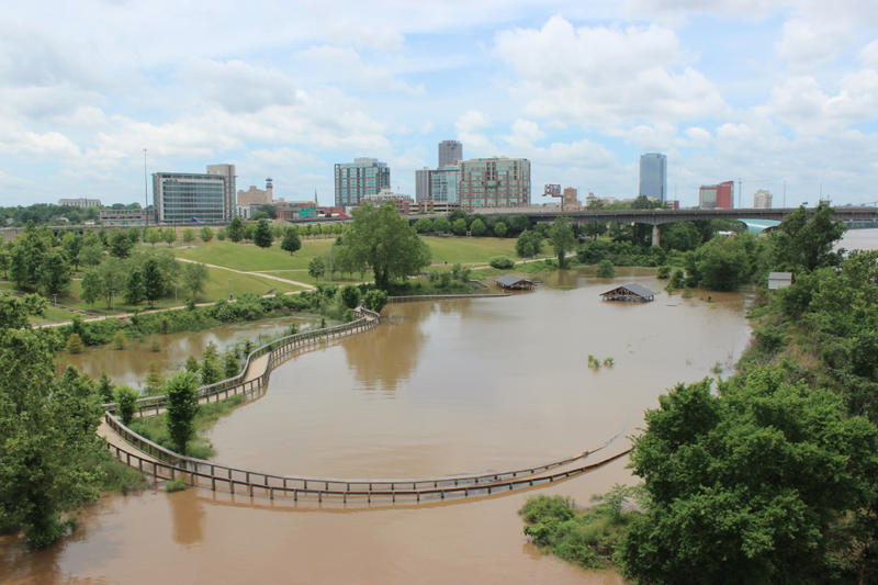
The flood stage for the Arkansas River at Little Rock is 23 feet, and at 7 a.m. Thursday, the river had reached 20 feet. The river is forecast to crest Friday and Saturday and 22.7 feet, the National Weather Service said.
The flows of the Arkansas River near Little Rock have reached over 300,000 cubic feet per second and could rise as rain is expected over the weekend, forecasters said.
Forecasters said the flood crest in Little Rock is almost three feet higher than it was a few weeks ago, and just below the flood crest of 23.30 feet in October 1986.
The flood stage for the Arkansas River at Dardanelle is 32 feet, and at 6 a.m. Thursday, the river had reached 37.7 feet.
The river is forecast to drop to 35.9 feet there by Friday. Forecasters said numerous roads and highways near Dardanelle flood at 36 feet.
At Morrilton, the flood stage for the Arkansas River is 30 feet. As of 8 a.m. Thursday, the river had reached 38 feet, the National Weather Service said.
The river there is forecast to drop to 37.8 feet on Friday, forecasters said.
The Arkansas River in Pine Bluff floods at 42 feet. As of 8 a.m. Thursday, forecasters said the river had reached 42.6 feet. The river is forecast to crest at 44.3 feet Saturday.
The Arkansas River at Toad Suck Lock and Dam Tailwater has reached three feet over the flood stage, forecasters said. The flood stage is 275 feet and at 3 a.m. Thursday, the river there had reached 278.5 feet and is forecast to crest at 279.1 feet Friday. This flood crest is forecasted to be a foot higher than flooding that happened a few weeks ago, forecasters said.
A flood warning also remains in place Thursday for the Petit Jean River at Danville in Yell County and the Fourche LaFave River at Houston in Perry County, the National Weather Service said.
The Fourche LaFave River was at 31.6 feet at 7 a.m. Thursday, and flood stage is 25 feet there, the weather service said.
Minor flooding was occurring, and the river is expected to continue rising to near 32.5 feet by early Friday morning, forecasters said. At 30 feet, Arkansas 216 and land near Harris Brake Lake and the Wildlife Management Area will flood, the weather service said. When the river hits 32 feet, roads around Harris Brake Lake flood.