Evacuations continued Sunday along the flooding Arkansas and Red rivers, with officials urging residents in the path of floodwaters to leave before it's too late.
On Sunday afternoon, the Jefferson County sheriff's office announced evacuation advisories and said that orders were imminent for residents on Island Harbor, Acorn Drive, Knotts Island, Riverside Drive and Maynard Road, but said more areas could be included.
Sheriff's spokesman Maj. Lafayette Woods Jr. said officials are asking people to leave before the waters prevent them from leaving on their own.
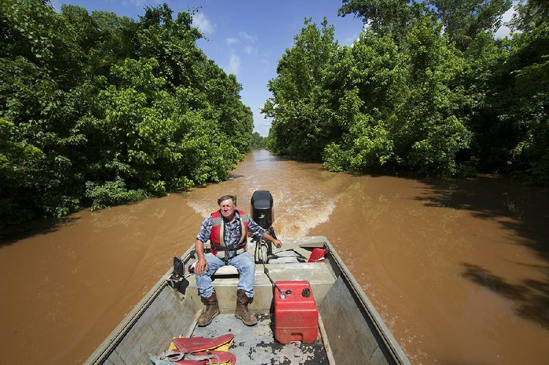
By Sunday afternoon deputies had already used boats to rescue two people who were trapped in their homes near Wright. The sheriff's office purchased additional equipment to prepare for the worst flooding in the area since 1986, but Woods said officials are asking people to leave before they need to be rescued.
"We're going to be limited in our efforts to evacuate people if needed because we don't have a boat for every person," Woods said.
Once the evacuation order is issued, residents will not be allowed to re-enter the area until the Arkansas River has receded.
Along the Red River in Garland, about 50 people have already evacuated in the town of 242, with more planning to leave, according to Larry Pritchett, coordinator for the Miller County Office of Emergency Management.
On the western banks of the river, Pritchett said some trailer homes are already sitting in 4 feet of water.
"By the end of this they probably will not have a house to go back to," Pritchett said.
Those not in the path of the flood also need to make smart decisions when it comes to the flooding. On Sunday, Pritchett said he was having a conversation with a man who said he had been out boating on the Red River around Fulton.
"I told him that was a very bad choice," Pritchett said. "No one needs to be on the Red River right now until this thing goes down."
Another bad choice is stopping on bridges over highways to take photos of the high water, which Pritchett said he has been seeing.
"That's creating a bad situation," he said.
Officials from the Arkansas Highway and Transportation Department announced the closing of 3.5 miles of Arkansas 108 between the Oklahoma state line on the west end and the intersection with Little River County Road 20 on the east end. According to a release from the department, water has reached the bottom of the beams of the bridge over Walnut Bayou and the structure is at the risk of being overtopped.
The Highway Department reported on its website Sunday night that 12 sections of roads in the state have been closed because of flooding. Those in Arkansas include Little River, Miller, Ouachita, Perry, Pope, Sebastian and Yell counties.
The Arkansas River is expected to continue to rise this week, with crests higher than the ones seen in recent days, according to the National Weather Service office in North Little Rock. Little Rock is forecast to be in the minor flood category, Dardanelle and Pendleton in moderate. and Morrilton, Toad Suck and Pine Bluff in the major flood category.
In Fulton, the Red River is forecast to be in minor flood stage, according to the National Weather Service office in Shreveport.
As of Sunday night, there was no rain in the forecast for the coming week, according to National Weather Service meteorologist Sean Clarke of North Little Rock.
Metro on 06/01/2015