It's good to see our tax dollars at work in a positive way, especially when the effort educates and adds a little fun to boot. Such was the scene on a visit to Beaver Dam and the remodeled overlook on the dam's south end.
The flood gates were open a crack when we visited the overlook on July 9, a rainy day. Anytime the gates are raised, people drive over to the dam to see the waterfall show. Even when the gates are open just 6 inches, as they were this day, it's a sight to see.
There's no telling how many times we'd been to the dam to fish for trout in the White River, or take the easy 7-mile float trip from the dam to Houseman Access. We'd heard glowing reports about the remodeled overlook from rangers with the Army Corps of Engineers, but had never seen it.
After watching the impressive water show at the dam, we headed up to the overlook.
Here the view of the open flood gates is even more stunning than down below. Gazing at the dam, it's amazing that humans are capable of building such a thing as this massive dam that creates Beaver Lake. Not only that, it produces electricity.
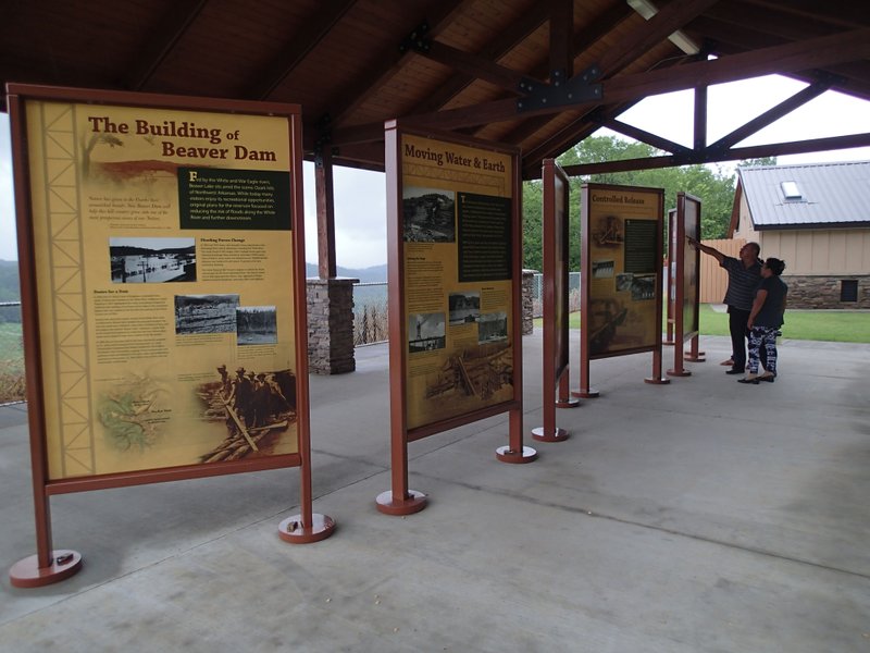
The centerpiece of the overlook is a pavilion with large, easy to read information panels that tell how the dam was built, how it produces electricity and some history of the dam and lake. The panels have lots of photos from the 1960s of the dam construction. Reading the fascinating story on the panels is an hour well spent, especially on a rainy day.
About 30 people felt the same way. That's how many were at the overlook when we visited. Here's some of what we learned from reading:
• It took 780,000 cubic yards of concrete to build the dam. Concrete had to be poured in small increments. Otherwise it would produce too much heat as it dried and the concrete would crack. The dam was finished in 1965.
• Beaver Dam has two hydroelectric power generators. Water flows from near the bottom of the lake through two conduits that are 20 feet in diameter, large enough to drive a bus through. At maximum generation 59,000 gallons of water per second goes through the dam.
• Most water loss at Beaver Lake is through evaporation. On a hot summer day, as much as 48 million gallons of water per day evaporate, or about 28 billion gallons per year. Evaporation can drop the lake level up to one-quarter inch per day in the summer.
• The highest lake level occurred during a flood event in April 2005 when it reached 1,132.2 feet above sea level. The lowest lake level was in 1977 at 1,092.8 feet above sea level. The lake level Wednesday was near 1,129 feet.
• Beaver Lake is about 70 miles long from the headwaters near Goshen to Beaver Dam near Eureka Springs. It is the drinking water source for about 500,000 people in Northwest Arkansas and beyond.
It boggles the mind to read the info, then look away from the panels and see Beaver Dam and lake right there, for real.
Flip Putthoff can be reachd at [email protected] or on Twitter @NWAFlip
Sports on 07/16/2015