Temperatures Dip Below Zero In Northwest Arkansas
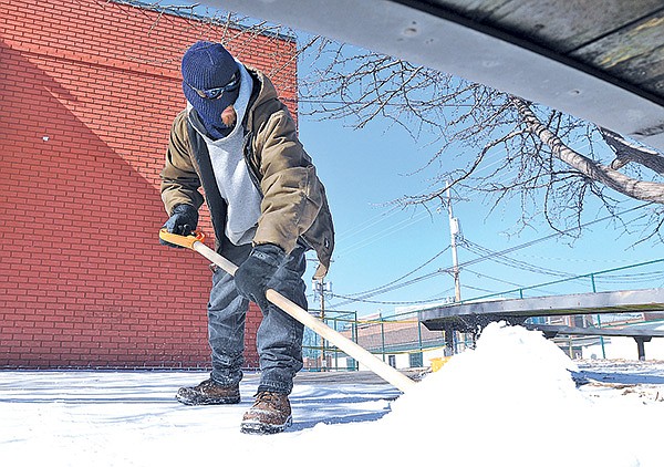
STAFF PHOTOS SAMANTHA BAKER • @NWASAMANTHA Brandon Sabart with Lawnworks shovels snow Monday off the sidewalk of the First Baptist Church’s Studio 412 Student Ministry in Bentonville. Sabart said his shovel broke trying to pry up ice that has coated the sidewalks and parking lots in the area.
Tuesday, January 7, 2014
Temperatures in Northwest Arkansas plunged below zero for the first time this season after an incursion of arctic air stretched unusually far south into the Midwest.
The temperature in Fayetteville fell straight down from 42 degrees at noon Saturday to minus 2 degrees Monday morning — just shy of the record for Jan. 6 of 3 below zero set in 1970 — before finally warming up to a high of about 10 for the day, according to the National Weather Service office in Tulsa, Okla.
The Northwest Arkansas Regional Airport may have reached minus 4, according to the weather service, though it’s unclear if that’s a record. The area’s average high for this time of year is 46.
At A Glance
Forecast
Tuesday: Highs could reach about 37, but wind chills below zero are still possible. The overnight low should be about 24.
Wednesday: High again near 37, with a 50 percent chance for sleet and rain in the evening and a low just below freezing.
Source: National Weather Service
A massive cold front, stretching from Montana to the Deep South, brought subzero temperatures to roughly half the United States.
Northern winds made the entire area north of the Missouri and Ohio Rivers feel like minus 30 or colder Monday. Actual air temperatures across North Dakota, Minnesota and Wisconsin were comparable to regions of Mars, the fourth planet from the Sun where no liquid water flows.
Such frigid air blew in directly from the Arctic, weather service meteorologist Amy Jankowski said.
“This one goes all the way from mainly southern Missouri and extends all the way up to basically the North Pole,” she said. “There was just a really big arctic trough that pushed all the way down from across Canada. Usually they don’t make it this far south.”
During the weekend the cold front was often described with the short, evocative phrase “polar vortex.” Specifically, the polar vortex is a persistent spiral of cold air around the North Pole, according to Weather Underground, a private weather service.
This hurricane-sized whirlpool of air is more or less fenced in by a jet stream, a high-speed river of air that meanders and curves across Canada and the Unites States. Last weekend, that fence broke, in a word, unleashing incredibly cold temperatures.
“Usually they kind of round out across the northern third of the United States, and this one dipped down all the way into the Central Plains,” Jankowski said, referring to the typically gentle curves of the jet stream.
She wasn’t sure what caused the break, pointing to a pressure cycle in the North Atlantic as just one of several possible factors. The North Atlantic Oscillation is in a pattern that can lock cold air into the nation’s center.
Monday’s temperatures topped off several weeks of cold temperatures in Northwest Arkansas. Two-thirds of the past month have been spent at below-normal temperatures, according to weather service data, and daily highs dipped to 30 degrees or more below normal three times since Dec. 6.
While Arkansas temperatures have been cold enough to flirt with daily records, none have been broken this winter. Fayetteville’s coldest recorded temperature was reached just two years ago, when temperatures reached minus 18 in February 2011, Jankowski said. On Jan. 8, 2010, the temperature went down to 1.
“It doesn’t happen frequently, but it does happen,” she said.
Temperatures are forecast to rise abruptly as the cold air moves out of the area, with highs expected to reach near 40 today and increase through the end of the week.
“The cold air shifts into the east and the winds shift into the south,” Jankowski said. “All that nice warm air from the Gulf of Mexico will try to make it up here.”