Map shows real-time BB&BBQ traffic
Posted: September 26, 2012 at 4:14 p.m.
A Google map showing real-time traffic conditions Wednesday afternoon.
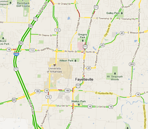
A map showing real-time traffic conditions available on Google Maps showed traffic slowing Wednesday afternoon as the official start of Bikes, Blues and BBQ approaches.
The map is based on data collected from GPS-enabled smartphones, according to a Google blog.
Some of the worst areas around 4 p.m. Wednesday were College Avenue between Martin Luther King Jr. Boulevard and Township Road, Gregg Avenue north of of Township, and areas near Interstate 540 exits.
The map showed worse conditions than typical for a Wednesday afternoon.
(Advertisement)
« Previous Story
Provost, 24 others, apply for NWACC presidenc...
A NorthWest Arkansas Community College administrator has applied for the college’s president position. Steven Gates, senior vice president for Learning and Provost at the... Read »
Next Story »
Jordan, Coody engage in first debate
More than 50 people filled the City Council chambers Wednesday to watch the first debate of the 2012 election ... Read »

Comments
To report abuse or misuse of this area please hit the "Suggest Removal" link in the comment to alert our online managers. Please read our comment policy.
Use the comment form below to begin a discussion about this content.
Registration is required to make comments. Click here to LOGIN.
You can register for FREE to post comments and receive alerts.