PRAIRIE GROVE — Archaeologists have determined the location of five houses, a post office and a road that existed during the Battle of Prairie Grove, which took place on Dec. 7, 1862.
The homes were owned by Hugh Rogers, William Rogers, Josiah Thompson, the Morton family and the Borden family. Archaeologists also located the Ada Post Office and the old Fayetteville-Cane Hill Road.
Some of the buildings were burned during the battle or the day after. Others stood for almost a century before being torn down. The road changed when a bridge was built over the Illinois River, north of the original ford, late in the 19th century.
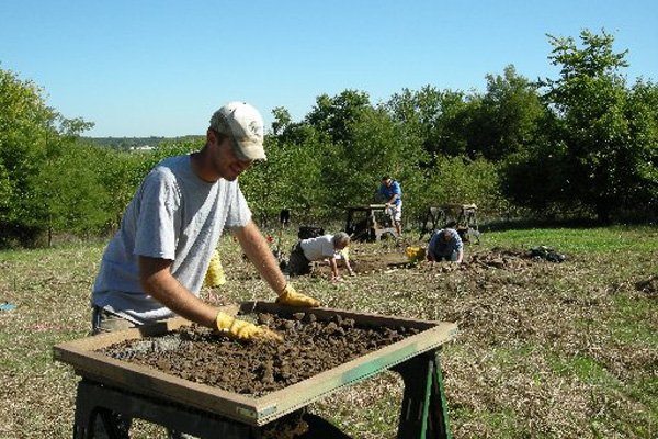
The locations were found using a combination of old and new technologies - everything from ground-penetrating radar to shovel tests. Historical descriptions, a map drawn by a Union soldier and aerial photographs from 1941 also provided valuable information.
Previously, the general location of the Thompson and William Rogers houses was known within a square mile or so, said Jerry Hilliard, assistant archaeologist with the Arkansas Archeological Survey, which did the fieldwork in 2011 and completed its study earlier this year. The Arkansas Archeological Survey is part of the University of Arkansas at Fayetteville.
Archaeologists had moreaccurate knowledge of where the Hugh Rogers house, Morton house and Ada Post Office once stood but still didn’t know their exact locations.
Now the buildings’ foundations, cellars and brick walkways have been uncovered, as well as artifacts, including buttons, bullets, a rifle butt and fragments of four harmonicas.
Alan Thompson, museum registrar at Prairie Grove Battlefield State Park, said the information will help the staff provide a more meaningful experience for visitors.
“People come in and say, ‘Great-grandpa fought near the William Rogers house. Where is that?’” said Thompson. “And we’d say, ‘We don’t know.’”
Now visitors can be taken to the site of William Rogers’ house in a remote field framed by an Osage-orange tree on one side and the distant rumble of traffic on U.S. 62 on the other.
“This didn’t just happen in a field,” said Thompson of the battle. “This happened in somebody’s yard.”
The park expects more than 1,000 participants this weekend for re-enactments of the battle beginning at 1 p.m. today and Sunday. Friday is the 150th anniversary of the Battle of Prairie Grove.
UNION VICTORY
The William Rogers house drew fire the day of the battle because Confederate snipers were trying to shoot Union soldiers from the upstairs windows, said Thompson. Union cannon fire set the house ablaze, he said.
The Battle of Prairie Grove resulted in 2,700 casualties and a Union victory. About 700 of those soldiers died, said Thompson.
The Union soldiers didn’t know they’d won the battle until the next day, when they realized that the Rebels had retreated, former park historian Don Montgomery wrote for The Encyclopedia of Arkansas History & Culture. After the battle, a truce was called at nightfall to collect the dead and care for the wounded.
“During the night, the Confederates wrapped blankets around the wheels of their cannon to muffle the sound and quietly withdrew from the ridge because of a lack of ammunition and food,” Montgomery wrote. “The battle was a tactical draw, with the casualties about the same in each army. But the Southern retreatduring the night gave the Union a strategic victory, as a full-scale Confederate army would never return to Northwest Arkansas, and Missouri remained firmly under Union control. This savage battle was probably the bloodiest day in Arkansas history.”
Some maps have shown the William Rogers house to be north of the home of his father, Hugh Rogers. But a map drawn by a Union soldier, David B. Arthur, indicated that the William Rogers house was west of his father’s house, and that ended up being correct, according to the archaeological evidence.
It was at Hugh Rogers’ house that Union Brig. Gen. James Blunt and Confederate Maj. Gen. Thomas Hindman met the day after the battle to discuss the return of wounded soldiers and burial of the dead.
RESEARCH TECHNIQUES
The work done by Hilliard and several others resulted in the study Archeological Reconnaissance of Selected Features at Prairie Grove Battlefield State Park. It was funded primarily with an $82,000 grant through the American Battlefield Protection Program, which is under the National Park Service,said Jessee Cox, superintendent of Prairie Grove Battlefield State Park.
Besides ground-penetrating radar, archaeologists researching the site used other geophysical techniques, including electrical resistance, magnetometry, magnetic susceptibility and electromagnetic conductivity.
“Each one of those five different technologies senses a different physical property that is changed beneath the surface by different things that people have done in the past,” said Jami Lockhart, director of remote sensingat the Arkansas Archeological Survey. “Digging trench graves, the burning of the structures, all manner of changes that occurred ... change the physical properties in a number of ways. It conducts electricity differently. It may be more or less magnetic than what’s around it.”
With ground-penetrating radar, radar pulses are sent into the ground, and the return time of the radar echoes indicates approximate depth to the target, according to the study.
Geophysical technology was developed for use in geology to find larger objects, such as oil deposits, said Lockhart. It has since been refined to the point of being useful for archaeologists.The Arkansas Archeological Survey has been using geophysical techniques since 1999, he said.
“It gave us a better idea where to do the excavations,”Lockhart said. “They had sort of lost track of where these structures were after 150 years.”
EXCAVATIONS, PHOTOS
The geophysical research was done in concert with traditional archaeological methods, including excavations of selected areas, in particular the William Rogers house. Also, aerial photographs taken in 1941 proved instrumental in locating some of the structures and foundations that were still visible at that time, including the Hugh Rogers house and Ada Post Office. Those photographs were on file at the National Archives in Washington, D.C., said Lockhart.
Within the footprint of the William Rogers house, archaeologists found round balls, rifled bullets, two percussion caps and a few artillery shell fragments. In what would have been the yard, there was more evidence ofheavy fighting with small arms.
The cellar of the Morton house was also studied. Area residents took refuge there during the battle.
Nancy Morton Staples, who was a child at the time of the battle, wrote in about 1896: “They fought through and around the house, the shots flying like hail in every direction, only a few cannon balls striking close.” Staples’ manuscript is on file at the Arkansas History Commission in Little Rock and excerpts were included in the archaeological study.
Lockhart said a photograph from the 1950s makes it appear that the cellar was directly under part of the house. Hilliard said more work needs to be done to determine exactly where that cellar was. A house had been constructed on the site of the old Morton home but has since been torn down, said Lockhart.
Northwest Arkansas, Pages 11 on 12/01/2012