VENICE, La. — The surface area of a Gulf of Mexico oil spill quickly tripled in size amid growing fear among experts that the slick will become vastly more destructive than was expected just two days ago.
President Barack Obama planned to visit the region today to assess the situation. Meanwhile, efforts to stem the flow and remove oil from the surface by skimming it, burning it or using chemicals to disperse it continued with little success.
“These people, we’ve been beaten down, disaster after disaster,” said Matt O’Brien of Venice, whose fledgling wholesale shrimp dock business is under threat from the spill.
“They’ve all got a long stare in their eye,” he said. “They come asking me what I think’s going to happen. I ain’t got no answers for them. I ain’t got no answers for my investors. I ain’t got no answers.”
The Coast Guard conceded Saturday that it’s nearly impossible to know how much oil has gushed since the April 20 rig explosion that killed 11 workers and threatened beaches, fragile marshes and marine mammals, along with fishing grounds that are among the world’s most productive. The Coast Guard said earlier that the spilled oil totaled at least 1.6 million gallons - equivalent to about 2 1/2 Olympic sized swimming pools.
At that rate, within about a week it will eclipse the 1989 Exxon Valdez spill as the worst U.S. oil disaster in history. A growing number of experts warned that the situation may already be much worse.
The oil slick on the water’s surface appeared to triple in size over the past two days, which could indicate an increase in the rate the oil is spewing from the well, according to one analysis of images collected from satellites and reviewed by the University of Miami. While it’s hard to judge the volume of oil by satellite because of depth, it does indicate a change in the oil slick’s size, experts said.
“The spill and the spreading is getting so much faster and expanding much quicker than they estimated,” said Hans Graber, executive director of the university’s Center for Southeastern Tropical Advanced Remote Sensing. “Clearly, in the last couple of days, there was a big change in the size.”
Florida State University oceanography professor Ian R. MacDonald said his examination of Coast Guard charts and satellite images indicated that 8 million to 9 million gallons had already spilled by Wednesday.
Doug Suttles, chief operating officer for exploration and production at oil company BP, said it was impossible to know just how much oil was gushing from the well but that the company and federal officials were preparing for the worst.
In an exploration plan and environmental impact analysis filed with the federal government in February 2009, BP said it had the capability to handle a “worst-case scenario” at the Deepwater Horizon site, which the document described as an uncontrolled blowout leading to a leak of 162,000 barrels, or 6.8 million gallons, each day.
EAST COAST DANGER
The Deepwater Horizon well is at the end of one branch of the Gulf Stream, the famed warm-water current that flows from the Gulf of Mexico to the North Atlantic. Several experts said that if the oil enters that stream, it would flow around the southern tip of Florida and up the Eastern Seaboard.
“It will be on the East Coast of Florida in almost no time,” Graber said. “I don’t think we can prevent that. It’s more of a question of when rather than if.”
At the joint command center run by the government and BP near New Orleans, a Coast Guard spokesman maintained Saturday that the leakage remained about 5,000 barrels, or 200,000 gallons, per day.
But Coast Guard Adm. Thad Allen, appointed Saturday by Obama to lead the government’s oil spill response, said no one could pinpoint how much oil is leaking from the ruptured well because of its depth - about a mile underwater.
From land, the scope of the crisis was difficult to see. As of Saturday afternoon, only a light sheen of oil had washed ashore in some places.
The real threat lurked offshore in a swelling, churning slick of dense, rust-colored oil the size of Puerto Rico.
The fishing industry is worried that marine life will die and that no one will want to buy products from contaminated water. Tourism officials are worried that vacationers won’t want to visit oil-tainted beaches. And environmentalists are worried about how the oil will affect the countless birds, coral and mammals inand near the Gulf.
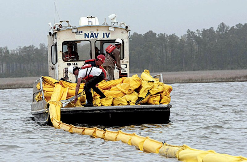
Fishermen and boaters want to help contain the oil. But on Saturday, they were again hampered by high winds and rough waves that splashed over the miles of orange and yellow inflatable booms strung along the coast, rendering them largely ineffective. Some coastal Louisiana residents complained that BP, which owns the rig, was hampering mitigation efforts.
“They’re letting an oil company tell a state what to do,” 57-year-old Raymond Schmitt said in Venice as he prepared his boat to take a French television crew on a tour.
BELOW THE SURFACE
As bad as the oil spill looks on the surface, it may be only half the problem, said University of California Berkeley engineering professor Robert Bea, who serves on a National Academy of Engineering panel on oil pipeline safety.
“There’s an equal amount that could be subsurface too,” said Bea, who worked for Shell Oil Co. in the 1960s when the last big northern Gulf of Mexico oil well blowout occurred.Oil below the surface “is damn near impossible to track.”
Louisiana State University professor Ed Overton, who heads a federal chemical hazard assessment team for oil spills, worries about a total collapse of the pipe inserted into the well. If that happens, there would be no warning, and the resulting gusher could be even more devastating because regulating flow would then be impossible.
“When these things go, they go KABOOM,” he said. “If this thing does collapse, we’ve got a big, big blow.”
BP has not said how much oil is beneath the Gulf seabed that Deepwater Horizon was tapping, but a company official speaking on condition of anonymity because he was not authorized to discuss the volume of reserves, confirmed reports that it was tens of millions of barrels.
At a church in the Lower Ninth Ward of New Orleans, Environmental Protection Agency Administrator Lisa Jackson told community leaders that the spill has created an “environmental challenge of the highest order.”
“Every oil spill is a challenge. But this is quite different because of where it is, because the marshes are so different than the beach and the coastline in Alaska when we had the Valdez,” she said. “This one is complicated by the fact that the wellhead is 5,000 feet below the water.”
Jackson said efforts to chemically break down the oil at the surface of the oil spill have been “moderately successful,” but she was skeptical of a proposal to try to disperse oil at the ocean floor.
However, the Coast Guard’s Allen said Saturday that a test of new technology used to reduce the amount of oil rising to the surface seemed to be successful.
During the test Friday, an underwater robot shot a chemical meant to break down the oil at the site of the leak rather than spraying it on the surface from boats or planes, where the compound can miss the oil slick.
Louisiana Gov. Bobby Jindal said Saturday that the Coast Guard approved a plan from one of the state’s parishes to help contain the spill.
Plaquemines Parish President Billy Nungesser said the parish would set up a jack-up boat inside the barrier islands where inflatable booms would be distributed. A jack-up boat is a vessel with poles on four corners that allow it to lift itself out of water to become a stationary platform.
The reason for using this technique is that there is not enough boom to make a continuous line around the coast. The jack-up boat could be used as a staging center.
Jindal asked every coastal parish to come up with its own plan.
Jindal said he has asked BP and the Coast Guard for detailed plans on how to protect the coast.
“We still haven’t gotten those plans,” he said. “We’re going to fully demand that BP pay for the cleanup activities.We’re confident that at the end of the day BP will cover those costs.”
The wetlands in the Mississippi Delta have been shrinking at a rate of about one football field an hour for decades, deprived of sediment replenishment by levees in the river, divided by channels cut by oil companies and poisoned by farm runoff from upriver.
Louisiana has lost an area the size of Delaware since 1932 and is still losing about 24 square miles a year. The hurricanes of 2005 turned about 217 square miles of marsh into water, according to a study by the U.S. Geological Survey.
Robust wetlands can serve as a buffer zone between hurricanes in the Gulf and cities such as New Orleans.
“The trouble with our marshes is they’re already stressed, they’re already hanging by a fingernail,” said Denise Reed, interim director of the Pontchartrain Institute for Environmental Sciences at the University of New Orleans.
In Pass Christian, Miss., 61-year-old Jimmy Rowell, a third-generation shrimp andoyster fisherman, worked on his boat at the harbor and stared out at the choppy waters.
“It’s over for us. If this oil comes ashore, it’s just over for us,” Rowell said angrily, rubbing his forehead. “Nobody wants no oily shrimp.” Information for this article was contributed by Tamara Lush, Brian Skoloff, Melissa Nelson, Mary Foster, Michael Kunzelman, Chris Kahn, Vicki Smith, Janet McConnaughey, Alan Sayre, Dave Martin, Cain Burdeau, Melinda Deslatte of The Associated Press; and by Leslie Kaufman and Campbell Robertson of The New York Times.
Front Section, Pages 1 on 05/02/2010